Estrela's African Land Adventure Journal
Estrela's African Land Adventure Journal. Day 1. 6/1/08
Knysna, South Africa. June 1, 2008.
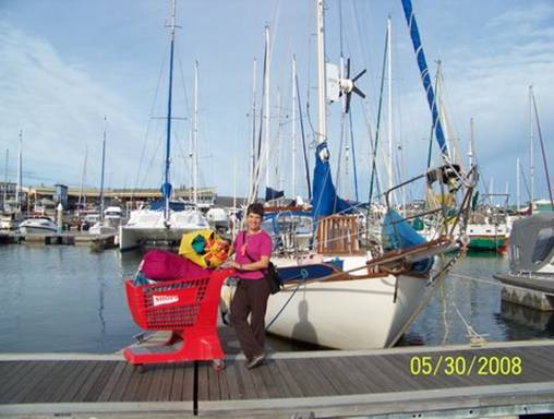
We said goodbye to our good ship Estrela (see attached photo of her in our Knysna Quays Marina slip), jammed into our land yacht, a borrowed twenty-two year old Mercedes sedan, and began a two-month tour of southern Africa. We'll drive counter-clockwise through South Africa,
Botswana, Namibia and Lesotho, returning to Knysna around August 1. Then August 4 Estrela gets hauled out for bottom painting, routine maintenance and a new survey.
We had sailed through the infamous Knysna Heads on April 14, after a short but exhilarating passage down the treacherous east coast of SA, riding the Mozambique/Agulhas Current like a (lumpy) magic carpet. It took us three days to get from Richard's Bay, our port of entry, to Port Elizabeth. We sailed right past Durban and East London, as the usually changeable weather held in our favor. Estrela literally surfed into Port Elizabeth in an easterly gale, the 40 plus knots of wind ripping our staysail while I desperately fought to furl the flogging mess. THAT WAS INTENSE! Ten days later, having weathered another gale triple tied in our slip (60 kts recorded by our anemometer), we sailed overnight to Knysna. The nail biting experience of passing through the Heads deserves a whole separate entry. Suffice to say that we made it safely and are the stronger for it.
Enough of the sea for a while, it's time to trek Africa!!!
-- Kyle
Estrela's African Land Adventure Journal. Day 2. 6/2/08
Port Elizabeth, Eastern Cape Province, South Africa. June 2, 2008.
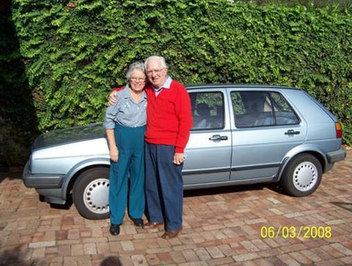
Meet Noel and Grahame Perry (see attached pic), our SA surrogate grandparents and the generous owners of our borrowed car. In Richard's Bay we had met their sailor son John aboard his Indian Ocean-bound catamaran, Stingo II. John gave us his parents' Port Elizabeth (PE) phone number, called to warn them about us, and then extracted our promise we would look them up. "They'll take care of you . . . really,"
he said. John wasn't kidding.
While we Estrelans were waiting out gales in PE, the Perrys took us under their wing. First they led us on a hunt for abalone shells and red-beaked Oystercatcher birds along the wind-sculpted beach by Cape Recife lighthouse. Then after an outdoor lunch at the Sacramento restaurant, named for a wrecked 17th century Portuguese ship whose remains were discovered a few meters away, we all hiked a wild stretch of coast protected by a nature reserve. The next day they rented a comfortable mini-van and took us to Addo Elephant National Park. By Eliza and Abigail's count we saw 90 warthogs, 11 ostriches, 2 cape buffalo, 2 red hartebeests, 1 fiscal shrike (bird), 1 bokmakierie (also bird), 14 kudu (2 in the later stage of courting), 1 vervet monkey, 1 secretary bird, 1 black-headed heron, countless guineafowl and cape wagtail (birds), and 50 African elephants in two major groups. After two days together we were hooked on South African wildlife and habitat and the Perrys were family.
We sailed into Knysna on April 14 and the Perrys stole us away for a short holiday at their second home in Plettenberg Bay. Four days later, after an unforgettable hike on the rocky coast of Robberg Peninsula, a SA National Park, we drove home to Knysna as the temporary custodians of the Perry's 1986 Mercedes 230E sedan. They were about to take over John's car and will sell their old "Merc" when we return it in November.
Are we the lucky sailors or what!
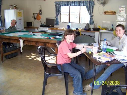
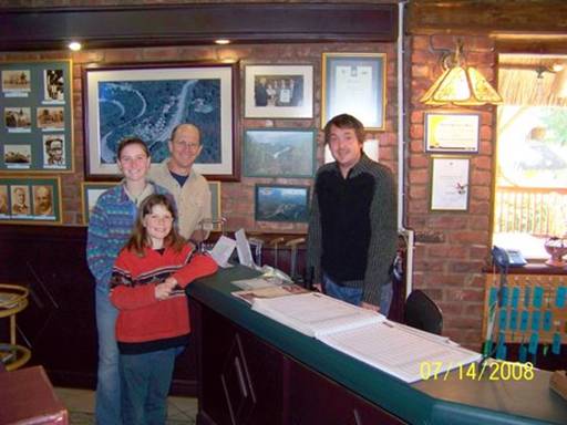
So it was only fitting that we spent the first two nights of our African Land Adventure with Noel and Grahame at their PE home. We had made a few upgrades to the car, including new rear springs and a Thule rack/carrier, and it passed Grahame's inspection. Meanwhile Noel not only plied us with delicious food, but also took over my mending pile and performed miracles with her sewing machine. While I was doing laundry and repacking, Doug went out with Grahame to find those last crucial additions to our car camping rig. Eliza was trying to finish a school paper. Abigail finished her schoolwork early and made lunch for her hard-working companions. It was a very busy day.
-- Kyle and Doug
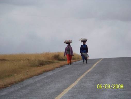
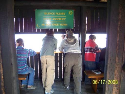
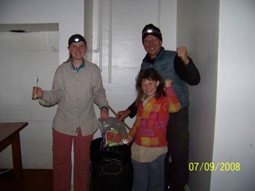
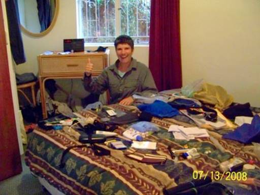
Port Elizabeth, Eastern Cape Province, South Africa. June 3, 2008.
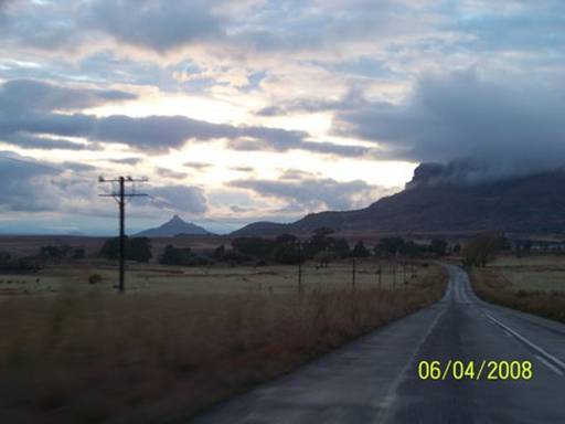
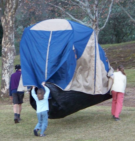
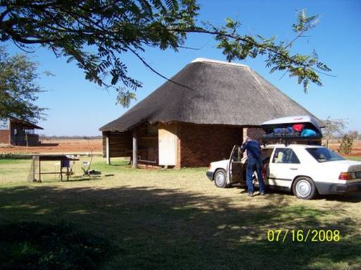
By 10:30 AM we were all packed (see first picture)

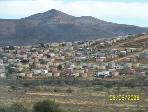
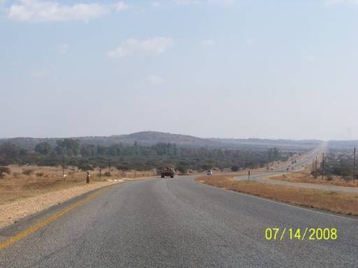
and so with goodbyes to the Perrys, we finally started driving. We drove from PE to Cradock
(N2 to N10), where we stopped for fuel, having passed a typical large outlying settlement of government-built houses (see second picture).
We continued on extremely straight roads (see third picture)
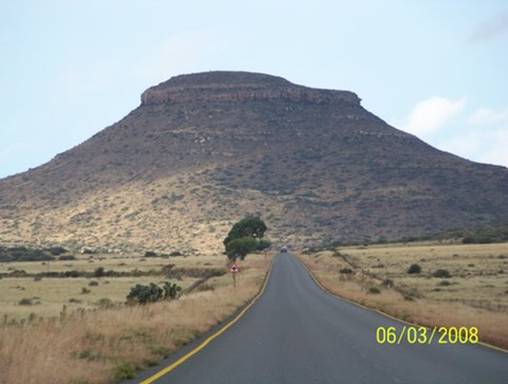
to Hofmeyr, a very small, poor town; to Steynsburg (R390); and then on to Burgersdorp (see fourth picture),
where we got a bit lost and drove in circles for a while (R56 to R391). 488 kms and six hours after setting outh, we drove into Aliwal North, a town on the Orange River, the border between the Eastern Cape and Free State provinces.
This whole drive was spectacular with beautiful views of the rugged, stark Karoo landscape. The Karoo is very, very dry, sort of grassland dotted with little green bushes. There were rolling hills and it all was gorgeous. It's incredible to me that the early Dutch settlers, the Boers, could actually survive in this inhospitable land. I'm in awe of them, for that. While driving along we listened to an audiobook recording of African folk tales, which added to the atmosphere. When we finally arrived in Aliwal North, it was raining, getting dark, and thunder and lightning stormed all around us. I was glad we found a guesthouse instead of camping.
-- Eliza
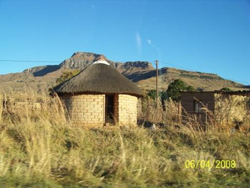
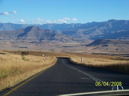
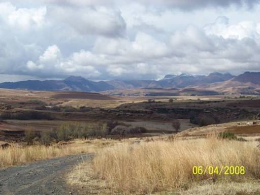
Day 4. June 4, 2008. Aliwal North, Eastern Cape Province to Royal Natal National Park, KwaZulu-Natal Province, South Africa.
We had many kilometers to cover today to reach Royal Natal National Park
(RNNP) before the gate closed for the night. So we left Aliwal North in the dark, with just a quick coffee and tea from the electric pot to get us started.
The day was all about vistas. Around every corner and over every rise, there was a new inspiring view. I kept the camera in my lap and took hundreds of pictures right through the window. I won't win any photography awards for technique. But the beauty of the arid landscape was irresistible.
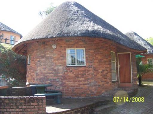
These four pictures are a sampling of what we saw. The last is of a rondeval, a traditional Zulu house, we passed just outside the park entrance.
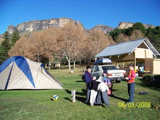
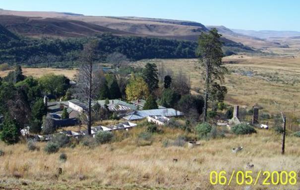
Day 5. June 5, 2008. Royal Natal National Park, KwaZulu-Natal Province, South Africa.
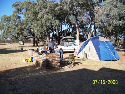
We woke today within view of the legendary Amphitheatre of the Royal Natal National Park (see Amphitheatre in background of Pic 4).
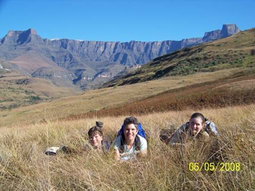
Amazingly, we were the only overnight visitors -- except some wildlife that managed to enter over or around the 7' high electrified fence (more on this later). We had the campground to ourselves (see Pic 1 and the tiny blue dot - our tent - in lower center of the green patch in Pic 3).
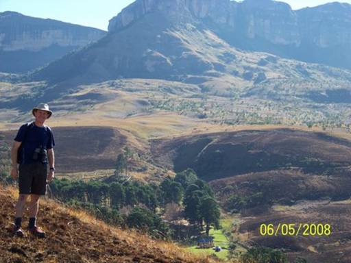
Heading out for a hike to photograph the Amphitheatre, we ambled past the decrepit remains of what was until the mid 1990's a classic mountain retreat, the Royal Natal National Park Hotel. Noel Perry had spent her teenage years here. Her father and mother ran the hotel in the late 40's and early 50's. Noel recounted to us before we left PE her vivid recollections of the magical four days in 1947 when the King of England, his wife, and daughters Elizabeth and Margaret vacationed at the hotel seeking a respite from the paparazzi who had dogged their long tour of South Africa. Look at the second picture.
In the foreground you can make out a block of four rooms, now roofless. Later dubbed Royal Row, they were extravagantly renovated in anticipation of the royal family's visit. While at RNNP we learned the exciting news that a consortium of investors may soon restore the abandoned hotel, with plans to maintain its rustic mountain charm.
-- Doug
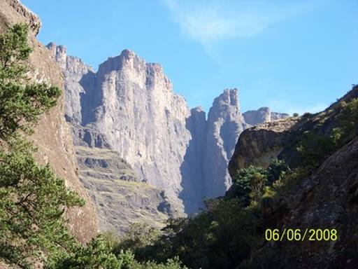
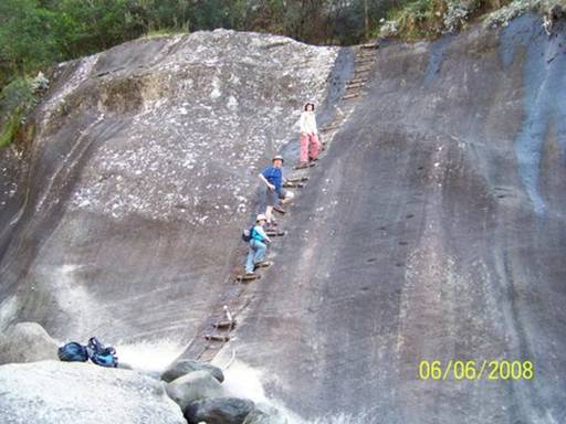
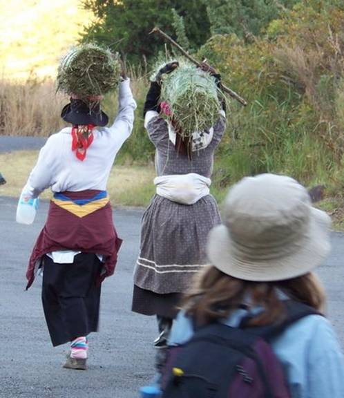
Day 6. June 6, 2008. Royal Natal National Park, KwaZulu-Natal Province, South Africa.
Big hike day . . . the Tugela River Canyon Trail into the heart of the Amphitheatre, a legendary hiking and technical mountaineering destination. From our lunch and turn-around spot we looked up at the towering escarpment (Pic 1).
Had we continued further to the base of Tugela Falls, the world's fourth highest waterfall, we would have had to ascend a chain ladder up a cliff (Pic 2).
On our descent we caught up to three Zulu women who had spent the day in high meadows gathering reeds to weave traditional baskets (Pic 3).
Back at camp we made plans for a lay-over school, journal writing and laundry day. In Pic 4 we're moving the tent to a new site with more shade and an electricity plug-in point.
-- Doug
Day 7. June 7, 2008. Royal Natal National Park, KwaZulu-Natal Province, South Africa.
Today a baboon took some food from our camp! I was just leaving the campsite to do the dishes in the camp kitchen when I saw a big baboon appear from behind the car. At first I was just surprised and then I got scared. "Mom?" I said, running back and putting down the dishes.
Mom turned and saw him. "Doug?" she said, and then, "DOUG!!" Dad came running. Eliza, who had been changing in the tent, heard the commotion and came out. Together we all stood and stared in shock. Then we realized what was happening. The baboon was looking through our grocery bags next to the cooler and stealing food. In the first picture, taken just before the baboon came, you can see how everything was laid out.
He grabbed two pieces of bread and two packages of crackers. Mom started yelling and he got a little scared and ran around the hedge to the right of the cooler, still holding onto his stolen food. He jumped onto a stone wall and started to eat. He was big. I'm sure that if he stood on his legs, he would have been as tall as I am. Mom continued yelling things like, "Give me my crackers, you jerk," and, "I want my crackers!" But the baboon paid no attention. Dad was in a fog. He tried to take pictures, but the batteries died. Then he looked for new batteries to put in the camera. But he never got any pictures. Overall . . . useless; he admitted it himself. "Get the baboon horn," Mom called. (Mom said to explain that the "baboon horn" is actually a red plastic horn we use on Estrela to blow farewell to boats that are leaving an anchorage. It hardly makes any noise, but when it does, it sounds like a party favor.) Eliza opened the trunk and looked for the horn, but couldn't find it. I knew where it was, so I grabbed it and tried to make a sound. I couldn't make it work. So I gave it to Eliza, who made a small sound. Then Mom grabbed it from Eliza and made a bigger sound, which still wasn't that big. The baboon just looked at Mom in such a way that said, "Do you really think THAT'S going to scare me?"
Then all of a sudden, he spooked, jumped off the stone wall and scrambled away with the two pieces of bread in his stomach and one of the packs of crackers, half-eaten, in his hands. Then we saw what had scared him. Another baboon was climbing a tree on the other side of the so-called "baboon fence". This one was even bigger than the first. He would have been as tall as Mom! He jumped from a tree outside the fence to a tree inside the fence, swinging over the electrical wire on the top of the 7 foot high fence. First he climbed and then he jumped down the rest of the way and grabbed the crackers. Then Eliza and Mom stuffed everything else into the trunk and Mom and I jumped into the back seat.
We closed the door and waited. Eliza was brave enough to stay outside.
Then Dad called, "He's gone." Mom started to laugh as she got out. I opened the door shakily because I was still really scared and I didn't want to get out. Dad came and hugged me and said it was all right.
A little later Dad went to talk with a park security guard he saw using a sling-shot (in Zulu, a "Katy") to scare away some other baboons. When Dad came back he said that the guard had told him that a baboon will usually ignore women who try to shoo them away. Only an aggressive man can drive them off. So Dad and I spent the rest of the day whittling "baboon spears" and then hardening the tips in the fire (see the second picture).
It was an odd day.
-- Abigail C.
Days 8-10. June 8-10, 2008. Royal Natal National Park, KwaZulu-Natal Province, to Kruger National Park, Mpumalanga Province, South Africa.
We planned to take three days to travel to Kruger National Park from Royal Natal National Park. Before leaving RNNP, we stopped to purchase a few small baskets from local weavers. Remember the picture two days ago of the ladies carrying bundles of reeds from the high meadows?
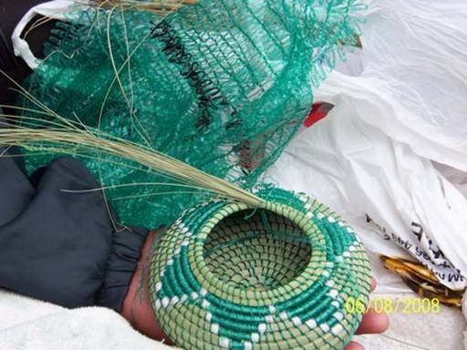
Pic 1 above shows a reed basket in the making. You can see the distinctive way the weavers bind the reeds. They get the material for the colored strands by unraveling those loosely woven sacks in which onions and oranges are sold.
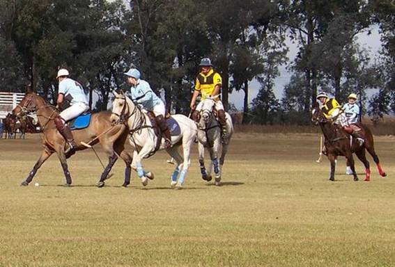
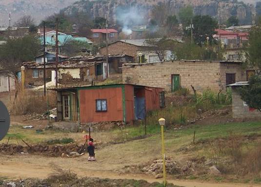
In anticipation of driving many kilometers on our two-month road trip, I packed school books for the girls to study in the car. What was I thinking??? On this leg we would be traveling through historically important lands in KwaZulu-Natal called the Battlefields, where Boer, English, Xhosa and Zulu clashed at different times in South Africa's turbulent history. I had just read Michener's "The Covenant." Whenever we passed a town or monument, or even a road sign, whose name I recognized from the book, I would find the relevant passage and read aloud to the family, trying to make these places along the roadside come alive: Dingaan's Kraal, Piet Retief's Grave, Blood River Battlesite, and Chrissiemeer. And when I wasn't reading out loud, we listened to music, the Soweto Gospel Choir and Ladysmith Black Mamboza, or to Harry Reasoner narrate a radio broadcast we'd downloaded entitled, "A History of South Africa." How could we even try to understand this complicated, tragic country? As we drove we observed this land of contrasts -- wealth (Pic 2-a polo club, where we had a picnic lunch)
and extreme poverty (Pics 3 & 4);
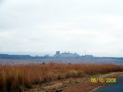
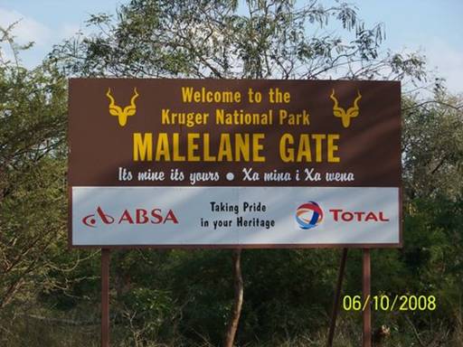
a huge coal-fired power plant in the middle of fertile grazing land; and highly productive, beautifully kept, lushly irrigated fruit farms across from the arid wilderness of Kruger National
Park (Pic 5).
And this is just one corner of South Africa!
--Kyle
Day 11. June 11, 2008. Kruger National Park, Mpumalanga Province, South Africa. Overnight stay at Crocodile Bridge Rest Camp (25.35891ºS 31.89204ºE).
This is the deal about Kruger National Park. First of all, you have to get the scale of the thing -- it is the size of Wales. According to our Lonely Planet guide book Kruger has 147 species of mammals, more than 500 of birds and 114 of reptiles, probably more diverse wildlife than any other park in Africa. The animals roam freely and human visitors are allowed to drive their own cars around the various paved and gravel roads inside the park looking for them. Between official sunset (5:30 pm during our visit) and first light (currently 6:00 am) visitors are locked inside the gated camps, where there are a range of accommodations from simple campsites to fancy guest lodges. The largest of these, the 12 main rest camps, each has a small store, restaurant, communal kitchens, laundromats, and ablutions blocks (toilets and showers), almost like a mini-town. There are also smaller camps with fewer, or more basic, facilities. One can get out of the car at picnic areas, though there are surprisingly few of these, animal viewing blinds or "hides", and some scenic lookouts (FYI -- there are not enough places to pee legally!). But the major rules of Kruger are: never stick your head out of a window or sunroof, never alight from your car except where explicitly permitted, stay within the speed limits (50kph for tar and 40kph for gravel), do not feed the animals ("you feed 'em; we shoot 'em"), and always return to camp by curfew. There are huge penalty fines. It always amuses me to think that the people are caged and the animals are free. I love that!
--Kyle
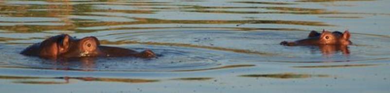
We left Crocodile Bridge Rest Camp five minutes after the gates opened at 6:00, after waking up at 5:00 so we wouldn’t be late. We had heard that lions in this part of the park often lay on the tarred roads at dawn, but we didn’t see any. On the bridge at Lower Sabie Rest Camp we saw our first hippos, their Shrek-like ears flicking away the water every time they surfaced (see Pic 1).
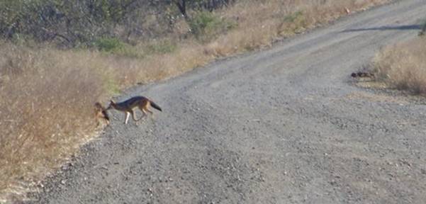
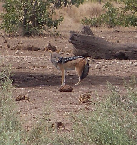
Abby was so happy when we saw a black-backed jackal slink across the road (see Pic 2)
on our way to Mlondozi Dam, one of my favorite places in Kruger. Just after we left the Dam, where we were allowed to get out of our car and eat at the picnic area overlooking a waterhole, we stopped to let a huge African rock python slither across the gravel road just ahead of us (see Pic 3).
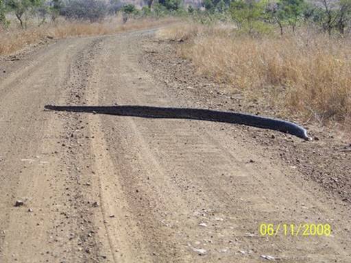
When fully extended it reached from one side to the other. If I tried to tell about all the incredible animals I saw today, the entry would be ten pages long, so I’ll just describe my favorite moment. We were driving along the Old Tshokwane Road when Abby spotted three specks far ahead of us that turned out to be cheetahs. Entranced and incredulous, we watched as they got up from their resting place under a tree and ambled casually up the road towards us. For almost a half an hour, they crossed the gravel road back and forth gradually coming closer and closer (see Pic 4),
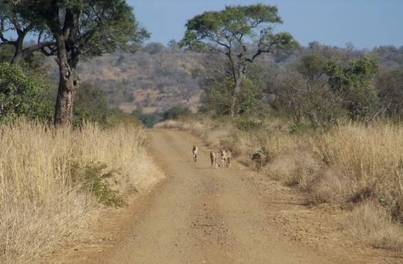
before slipping quietly into the tall grass on the roadside, and disappearing from our sight. We learned later from some South Africans who visit Kruger all the time that it's rare to see cheetahs in the park. In 2005 scientists estimated only 200 cheetahs lived in the park, compared to 2000 lions and 12,470 elephants.
--Eliza
Day 12. June 12, 2008. Kruger National Park, Mpumalanga Province, South Africa. Overnight stay at Crocodile Bridge Rest Camp (25.35891ºS 31.89204ºE).
We saw another cheetah! It was sitting on an old railway berm. We were driving along, rushing to get back to the gate in time (saying we would only stop for a big cat) when Dad saw something on the man-made ridge a ways off to our right. He looked at it through the binoculars and said, "Guys, I think it's a lion. No, it can't be, it has spots. It could be a leopard." But then the cat looked at us and we saw its small head and characteristic black "tear streaks" down its cheeks (clearly visible in the attached picture). We knew it was a cheetah. We watched as it got up, brushing its fluffy tall on the ground, and disappeared down the other side of the old railway berm. I LOVE cheetahs.
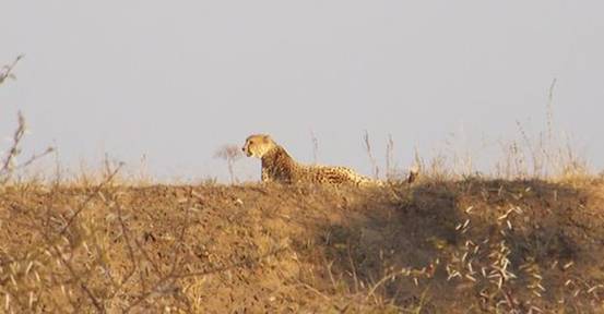
We made it through the camp gate with seven minutes to spare.
-- Abigail C.
Day 13. June 13, 2008. Kruger National Park, Mpumalanga Province, South Africa. Overnight stay at Satara Rest Camp (24.39258ºS 31.77953ºE).
I saw four of the “Big Five” today! We began the day with a magical, slow, four-hour drive beginning before dawn. First were the elephants, who, hiding behind a bush, gave us a bit of a scare when they emerged less than 10 meters in front of our car and crossed the road, stopping in the middle to stare us right in the eyes and flap their ears (see Pic 1).

Next we saw the rhinos, a mother and a baby just off the road in some thorn thickets (see Pic 2).
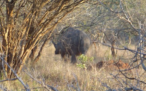
Shy creatures, they lumbered off as we approached, disturbing birds as they went. I especially love rhino feet, which have three large toes splaying out from the foot.
We returned to Crocodile Bridge at 10:30 to break camp, packing the bags and tent, stuffing the car, and beginning the drive 120 km north to Satara Rest Camp, where we had a one-night camping reservation. A few kilometers from Croc Bridge we came across a herd of 80 to 100 cape buffaloes in a clearing down an embankment beside the road (see Pic 3).
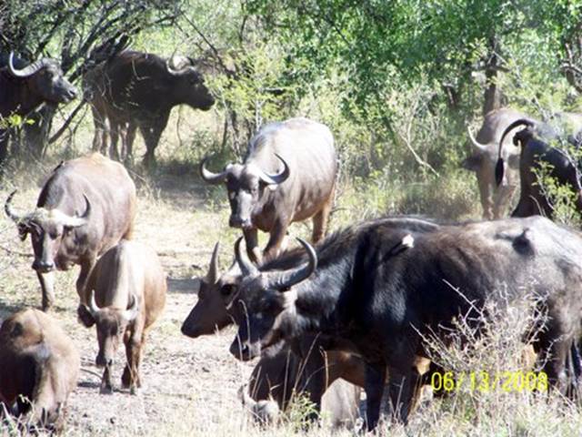
They seemed docile, almost dully familiar, like just another herd of grazing dairy cows in Woodstock, CT. You’d never know they are infamous for cleverly stalking and attacking pursuing human hunters. I was glad we had stopped to watch them, though, because someone drove up while we were there and rolled down her window to tell us excitedly that she had seen a lion just up ahead. We raced on (at less than 50kph, of course) and stopped when we came upon several other cars pulled off to the east side, just in time to see a lioness rise from her nearly invisible resting place about 50 meters from us in the tall grass, turn away from us, and melt into the tangle of thorny shrubs with a twitch of her tail (see Pic 4).
Most spectacular and awe-inspiring of all the animals we viewed today were the five lions on a freshly killed cape buffalo by Mlondozi Dam (my favorite place in Kruger). The two males and one of the females rested in the shade of an acacia tree (see Pic 5).
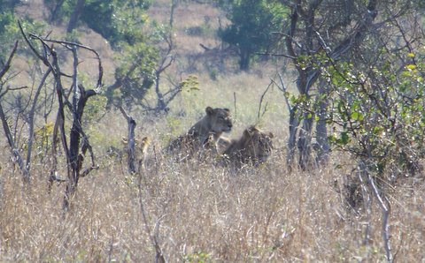
A few meters from them lay the dead cape buffalo, its blood still glistening in the sun. Two lionesses kept guard against the huge Lappet-faced vultures perched patiently in nearby trees. One lioness was still tearing at the flesh, her head disappearing between the ribs, her muzzle emerging stained with blood. As we watched, she flipped the whole carcass over with a twist of her powerful jaws. The other seemed full and satisfied, lying with her head on the haunch of the feeding lion (see Pic 6).

It looked like a peaceful domestic scene, but we couldn’t help thinking about the terror and violence that had happened here just a few hours earlier.
This was not warm, fuzzy Simba and his friends.
The only “Big Five” member whom we hadn’t seen yet was the elusive leopard. Big game trophy hunters had named these “The Big Five” (elephants, rhinos, cape buffaloes, lions, and leopards) because they were the most dangerous African animals to hunt. The term originally had nothing to do with photography or animal viewing by tourists. But now if one gets to see the Big Five it’s a mark of accomplishment by the Kruger visitor. I was even a little jealous when we returned to our camp at night and discovered that other tourists had seen Big Five animals that day that I had missed. Fortunately we also gradually became very interested in the incredibly diverse, colorful, and unusual bird life of Kruger, distracting us from our initial obsession with the Big Five.
-- Eliza
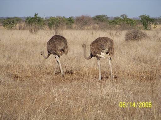
Day 14. June 14, 2008. Kruger National Park, Limpopo Province, South Africa. Overnight stay at Shingwedzi Rest Camp (23.11357ºS 31.43314ºE).
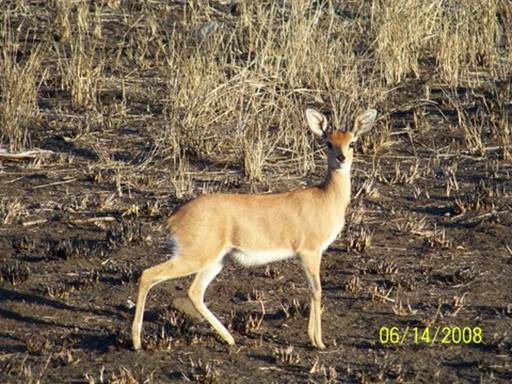
Today we got up when it was still dark and left Satara to drive a long way to Shingwedzi Rest Camp. Almost right away we started seeing animals we had never seen before. First were two skittish and alert steenboks (see Pic 1).
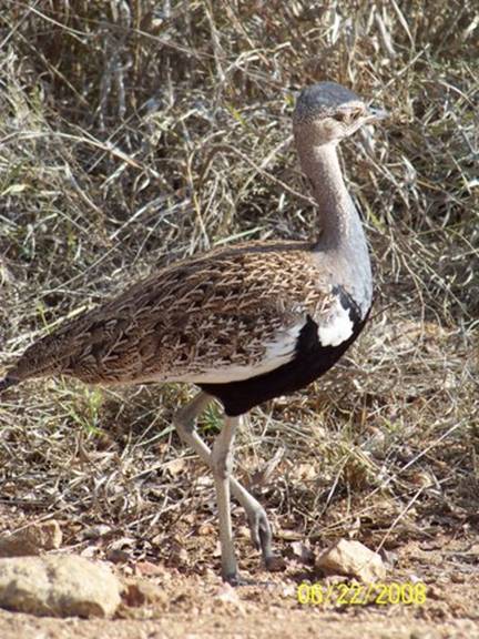
I held my breath for fear they would bolt. Then an elegant Kori Bustard strutted into the scene (see Pic 2).
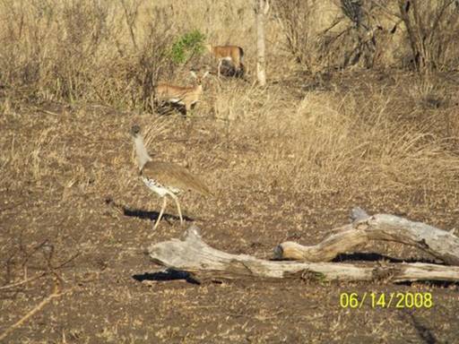
These endangered birds, which are almost my height, are very vulnerable to predators because they mostly walk and can only fly very slowly (see Pic 3).
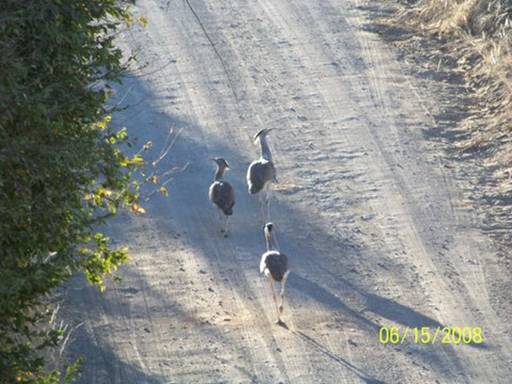
A little further we saw proud looking ostriches, who stood taller
than Dad when their necks were straight (see Pic 4).
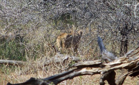
Before finding a good place to stop for a cold cereal breakfast in our car we pulled over where some people were looking at something through their window. We asked what it was and they said, “A lion.” They pointed to where she was but only Eliza could see her. Then we drove on a short way to a “hide” called Ratelpan. From inside the hide we could see the same lioness in the reeds and a BIG male lion lying down under a tree. Both were on the other side of the river. I felt so small looking at the big lion. He had a dark tinge to his big fluffy golden mane. He was beautiful.
--Abigail C.
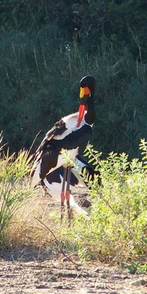
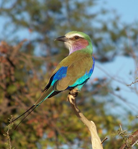
Day 15. June 15, 2008. Kruger National Park, Limpopo Province, South Africa. Overnight stay at Shingwedzi Rest Camp (23.11357ºS 31.43314ºE).
Jeans washed after 2 weeks of wearing them non-stop! Yay! Today we mostly did laundry, slept in, and tried to catch up on journals. Well anyway, back to wild animals. We went out on a short drive in the late afternoon. We saw many birds. Some of these were two saddle-billed storks (see Pic 1),
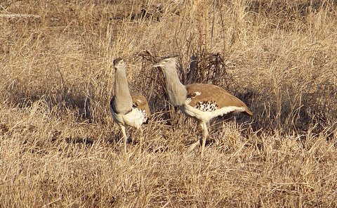
a pied kingfisher, three kori bustards (see Pic 2),
many lilac-breasted rollers (see Pic 3),
and my favorite, a hamerkop (see Pic 4),
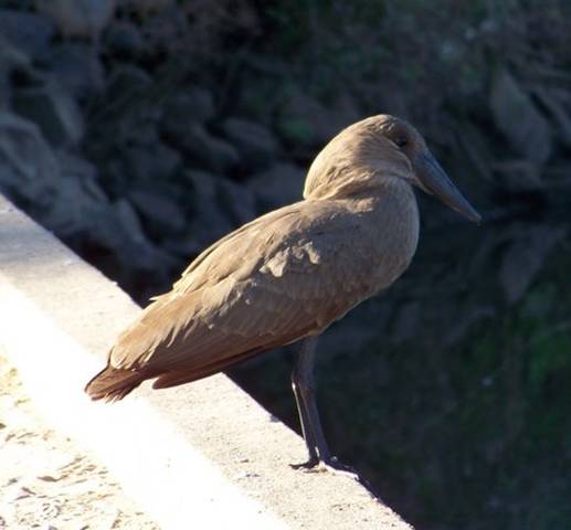
a water bird which we had never seen before.
My favorite moment, which was also a little bit scary, came at the end of the ride. We were driving along a little loop right near the Shingwedzi gate when we saw some elephants. There was a teensy weensy baby ellie that was looking at us, bobbing his head up and down and waving his trunk. Then he ran away (see Pic 5).
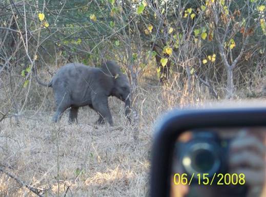
The mommy ellie crossed the road and looked at us, flapping her ears, looking angry. We quietly backed away and went the other way around the loop. Luckily she and the baby ellie weren’t on the road when we came back around.
--Abigail C.
Day 16. June 16, 2008. Kruger National Park, Limpopo Province, South Africa. Overnight stay at Letaba Rest Camp (23.85102ºS 31.57673ºE).
Today we drove back south to Letaba Rest Camp and met up with the Rapoports, our friends from Woodstock, Bradley (14), Dylan (18) and their dad, Mr. Rapoport. They flew to South Africa for two weeks to visit Kruger (and us). Our families have been friends since before I was born. It was fun having other kids around to play with. We were going to be together for five nights.
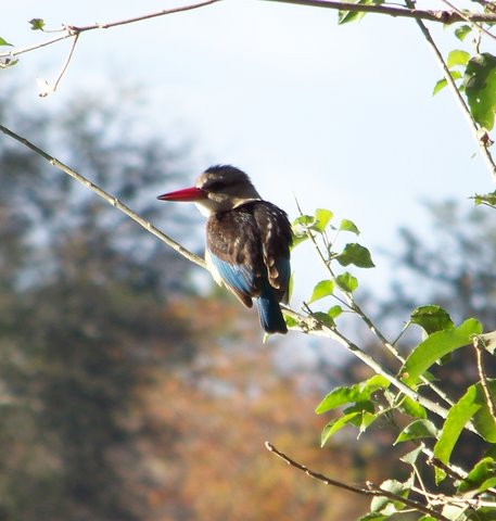
We saw lots of animals today. I really, really like kingfishers. I identified my third type today, the brown-hooded kingfisher (see Pic 1).
We also saw our first goliath heron (see Pic 2).
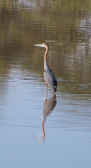
We had seen a goliath heron’s footprint once before, in Richards Bay. It was as big as Dad’s hand. Later we watched another black-backed jackal (see Pic 3);
I love them.
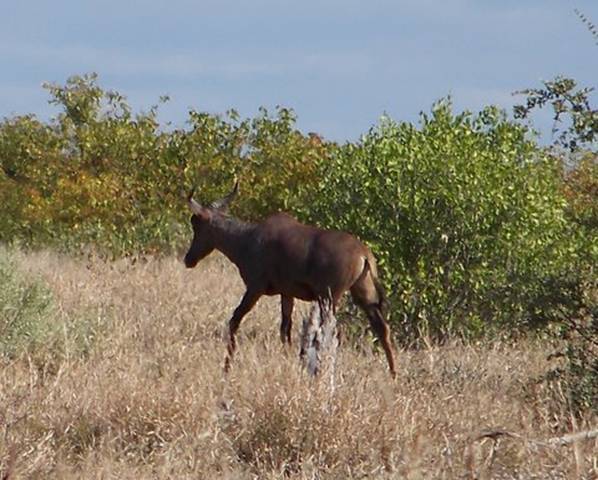
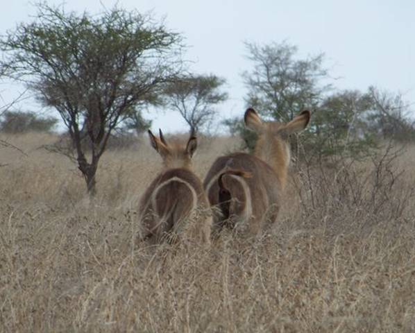
I think we all agree, though, that our family’s highlight on the drive to Letaba was identifying the tsessebe and the roan. The tsessebe is an odd looking antelope, with a purplish sheen to its coat and thick curving horns (see Pic 4).
The roan antelope is an endangered species; there are only 100 in Kruger. It has big floppy ears and horns that curve backwards. We saw two roans. One looked normal (see Pic 5).
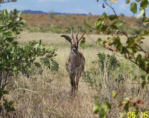
The other one had half of his right horn broken off. I bet they will be the last roan antelopes we will ever see.
--Abigail C.
Day 17. June 17, 2008. Kruger National Park, Limpopo Province, South Africa. Overnight stay at Letaba Rest Camp (23.85102ºS 31.57673ºE).
Until this morning our usual Kruger regime had been to get up in the dark (around 5:00), wash-up, and leave the camp when the gate opened at 6:00. I would sit in the front passenger seat, as not only chief navigator but also head chef -- two grocery bags at my feet, one filled with breakfast and the other with lunch fixings. We never knew if we'd reach a designated “get-out” spot in time for the next meal -- couldn't count on getting to the cooler in the trunk. Talk about meals on wheels! Coffee and tea served while the sun rose, we greeted the cool African morning with the car stopped and windows rolled down, wearing fleece hats and sweaters and listening to the birds. Later, we’d eat a breakfast of cold cereal and boxed milk, sometimes while crawling along at about 25 kph, a good pace for spotting animals.
We’d look for signs: fresh dung on the road (was it a huge pile of rhino poo, called a midden, a single huge Tootsie-Roll shaped ellie poo, large cape buffalo cow-pies or antelope mini-pellets?); circling birds of prey (was there a kill last night?); trampled trees (was an elephant close by?); and spoor (footprints) in mud patches or sandy dry river beds. The girls had acquired a great new passion early in our Kruger visit -- birds. And Abigail was carefully recording every new animal we spotted each day.
Driving for hours and hours, we scoured many different eco-zones, aided by excellent guide-books -- Mopane Shrubveld, Delagoa Thorn Thickets, Marula/Knob-thorn Open Tree Savanna, to name three of the twenty different zones.
Every late afternoon, it seemed, we'd find we had roamed a little too far from camp and a heart-pounding drive would follow. “Ok, no stopping except for a big cat!” We had visions of having to sleep in the locked car on the roadside outside the gate, hungry hyenas prowling around us. In truth, they'd have let us in, though after we paid a big fine. But we never missed the gate closing.
So when we rose at 7:30 this morning, ate breakfast at the tent and met the Rapoports, who were staying in a simple rondavel, at 8:30, it seemed like a vacation day! As a group we decided to try something totally different.
Instead of clocking the kilometers in search of animals, we would drive a short distance to a nearby “hide” and just watch the scene for a few hours, leave during the midday, and return to watch again near the end of the day. We’d stay put and let the animals come to us.
Armed with thermos and tea paraphernalia, I drove the Rapoport's 4WD with the kids, and Doug drove Ken in our car. On the way we came upon the most peculiar sight. Within a herd of six or more tall, feeding giraffes, a baby stood quietly, legs splayed out, hunched over and sniffing something on the ground (Pic 1).
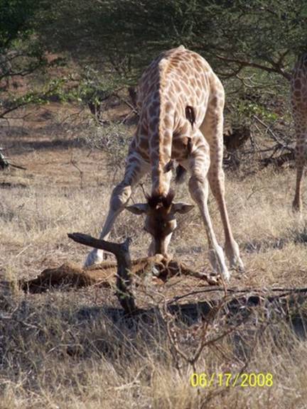
The object in front of it looked like a long jointed bone still covered in muddy hide. What was this baby giraffe doing? Back at the camp, when examining the photo zoomed-in on the computer, we could make out the spotted brown hide of a giraffe! It was a giraffe's leg! What had happened? Was it a member of the baby’s herd? Oh, this is a wild place.
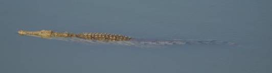
Once at the Matambeni hide (Pic 2),
we silently watched an amazing but typical variety of animals along a short stretch of the Letaba River (Pic 3).
Dylan was fascinated by the stealthy patrol of a lone nile crocodile (Pic 4).
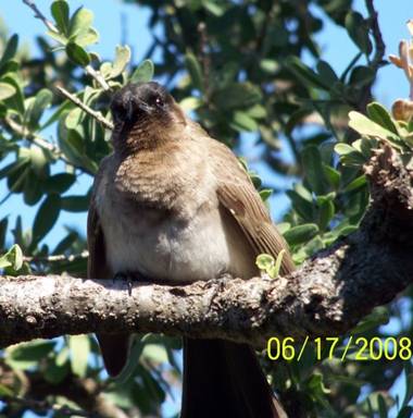
Abigail took many pictures of one of her favorite birds, the black-eyed bulbul (Pic 5).
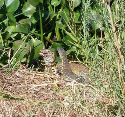
And engrossing for all of us were the two huge cape crag (monitor) lizards, mating, a sight rarely seen by Kruger visitors (Pic 6).
A couple hours later, after enjoying tea in silence, we returned to Letaba Rest Camp where Ken treated us to lunch at the restaurant overlooking a wide section of the Letaba, several kilometers upriver from the hide.
Later, Ken took the four kids back to Matambeni to see how life had changed there, while Doug and I got things started for a traditional South African braai outside the rondavel (Pic 7).
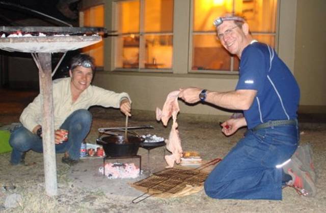
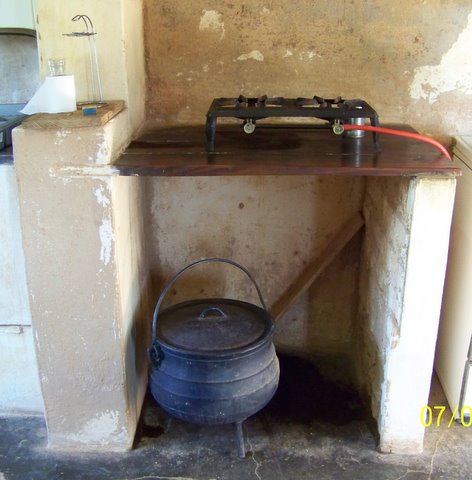
A braai is different from an American barbeque. The fuel is usually wood, instead of gas or charcoal, with cooking done slowly over low coals, no flames. In addition to a folding stainless clamp-type grill for "braaiing" fresh meat directly, the main implement is a cast-iron cooking pot called a potjie (pronounced poy-key).
Some have three legs and others a flat bottom; all have a heavy lid on which coals are placed. They are basically Dutch-ovens, used to simmer stews (also known as "potjies") and to bake breads. This technique was brought to South Africa by the Cape Dutch settlers (Boers) and especially put into use by the traveling Boers or Voortrekkers. But for this little American, I felt more like Ma Ingalls from Little House on the Prairie.
Doug's and my sacrifice for minding the hearth-fires? We missed the others’
fleeting sighting of a lion across the river and their gut-wrenching race back to the camp gates seconds before curfew, after an enormous herd of agitated cape buffalo blocked their road for ten minutes.
--Kyle
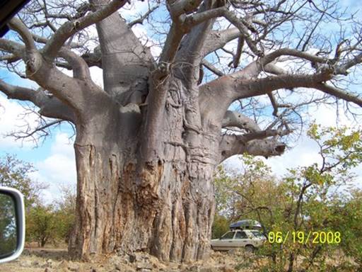
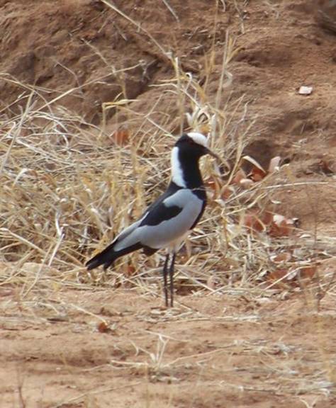
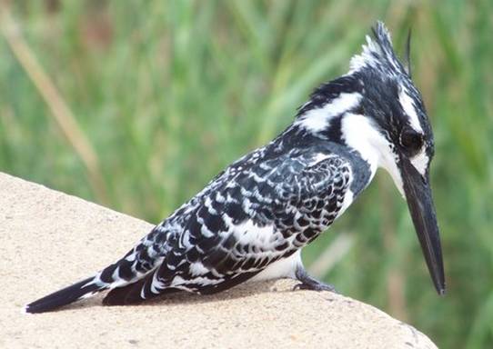
Day 19. June 19, 2008. Kruger National Park, Limpopo Province, South Africa. Overnight stay at Olifants Rest Camp (24.00565ºS 31.74022ºE).
Today, driving from Shimuwini to Oliphants Rest Camp, we saw our first spotted hyenas! We were at the intersection of Shimuwini Road and H14 when a spotted hyena came out of the grass and started to cross the road in front of us. Then two more walked out. One stumbled and fell down: his front left paw was missing (Pic 1).
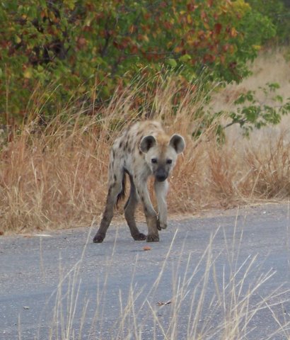
The other walked a little closer to us and then lay down right in the road. By this time, the first hyena had walked all the way across to the shoulder (Pic 2).
It lay right next to our cars. They all looked very thin and unhealthy, almost sick. I named the one with the missing forepaw “Braveheart”, and his clan, “Braveheart’s Clan”. I hope that he will live.
We also saw a huge baobob tree, scarred by elephants (Pic 3),
a blacksmith plover (Pic 4),
and a pied kingfisher (Pic 5),
plus a lot of other animals as well. It was a great day.
--Abigail C.
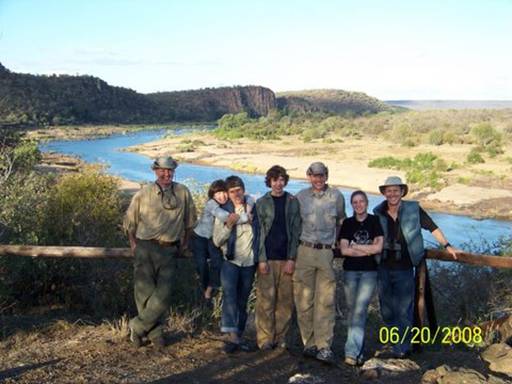
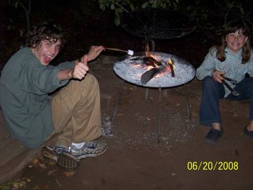
Day 20. June 20, 2008. Kruger National Park, Limpopo Province, South Africa. Overnight stay at Olifants Rest Camp (24.00565ºS 31.74022ºE).
It was a rest day today, with all of us either reading or napping, but generally relaxing. I read "The Power of One" (the story of a boy of British descent (a “rooinek” or redneck) in pre-Apartheid South Africa and how he struggles growing up in a mainly Afrikaner society); Abby read "Mahlangeni" (by a Kruger game ranger’s wife); Dylan read "War and Peace;"
and Bradley read "Three Cups of Tea" for school. In the afternoon we drove in the Rapoport’s car to a lookout on the Olifants River (Pic 1),
where we spent a long time gazing at the incredible view. Because we stayed so long we saw many shifts of animals come down to the river to drink, and other aquatic animals move around upstream and downstream. The elephants, silhouetted against the silvery river as they sucked water into their trunks and then poured it into their mouths, were the most graceful. Back at camp we had a long, slow braai, with chicken and steak, pasta, salad, and toasted marshmallows (Pic 2).
It was sad to think this would be our last dinner together.
--Eliza
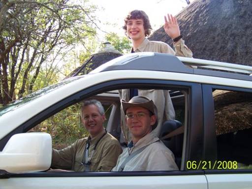
Day 21. June 21, 2008. Kruger National Park, Mpumalanga Province, South Africa. Overnight stay at Balule Bush Camp (24.05600ºS 31.72904ºE).
We saw more spotted hyenas! And cubs!
Today we waved goodbye to the Rapoports [:-(] (Pic 1)
and moved to Balule Bush Camp. We’ve been looking forward to Balule because it has no electricity and, since it’s very small, every campsite is against the fence and animals aren’t as scared of the camp. In fact, they have to keep the camp gate closed at all times, unlike all the other camps we’ve visited, where it is only shut at night.
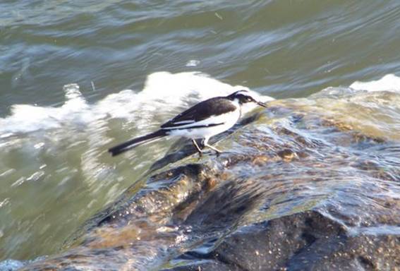
After setting up the tent we went out for an afternoon drive. The first thing we saw, crossing the bridge over the Olifants River, was a pied wagtail. It stood on a rock with water rushing over its feet (Pic 2).
Then we watched a group of about ten vultures perched in some trees on the river close to the camp (Pic 3).
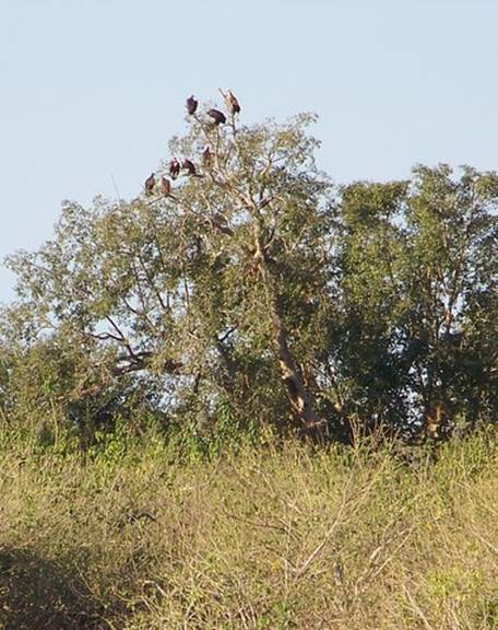
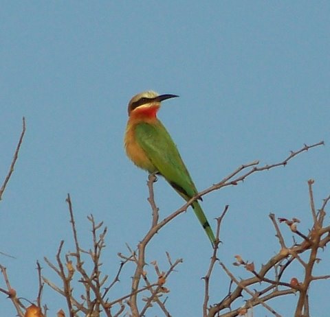
We drove around trying to get a good view of what they were waiting for. But we didn’t succeed. We thought there was a lion kill nearby. Setting up the tent we had heard violent roaring noises in that direction. Then I had to pee so we drove back to Balule to use the toilet. On the way we saw a white-fronted bee-eater (Pic 4).
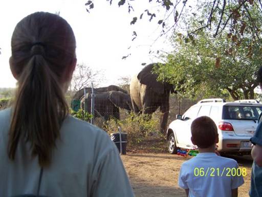
I really like bee-eaters, especially their long, slightly curved bills. When we entered the gate we saw a crowd of people looking at three elephants reaching over the fence with their trunks to eat leaves from trees inside the camp (Pic 5).
Then we left camp again for one more hour.
We were racing to get home when we saw some spotted hyenas in the grass right ahead of us. Then we saw the cubs, about four. They walked over to the car ahead of us and started to sniff the left rear wheel (Pic 6).
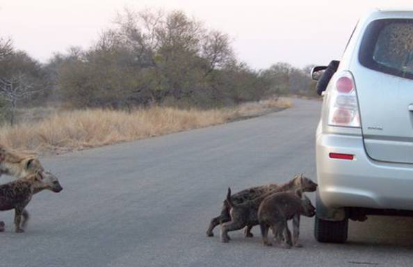
The people in the car made a noise to scare them away so that they wouldn’t bite the tire or something like that. Then a huge hyena came up from behind us and looked at us, on my side of the car. I was videotaping the whole thing and when I saw the big one I kind of hid behind the window frame because I didn’t want her to jump into the car thinking we were meat. A small hyena came over to the big one and lifted its leg for the other to sniff underneath (Pic 7).
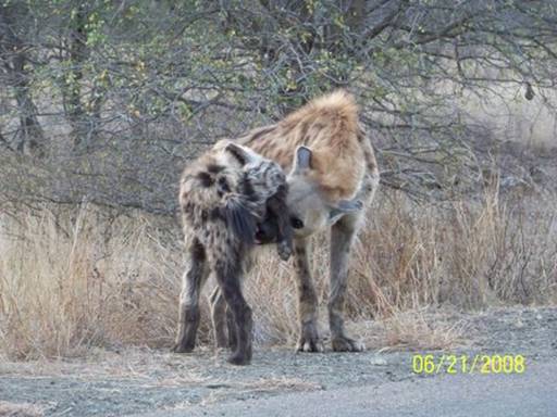
Later I read a Wikipedia article on spotted hyenas and learned that this was a friendly greeting and that hyenas are very social.
After dark, back at camp, we saw hyenas prowling around the fence. I really like hyenas and I hate how Disney makes them seem unintelligent and evil.
--Abigail C.
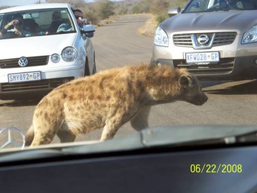
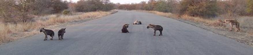
Day 22. June 22, 2008. Kruger National Park, Mpumalanga Province, South Africa. Overnight stay at Balule Bush Camp (24.05600ºS 31.72904ºE).
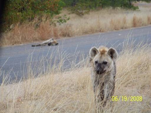
We saw the same spotted hyena clan this morning, I think. First, there was just a large female spotted hyena lying by the road, close to where we’d seen hyenas yesterday. But we suspected some of her clan might be nearby, so we waited (a lot of cars passed us). And we were rewarded. The female crossed the road and on the other side a little cub came out from its den and began nursing and playing around with her (Pic 1).

It was so adorable.
Then a hyena emerged from a den hidden under the other side of the road (we wondered if the dens were connected), walked across the road, and picked up a tiny, tiny cub in her jaws (Pic 2).
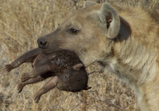
She carried it back across the road and then back again, looking anxious and unsteady. I thought the cub was dead because it was so still and stiff, but it wriggled a little when she set it down near the others. Abby named the tiny cub “Spirit” and the clan “Spirit’s Clan”. By this time a ton of cars had arrived and the hyenas seemed more nervous (Pic 3).
We finally drove on because we didn’t like disturbing the hyenas.
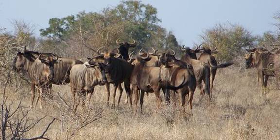
The rest of the day was a whirlwind of animal sightings. It felt as if we were just visiting all our old friends again. We drove in a huge loop way to the south before returning back to Balule seconds before the gates closed. We passed wildebeest (Pic 4),
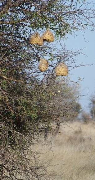
the basket-like nests of weavers (Pic 5),
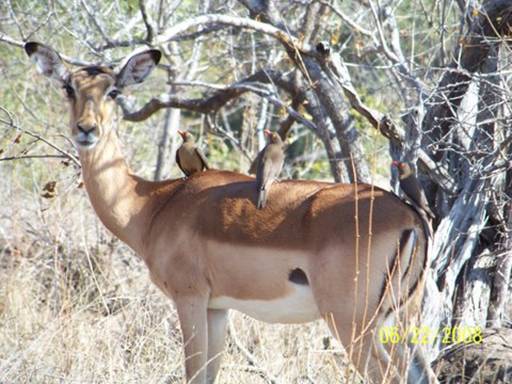
an impala ewe with three red-billed oxpeckers perched on her back (Pic 6),
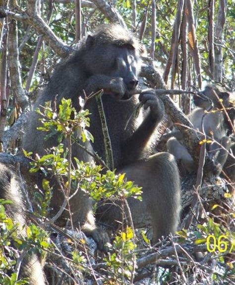
baboons munching noisily on long sjambok pods (Pic 7),
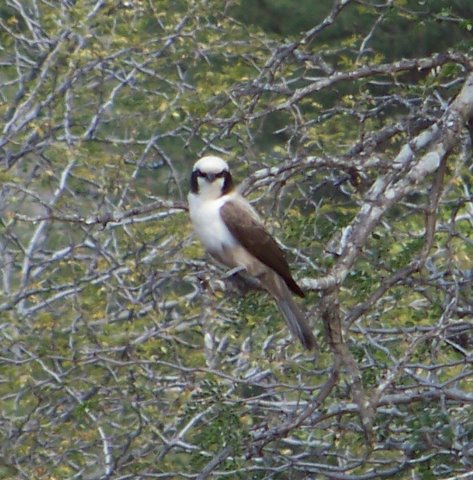
a whitecrowned shrike (Pic 8),
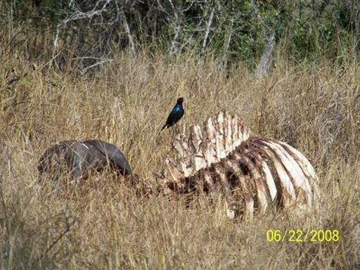
a cape glossy starling on the still blood-stained ribcage of a big cape buffalo carcass (Pic 9),
a red-crested korhaan (Pic 10),
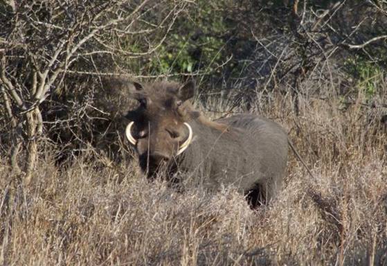
a warthog -- reminding me of Pumba (Pic 11),
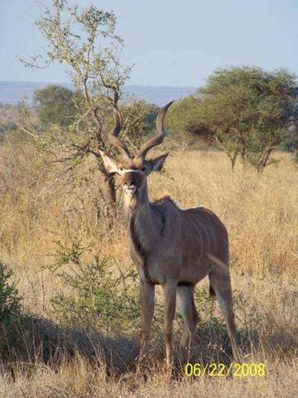
a young kudu buck with already magnificent spiraling horns (Pic 12),
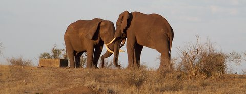
two elephants at a waterhole seeming to be sizing each other up (Pic 13),
and a group of spotted hyenas on the road near where we'd seen some the day before (Pic 14).
Later two hyenas prowled back and forth again outside the Balule fence, feet from our tent.
Sitting quietly by the light of the braai coals I felt sad because this would be our last night in Kruger National Park.
--Eliza
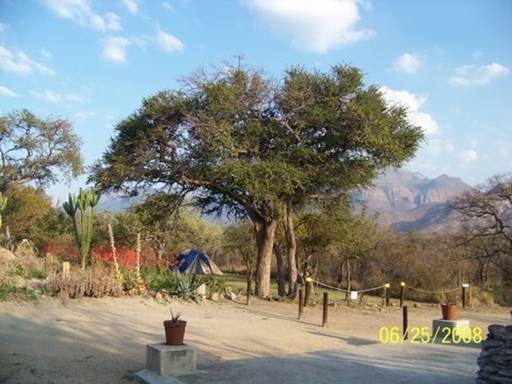
Days 24-30. June 24-30, 2008. Blyde River Valley, Limpopo Province, South Africa. Camping at Blyde River Canyon Backpackers (24º28.23’S 30º52.77’E).
So far our camping/living/traveling systems are working well because we feel at home wherever we are. And by the time we left this scenic (Pics 1&2 show the lovely gardens and the Klein Drakensberg escarpment),
friendly, and surprisingly empty backpackers, we felt thankful for the slower pace and the abundance of space here. We spread out all our gear in the communal kitchen/lounge area and culled anything that we hadn't used, whether school books (the girls didn't complain!), pleasure books, kitchen items, or extra winter clothes -- after our decision to skip the very wintery Lesotho on the way back to Knysna -- and mailed it all in three boxes to a friend who's been watching over Estrela. Our car's suspension is thanking us for lightening its load.
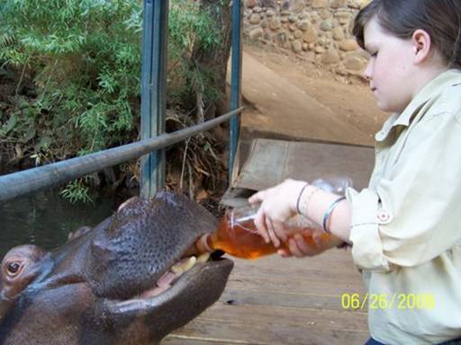
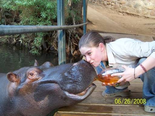
Breaking up our intense domestic focus a little, we also visited three different tourist attractions this week: Jessica the Hippo, the tamed 8-year-old hippo who's been on Animal Planet and has her own website -- www.jessicahippo.co.za (Pics 3&4 show Abby and Eliza feeding her rooibos tea);
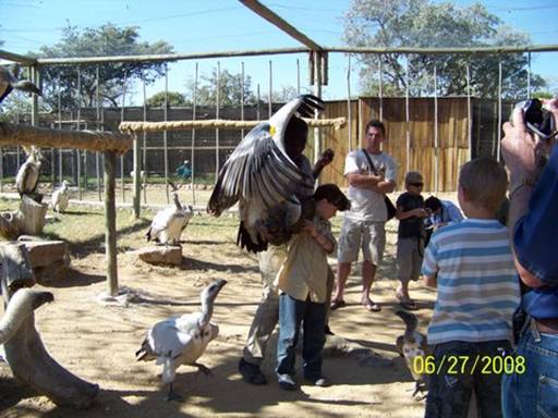
the Moholoholo Wildlife Rehabilitation Center, an educational and veterinary center where injured wild animals are treated (Pic 5 shows Abby feeding a rehabilitated Cape vulture);
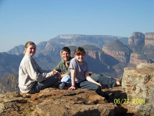
and the Panorama Route drive, a circular scenic drive up and down the northern Klein Drakensberg escarpment and Blyde River Canyon (Pic 6 shows us with The Three Rondavels in the background).
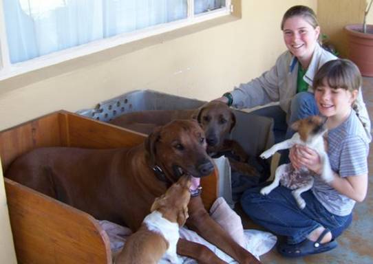
But mostly we stayed at the backpackers, worked on our Kruger log entries (Pic 7),
and played with the resident dog population (Pic 8).
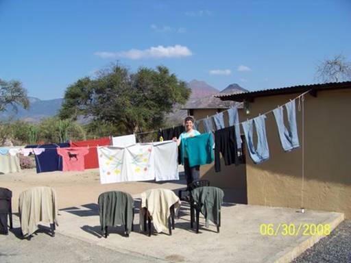
I also did laundry by hand in the sink with the abundant hot water and hung it out to dry (Pic 9)
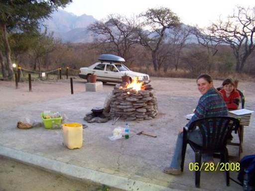
and we often cooked outside on a braai (Pic 10 shows the potjie with its own ring of stones, coals on the lid, next to the fire -- after a potroast dinner we baked muffins in metal mugs in the potjie ).
It was a lovely week at our temporary home.
-- Kyle
Day 23. June 23, 2008. Kruger National Park to Blyde River Valley, Limpopo Province, South Africa. Overnight stay at Blyde River Canyon Backpackers (24º28.23’S 30º52.77’E).
Waking in the pre-dawn and knowing this was our last day in Kruger was depressing; I wished we could have stayed here forever. We packed up the tent and gear and left Balule at 7:30. On the way south we detoured to look for our hyenas again (Spirit’s Clan). I was glad we saw them one last time. Then we slowly drove the gravel-surfaced Old Main Road toward Satara Rest Camp.
On one stretch of the road we saw many destroyed trees and shrubs (Pic 1).
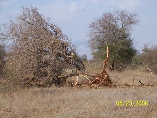
A herd of elephants must have passed. This is a common sight, as Kruger has about 12,500 elephants (2005 census), way too many. Elephants need space, lots of it. They eat by uprooting trees and stripping their leaves and bark, even that of the roots, which are the sweetest parts in the wintertime. In the wild, before most of southern Africa was turned into farmland, elephants migrated over vast distances, allowing the areas they’d passed through to regenerate before they returned. Kruger Park is too small for the current population. One symptom is a decline in the numbers of some birds of prey, species which depend on certain tall trees for nesting.
Elephant overgrazing is wiping out these trees faster than they can replace themselves. Logically some elephants should be translocated or culled. But this is a very emotional subject. Most other wildlife reserves have all the elephants they can sustain, and there’s great public opposition to culling, both in South Africa and in the rest of the world. “We shouldn’t be killing the elephants!” many people say, and I agree to a certain extent. Killing just for ivory, skin, bones, and other body parts, and even for food should definitely not be allowed. But killing, or culling, to protect smaller creatures whose habitats are being destroyed by elephants, like birds of prey, should be legal. And if elephants have to be culled, I support using everything, even the meat. It’s especially important for poorer people living near the park to benefit economically from Kruger so they don’t just view it as a place for wealthy tourists. The problem though is that now that selling culled ivory is legal, poached ivory is also slipping through loopholes into the international market and there’s a bigger incentive to poach. Why couldn’t an international organization track legal ivory and filter out poached ivory? The result of opposition to culling is that
there are now too many elephants in Kruger, and the ecosystem and many species are suffering.
Three giraffes stood motionless, knee-deep in a sea of waving yellow grass (Pic 2),
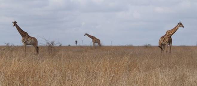
apparently chewing their cud. I don’t actually know if giraffes chew cud, but that’s what it looked like. I have a new admiration for giraffes since watching “The Killing Game,” a movie shown one night at Satara Rest Camp. It tracked a pride of lions that specialized in killing giraffes. One old bull lured the lions away from his herd and was nearly killed. Amazingly, he could still run while five fully grown lions clung by their teeth and claws to his four shoulders and rump. He escaped them but eventually died of infections and thirst. Now whenever we see giraffes we look for scars and wonder at their bravery.
As we dropped down to cross a peaceful stream, a thread of green in the parched savannah, we identified several new bird species, including the redbilled firefinch. Further down the road, a mother waterbuck and her baby walked alongside us for a few minutes before angling off into the long grass, presenting the distinctive white bulls-eyes on their rears (Pic 3).
While on our sunset drive in Shimuwini, Johann had told us that the waterbuck is a last resort for predators because for some reason its meat tastes horrible.
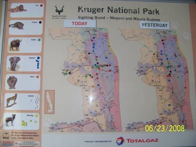
In Satara we refueled and went to the store to buy a springbok skin (Mom), postcards (Abigail), a Kruger mug (Dad), a Kruger bracelet (me – like my LiveStrong bracelet), and a bird ID book to feed our new addiction. Outside the store we checked the animal sightings board, a Kruger map with movable magnets, one color for each of seven species (the Big 5 plus cheetahs and African wild dogs). It was really fun at the end of the day to place a magnet in a spot no one else had yet “claimed.”
Driving slowly on the tarred road, we made the most of our last hours in the park. When we stopped to look down a bank to a water hole, Abby pointed out a bateleur, a striking, eagle-like bird with a bright red face and legs, by the water’s edge. Suddenly it shot upwards (Pic 4),
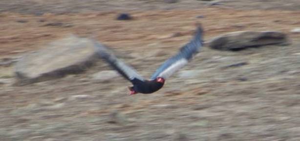
flying just feet over our car. It was spectacular.
Less than a kilometer from the gate, we saw another herd of Burchell’s zebra, the most common in South Africa, and the only zebra in Kruger. We had seen many herds almost everywhere in the park, often together with impala or wildebeest. A large female zebra crossed the road behind us; we saw blood caked on the white stripes of her neck and legs (Pic 5).
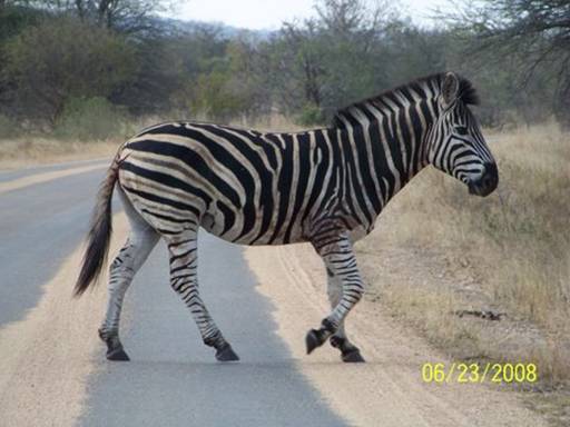
As she turned into the thickets we could see a long ragged gash beside the dock of her tail (Pic 6).
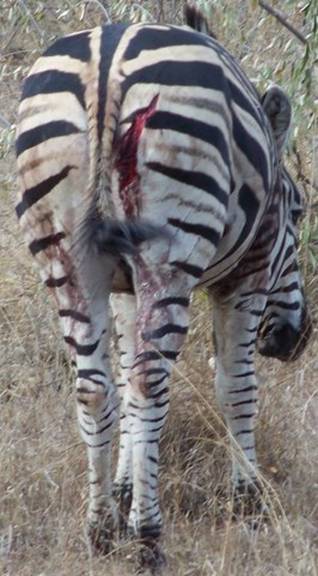
Widely-spaced parallel claw marks on both thighs left no doubt a lion had done this. The freshness of the wound and the lack of flies indicated she had been attacked as recently as last night or early this morning. Unbelievably, the zebra walked normally, as if nothing had happened. She must have been in agony, though. I hope her wound will heal.
We left Kruger National Park through the Orpen Gate. The animals we saw last were impala, not surprising considering their numbers in the park, 101,000 in 2005. They were also the first mammals we had seen on entering Kruger.
We drove about an hour further and pitched our tent at Blyde River Canyon Backpackers, not far from the towns of Kampersrus and Hoedspruit. I loved the gorgeous view of the Klein Drakensberg escarpment from our campsite, the towering cliffs red in the afternoon sun. We were the only campers. Mom made a simple spaghetti for dinner in the homey communal kitchen.
-- Eliza (Dad, thanks for the editing help . . . simplify, simplify,
simplify!!!)
Days 32-34. July 2-4, 2008. Tzaneen, Limpopo Province, South Africa.
Camping at Satvik Backpackers. (23º50.473’S 030º07.242’E).
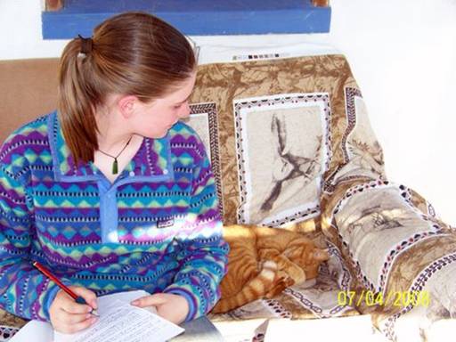
These three days have been schooldays. Yes, we did some math, but mostly it was just working on our website journal entries in the Satvik Backpackers lounge (Pic 3).
At Blyde River, Mom had typed in Abby's and my journal entries for Kruger, and so together with Dad we filled them in with more details and chose pictures. While one girl was working in the computer (Pic 4),

the other would write in her journal on the porch with Ginger the cat (Pic 5),
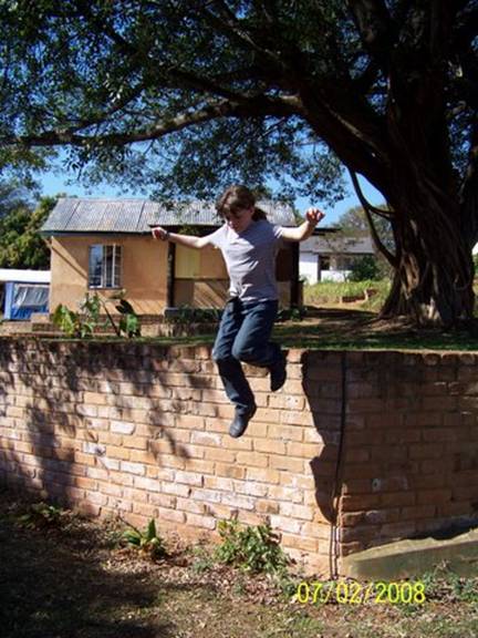
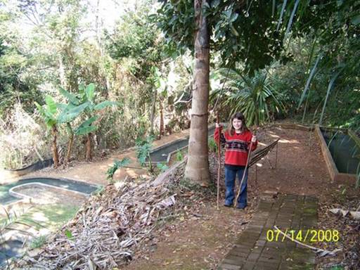
do regular school work, help Mom with laundry, or jump off the stone walls (Pic 1).
It was an intense time but also relaxing, in the breaks.
On Friday the fourth (Happy Fourth of July, everyone!) we woke up really early and began on the journals almost immediately, even before breakfast, so we could finish it all and leave Satvik the next day. After a couple hours of working, we took a break to eat breakfast on the lounge porch, talking about the future and what our life would be like when we got back.
Then we started writing again. Oh, one cool thing that happened was that on the bookshelf right next to where we were working we found a plastic box (see the little white shape on the far left of Pic 4) that turned out to be something called a "geocache." We had heard little bit about geocaching before -- it's kind of a big treasure hunt using GPS's -- and now we'd found one by accident. Here's the website where we logged our find:
Every night two of us would chop wood from a huge pile of brush to build a fire. The first two nights Mom cooked in the communal kitchen (Pic 2),
and we had a fire for warmth in the tiny woodstove in the lounge, with us huddled around it telling stories and playing guitar. The last night we had a roaring cooking braai on the ground outside (Pic 6).
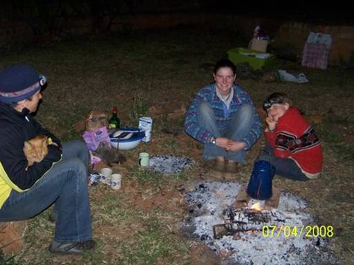
Finally we were DONE with the WEB LOG ENTRIES!!! Relieved, we gathered around the braai and sat on the ground to eat, Ginger weaving through our legs. I liked this fire the best of all the ones we've had over the last month because it was directly on the ground, heating us all over, instead of high up in a braaistand which typically left our legs freezing. We sang songs and talked and ate, enjoying the warmth and the happiness. Bushbabies watched us jealously from the trees, their eyes flashing red whenever we shone a light on them. After the food was all eaten, we roasted marshmallows over the coals. Before we scattered to clean up and get ready for bed, we all stood around the fire and sang one last song.
These three days have been full of accomplishments and victory, but of everything, my favorite part was just hanging out and having fun with my family (and Ginger: I really want a cat like her, but grey with green eyes).
I don't know exactly where we're going tomorrow, but it doesn't matter as long as I'm with my family and having a good time.
-- Eliza
Day 35. July 5, 2008. Tzaneen to Magoebaskloof, Limpopo Province, South Africa. Camping at Magoebaskloof Ruskamp. (23º51.811’S 030º00.563’E).
Elevation: 1199 meters (3934 feet).
We had grown to love this peaceful place, the Satvik Backpackers, with its wonderful animals weaving in and out of our lives, the rustic but lovely buildings nestled into the hillside, and its simple pace of life. It was a sanctuary. We became friends with Louis, the owner of Satvik (Pic 1).
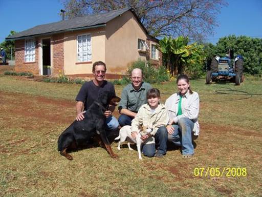
Through our several conversations with him, we learned that this had once been Louis's grandfather's thriving fruit plantation, whose main crop was bananas, with some avocados and mangoes as well. These stucco/cement and thatch buildings were the workers' living quarters. Louis said that his grandfather had been ahead of his time. I'm not exactly sure what he meant by that, but I think he was trying to illustrate that this picturesque setting, with grass and plantings, and the comfortably-sized, though simple, accommodations, were not typical for most apartheid-era workers' housing.
Just from what we've seen driving around South Africa, I would agree. We've mostly seen small huts lined up in a row, more like chicken coops than people's homes, many abandoned now, but some still occupied. My heart aches.
The long, uphill, dirt driveway was barely passable for our loaded-down rig, so the girls and I walked up the hill while Doug maneuvered his way up.
Then while sitting in the car waiting for us, he connected to the internet and sent off log entries to George.
The big question now was, do we go left or right, the usual dilemma for phantom travelers. After consulting maps and guide books, we decided to go left, which meant backtracking to town for a re-supply before continuing west toward Botswana. Surely there would be a place to camp on the scenic route 71 in the mountains! Our guide books didn't mention anything, but we thought that we'd take a stab at it. Luckily for us, there was one. So as the sun was dropping behind the mountains, we were raising our tent at the Magoebaskloof Ruskamp.
-- Kyle
Days 36-37. July 6-7, 2008. Magoebaskloof, Limpopo Province, South Africa.
Camping at Magoebaskloof Ruskamp. (23º51.811’S 030º00.563’E). Elevation:
1199 meters (3934 feet).
We awoke on Sunday to glorious weather (Pic 1).
No computer. No website.
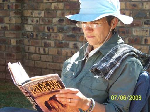
No journals. Today I wanted a real Sabbath. And so I read aloud our family book, "Sword at Sunset," by Rosemary Sutcliff, a sixth century Celtic version of the Arthur tale, for most of the day. But I did get a moment to read my own pleasure book about Botswana's Kalahari Desert (Pic 2).
Monday was a different story . . . Abby was bursting with unused energy. We decided to go out for a picnic lunch and afternoon hike. With directions from the Ruskamp manager Etienne, we found a dirt road into a recreational hiking area within the vast Komatiland forest plantation. As we parked the car by the Woodbush Hut, several miles in from the main road, a group of four South African hikers were cracking open celebratory beers; they'd just finished a three-day hike of the 42km Dokolewa Section of the Magoebaskloof Hiking trail. If we are considering tackling any overnight hiking trails during our visit to South Africa, they told us, this is one of the great ones -- don't miss it! They had traveled here from Cape Town -- the other end of the country.
Wellllll . . . . . we spread out our lunch on a picnic table and talked over the idea. Yup, let's do it, everyone agreed . . . uhhhhh, but wait, we need backpacks! Forget today's hike, let's drive to town. They've got to sell backpacks around here. The rest of the day was a whirlwind. We tried the nearest town, Haeaetsburg, 15 km west, but it was too small -- go back 40 km east to "Trappers Trading" in Tzaneen, they said. So back we raced (passing right by Satvik Backpackers!), our third or fourth trip to the town. I was making lists all the way . . . instant potatoes, cup-a-soups, a tin cup, milk powder, a wide-mouth "Nalgene" bottle for mixing milk, rice, biltong and droewors (various SA dried meat), instant hot cereal, Ryvita Crackers, PB and J (thank goodness SA PB is delicious), a chops braai pack and cabbage for a freshies dinner on our first night . . . oh yeah, and a compass. We had to get some more cell phone credit too so Doug could go online with the laptop and make a reservation for the three huts we'd be staying in. Yikes!!
Ok . . . we parked under the downtown mall with an hour and a half before stores closed. Backpacks selected in 45 minutes, after we had all logged several kilometers marching around the curiously poorly stocked and tiny outdoor store -- the water bottle selection consisted of only military style green plastic canteens, and NO compasses! Then the team did divide-and-conquer, Eliza and me to the Pick 'n Pay for food and Doug and Abby to roam the other mall stores for the other stuff. Their big success story??? . . . Finding compasses for 2 Rands each in a gumball machine.
They bought three, figuring the average readings would be reliable.
Actually, two read identically and the third seemed way off, so they chucked it.
It was dark when we drove away; we wouldn't take the tags off the packs, though, until we'd made hut reservations. But we knew everything would come together. Parking at a service station near a cell tower, Doug connected to the internet, found the website and filled out on-line forms to make our hiking request. We found a telephone number we could use tomorrow morning to confirm and pay by credit card. Phew.
I was thankful the family agreed to forego the usual campfire dinner (there's no communal kitchen with stove here) and eat stuffed baked potatoes and a plate of extra French fries at the Ruskamp restaurant (with tall glasses of tap water for drinks) instead. We left everything locked into the car and collapsed into our sleeping bags. Gotta love phantom . . .
-- Kyle
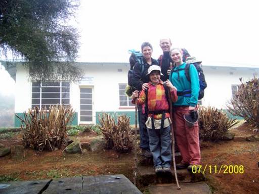
Day 39. July 9, 2008. Magoebaskloof Hiking Trail, Limpopo Province, South Africa. Overnight stay at Woodbush Hut. (23º50.484’S 029º59.266’E).
Elevation: 1540 meters (5052 feet).
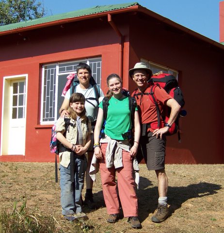
As Mom, Dad, and I packed our bags and stuffed everything else into the car, Eliza set up a before-the-hike group picture in front of De Hoek Hut (Pic 1).
We left the hut and walked down a steep hill to reach the Dokolewa Pool Hut. From there we crossed a really cool wooden bridge with a little waterfall behind it and a beautiful pool below it. Just after we crossed the bridge we passed two really friendly trail workers. They said that it was OK if Dad took their picture with us (Pic 2).
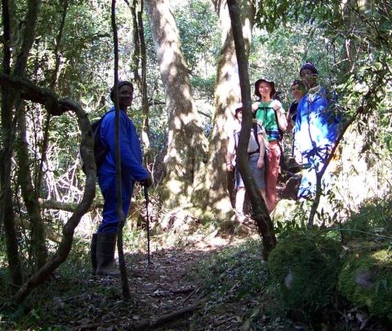
That's me behind the tree.
A little while later we passed out of the dark indigenous forest and onto a sandy road at the edge of a huge dry area where all the trees had been cut down. In the sand we saw some spoor -- paw prints (Pic 3).
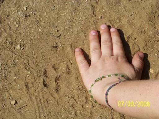
That's my hand.
I wish I had my "Tracks and Signs" book to identify which type of animal it was. We knew that it wasn't a cat because we could see little claws.
The rest of the hike was really exhausting and steep up and down. We finally reached the T-junction . . . left to Seepsteen Mule Stables Hut and right to Woodbush Hut (Pic 4).
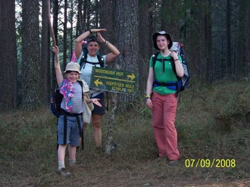
In my left hand I'm holding a dead butterfly and in my right I'm holding up "Lightning Bolt," my faithful walking stick I found earlier in the day. Joyfully, we turned right and walked uphill through a pine plantation the last short bit to Woodbush Hut (Pic 5).
In this picture you can get another view of Lightning Bolt and in Dad's hand you can see "Twig of Power," Dad's walking stick that had been one piece of wood with Lightning Bolt until Dad had put the middle in a notch in a tree and pushed to the left and broken it in two. The packs you can see us carrying were very comfortable the whole way from De Hoek Hut to Woodbush Hut.
We finally got there and as soon as I caught sight of the picnic tables I shrugged off my pack, dropped Lightning Bolt and ran the rest of the way.
The loyal sticks had done their duty and brought us safely to camp. Even though we were smiling at the camera our legs were shaking so much they felt as though they would fall off (Pic 6).
During the walk we had collected garbage along the trail, acting as though we were on a treasure hunt. Dad had offered prizes of five Rands each in four categories: Most Volume, Most Number of Pieces, Most Unusual Piece of Garbage, and Most Improved Collector. Today I won Most Number of Pieces because I had 21. Eliza won Most Improved. This is why. I kept on finding the pieces that were the size of my pinky nail and Eliza wasn't really finding anything. So she yelled to Dad, "Just give Abby the five Rand!!"
Later Eliza really started trying to find her own pieces. Mom won Most Unusual because she found a sponge, which was just a little bit more unusual than my newspaper clipping (we voted). Dad won Most Volume because instead of finding lots of small things like me, he found lots of large things. So each of us won a prize. We wouldn't pick up peepee paper wads but instead would bang our sticks on something as a sign of displeasure. This is a picture of Dad, Eliza and me at Woodbush Hut throwing away the garbage we found (Pic 7).
-- Abigail C.
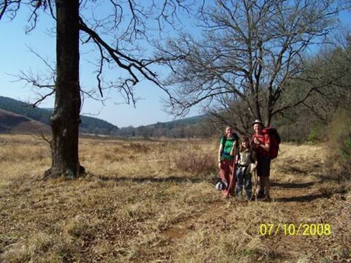
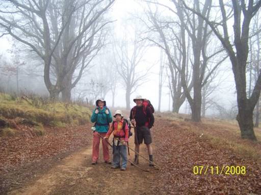
Day 40. July 10, 2008. Magoebaskloof Hiking Trail, Limpopo Province, South Africa. Overnight stay at Broederstroom Hut. (23º47.994’S 029º58.839’E).
Elevation: 1573 meters (5161 feet).
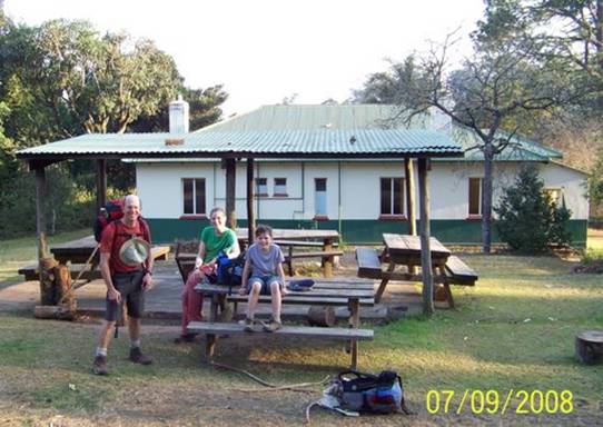
We woke up early and leapt from our beds at Woodbush Hut to start the fire.
They weren't the nicest beds but they were better than nothing (Pic 1).
Eliza, Mom, and I split kindling and got the fire going and started the hot water.
Instead of waiting for the hot water to boil we should go back inside and stuff our sleeping bags into our backpacks, Dad said. When Eliza and I got to the door it wouldn't open. We tried again and again. Mom apologized and said the latch had come apart and she should have put it back together before shutting the door and coming out to the fire the last time. We were locked out!!
Dad came over and he and Eliza and I looked for a window that was open but there weren't any, but some had latches only partly closed. So Dad chopped some wood into really slender pieces to use as wedges. He and I went from window to window checking quickly. Eliza was behind us checking a little more patiently. She called, "Dad, I think this one will work. Can you help me?" She was right. Dad tapped a piece of wood down through the tiny crack and pushed the handle open. Then I tried to climb in, but the edge of the window was too high. I was supposed to be the burglar, like in Oliver Twist or Bilbo in The Hobbit. So Dad lifted me up and I climbed in. I got up and walked down the long hall to the kitchen door. The broken face of the latch had swung down with the handle still attached and the axle had slipped out.
I pushed it together the best I could but it still didn't work. I called Eliza and she went to the other side of the door and pushed the handle in and turned and opened the door. Yay! We got inside!
We had breakfast and packed up. Just before we left we took a picture of us in front of The Door of Glory (Pic 2).
After walking through indigenous forest, pine plantation, and eucalyptus plantation we came to our first view on the hike so far (Pic 3).
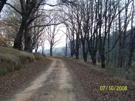
Nearing Broederstroom Hut we walked along a beautiful oak tree-lined dirt road, passing a white foot trail marker every once in a while (Pic 4).
In this picture you can see Twig of Power, Lightning Bolt and my new walking stick, "Stickfolk." We found him right on the trail by a waterfall where we had filled up our bottles and put purification tablets in them. Someone must have forgotten him there when stopping for a break.
When we reached Broederstroom Hut we all flopped down onto the benches and took our shoes off our throbbing feet. We hiked 15 kms, almost twice the distance we walked yesterday. It had been a long day, but tomorrow would be even longer. I love hiking. So it doesn't matter how long it is, as long as I am having fun.
-- Abigail C.
Day 41. July 11, 2008. Magoebaskloof Hiking Trail to Magoebaskloof, Limpopo Province, South Africa. Overnight stay (in a rondavel!!) at Magoebaskloof Ruskamp. (23º51.844’S 030º00.512’E). Elevation: 1194 meters
(3917 feet).
We woke up at Broederstroom Hut to a sky white with fog and the hiking clothes we'd left out to dry completely soaked, along with our firewood.
But luckily it was our last day, and we had extra wood and clothes. It sure was chilly (Pic 1).
At 8:00 we said goodbye to Selina the caretaker at Broederstroom Hut and walked down a forestry lane (Pic 2),
which, with all the gnarled oaks lining the way, could have been an old road in Woodstock, CT in late autumn. It looked totally different from when we had taken a picture of the same spot yesterday, when it was still sunny (Pic 3).
On we trudged, trying to avoid the tall, wet grass in the road, and struggling to keep our fingers warm. Mom and I just tucked our hands underneath our backpack straps, but since Abby and Dad had hiking sticks to hold onto, their fingers were moving about through the cold air, and so they were freezing. I think sticks are a huge nuisance sometimes, especially when walking steeply uphill; they always are in the way. Abby spent half the time dragging hers behind her. Her excuse was that it actually helped with balancing. Yeah, right.
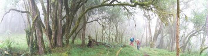
Most of the day we hiked through the indigenous forest, and in the mist it was even more mysterious than before. Giant tendrils of moss hung from wizened trees and the gloomy light barely touched the carpets of ferns (Pic 5).
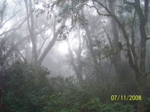
It seemed like the perfect place for a gnome or a fairy. I think an accurate description for it would be a cloud forest, because it never truly rained, it was just drizzly and misty (Pic 4).
The indigenous forest was disrupted by sections of pine plantations.
Actually the truth is that it was pine plantations disrupted by sections of indigenous forest, but they set up the trails so you walk curving around through mostly indigenous forest, skipping from one ribbon to the next. The pines were a break from the closeness and tangle of the ancient forest. The horizon opened up and we could see quite far between the neat rows. Most of the time the trails through the plantations were old disused logging roads, and it was lovely not to keep tripping over roots and fallen branches. But then I'd remember how this whole place was once indigenous forest, and they'd cut it down, all the animals' homes and the ancient hard woods, to make these pine and blue gum plantations for paper and building materials and other things. We would walk into clear-cut hillsides where the pines had already been taken away to a mill somewhere, and it looked so ugly and sad, like the soul of the land had been taken away as well, but not only because the pines were gone.
Halfway to the end, we were about to cross yet another drainage when Mom spotted an orange peel on the trail. It's amazing to me how careless some people are with their orange peels, especially since if it takes them 60 years to decompose in the ocean, it must take a long time on land, too (I don't know how long). Anyway, Mom put the peel in a bag and we carried on around the bend. A huge group of orange-eaters must have decided to use this section of the trail as a lunch stop because the ground on both sides was littered with little pieces of orange peels. I was really mad. We split up and gathered every scrap we could find, dumping it all in the garbage-collecting bag attached to the back of Mom's pack. The bag was very large by the end, and I don't know if we even got all the bits of peel, but at least the trail will look better for the next hiking group that comes along.
Dad's stick, Twig of Power, fell in the Dokolewa River five minutes away from Dokolewa Pools Hut, and a half hour from the car. Twig saved Dad from falling into a particularly good swimming hole we had walked closer to stare at longingly. Okay, so maybe sticks are good for something.
We climbed the last, steep hill up to De Hoek Hut, knowing that each agonizing step brought us a little closer to the end. Then we saw the red painted building and our beige car waiting for us. WE MADE IT!!!!!!!
Exchanging sweaty clothes for warm ones, we sat at the picnic table for hot drinks and crackers. The whole 18 km we'd hiked today we hadn't stopped for any food or water breaks, because it was too cold and we had so far to travel. So we all really needed this rest. Elated and exhausted and frozen, we decided to stay at the Magoebaskloof Ruskamp again because we had no idea where we were going next, it was getting dark, and we were all freezing. Thankfully Mom and Dad asked for a rondavel, instead of a campsite like last time, which meant we didn't have to do anything to get it set up, we didn't have to have a cooking braai because there was a little kitchen inside, and there was a TV (we watched James Bond's "On Her Majesty's Secret Service").
I love hiking and I can't wait to do more. This trail, the Magoebaskloof Hiking Trail (see website: www.komatiecotourism.co.za), was one of my favorites so far. I'll always remember hiking through the different types of forests and carrying everything we needed on our backs. We're thinking of maybe going hiking in the desert in western Namibia in a few weeks and also in the Outeniqua Mountains after we get back to Knysna. I'm really excited.
-- Eliza
Days 42-43. July 12-13, 2008. Magoebaskloof, Limpopo Province, South Africa. Overnight stay at Magoebaskloof Ruskamp. (23º51.844’S 030º00.512’E). Elevation: 1194 meters (3917 feet).
Very thankful to be off the trail, we awoke to an even gloomier and chillier day on the 12th and low clouds and misty rain hung on for two more days. We had all been chilled to the bone on that long last hike and couldn't seem to warm up. Then Eliza came down with a fever. No question that we'd just stay put in the rondavel (Pic 1).
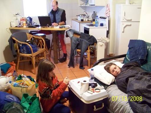
Our bodies wanted healing and all our gear needed to be emptied, cleaned, shuffled and repacked (Pic 2).
We had to make the transition from hiking-camping back to car-camping. So we enjoyed a few days of conventional living with an indoor kitchen, electricity (except for the few hours that it went out during dinner prep on the 13th when I wished that I had cooked over the fire!), and (by the second day) a space heater. We finally recuperated.
-- Kyle
Day 44. July 14, 2008. Magoebaskloof to Polokwane, Limpopo Province, South Africa. Camping at Polokwane Game Reserve Caravan Park. (23º53’S 029º27’E).
Pic 1: The rondavel, our sanctuary during the cold weather. We learned this morning we'd been the only guests last night in the whole Magoebaskloof Ruskamp! Notice the sunshine, which finally returned. Ahhhhhh . . .
Pic 2: Abby bids goodbye to Lightning Bolt and the baboon spear we had carried all the way from Royal Natal. She had a few minutes alone with them before leaving them propped against a tree.
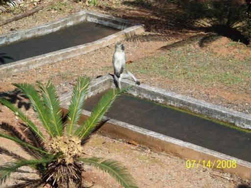
Pic 3: A typical African campground scene -- a vervet monkey somewhere in the background -- this one perched on the put-put course.
Pic 4: Checking out of the Ruskamp and saying goodbye to our new friend Etienne, the manager.
Pic 5: Back to arid roadside scenery. Heading west, we crossed a pass and left the hills and fertile, lush farm land behind. I think we'll be seeing a lot of this all the way through Botswana -- flat and dusty.
-- Kyle
Day 45. July 15, 2008. Polokwane to Grobler’s Bridge, Limpopo Province, South Africa. Camping at Big Fig Inn. (23º01.433’S 027º57.737’E).
Elevation: 779 meters (2556 feet).
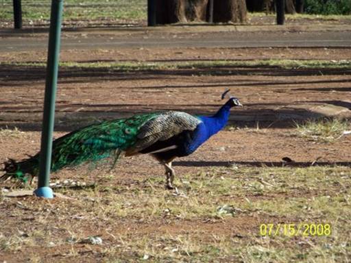
Waking up at the Polokwane Game Reserve campground we all felt energized and excited to be nearing the Botswana border. We had shaken off the nervous reservations we'd felt arriving at dusk the evening before. Yes the place was run-down, some broken windows gaping and many of the electrical boxes dead. But we had figured out the scene and felt safe. The bathrooms were dowdy but spacious and clean; they even had big bathtubs. This was surely no tourist spot. Groups of workers had arrived at dusk, setting up heavy staked canvas tents, cooking dinner on fires and portable hot plates, and going right to sleep, and then had packed and left well before we emerged from our tent. As we lingered over breakfast, warming our hands on coffee and cocoa mugs (Pic 1)
we watched the peacocks and peahens (Pic 2)
and braced for the big push to break camp, load the car, and drive to Grobler's Bridge, on the Botswana border.
Then we had one of those travelers' encounters that might have come to nothing more than an exchange of smiles and kind words and a memory of warm curiosity about a conversation or even a friendship that might have been.
But something led us to talk a little bit longer with the gentle young mother slowly walking her two busy toddlers crookedly around the campground, collecting peacock feathers and other treasures off the ground.
The story we heard from her and from her own mother who walked over after a while to check up on her errant family left us deeply moved. This was a family on the brink. It was the Will Smith movie, "The Pursuit of Happiness" come to life. Six of them were traveling, virtually living, in their compact car. The night before was the first in three days they had been able to afford the modest campground tenting fee. They had spent the coins they had collected from passersby to pay the camp fee, instead of to buy petrol to continue driving south, so the babies could get washed up.
They were refugees from Zimbabwe, their large game farm having been taken from them at gunpoint, with one hour to pack, two years before. The father had had his family wait for him at the farm gate while he returned to walk back through the house and barn to lovingly shoot their horses, dogs and tame cheetah. He knew from the stories told him by other farmers that his animals would have starved or have been slaughtered inhumanely.
Then their attempt to make a go of things in town hadn't worked out. The father was now terribly ill with a brain tumor and the recent political chaos had left them all deeply frustrated and fearful for their lives. They had lost dear friends, white and black, to the violence. Recently the mother and father had traveled to South Africa to make arrangements to emigrate, lining up a job sponsor and medical care. The father was determined to see his family safely resettled.
A few days before we met them, the parents and their daughter and her husband, with their two little ones, had packed up what they could carry and headed for South Africa. Five minutes before reaching the border, which was only a few hours north of Polokwane, they had had a flat. While changing the tire they were robbed by a group of young men with guns. They lost passports, wedding rings, all their cash and jewelry, even the medication the father needed for seizures and pain. They would have lost the car but the spare too was flat.
They had their lives, though, and spirits and hope like we could not imagine. And they still love their country, Zimbabwe. We heard stories of life there and of how beautiful and prosperous the country had been. If peace and security were restored they'd return in a heart beat. Kyle and I were so moved talking with them. The mother had a smile and sense of humor that we could see were sustaining this family. What strength. What love and faith. We helped them with some food and a loan of money toward their petrol costs. They'll be back on their feet again soon and we hope to visit them in a few months when they're settled in a new home further south.
There but for the grace of God go I? . . . it sure felt that way for us this morning.
-- Doug
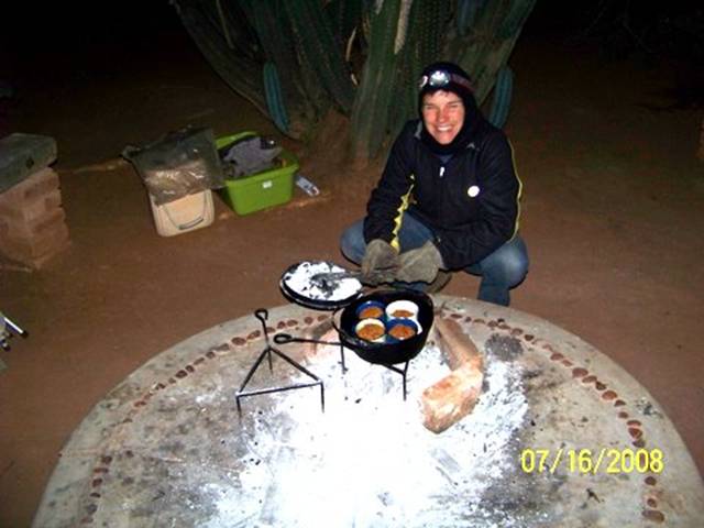
Day 46. July 16, 2008. Grobler’s Bridge, Limpopo Province, South Africa to Palapye, Botswana. Camping at Camp Itumela. (22º33.597’S 027º07.706’E).
Elevation: 909 meters (2982 feet).
Sue on Ocelot had told us we'd find camping at the Big Fig Inn, a few kilometers before the Botswana border. Our guide books, which include "Lonely Planet Southern Africa," "Coast to Coast" (a southern African guide to "backpackers" accommodations), and "WWW.CaravanParks.com South Africa,"
have thin coverage in the areas we're traveling through now. Word of mouth recommendations for routes, camping spots, and places to explore will be crucial until we are well south again.
What a haven we found here at Big Fig. Continuing one of the unexpected themes of this road trip, we were the only guests. And we could pitch our tent on lush green grass! Everywhere around was dusty, red dirt but the little camping area the Big Fig kept watered for a few tents and caravans (Pic 1).
Abby created a race course around trees, pestering us to time her.
Then she begged each of us to wrestle. There's something about grass like this that makes you just want to roll around. Our host, Vemsby, checked up on us several times and even lent us an electric iron to press an iron-on patch on my therma-rest pad, which had sprung a leak.
We had another very chilly sleep; it's been near or below freezing almost every night. But our sleep systems are working. Though we all wake up now and then when a bag shifts and a cold draft sneaks in or a pad slips and a limb gets stiff and cold, we've all slept well.
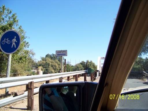
The Limpopo River forms the border here between South Africa and Botswana.
We crossed it on a one-lane bridge (Pic 2).
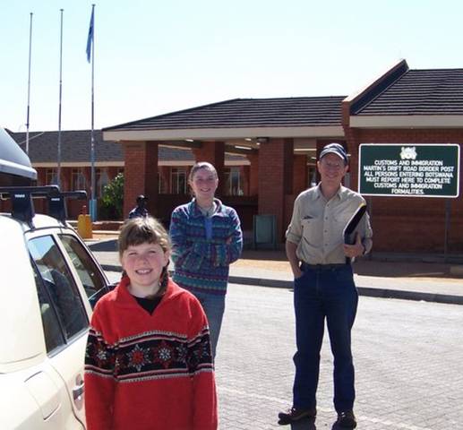
Customs and Immigration check-ins went smoothly on both sides (Pic 3).
We stopped at the first town to change some Rand for Botswanan Pula and to buy airtime for the Botswana "Orange" sim card Sue and John had mailed us to use in our cell phone.
Crossing the border we are losing the cell phone-based internet connection that has let us handle email in South Africa directly from our laptop.
We'll start looking for internet cafes in Botswana where we can plug in our computer.
The first big town we reached was Palapye, home of Camp Itumela, a backpackers and camping place with amazing landscaping; friendly dogs, cats, and owners (with kids!); and a well-deserved "warmly recommended" rating in Lonely Planet. There was hardly anyone here and we roamed all over before choosing just the right spot. We pitched our tent in the shadows of enormous clumps of cactus and hedges of an unusual plant with chlorophyll-filled green twigs and branches (Pic 4).
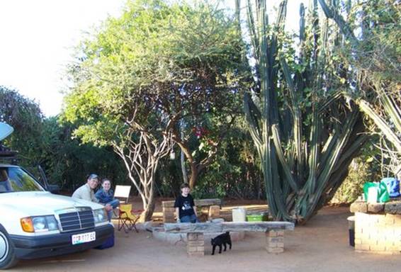
Our campsite's center was an eight-inch high circular concrete cooking slab with an outer ring of imbedded red stones. Kyle produced a delicious treat after dinner carrot muffins baked in the cast iron potjie pot in our tin and ceramic mugs (Pic 5).
-- Doug
Day 47-49. July 17-19, 2008. Palapye, Botswana. Camping at Camp Itumela.
(22º33.597’S 027º07.706’E). Elevation: 909 meters (2982 feet).
After we spent the first day at Camp Itumela only journaling, we thought the rest of our stay here would be pleasant, enhanced by the lovely roofless, outdoor showers and toilets (surrounded by cacti), but like all the other places we’d stayed at to write web logs, just a quiet haven. But we were so wrong. The next day when Abby and I had just pulled out our math books and journals, Simon, the owner of Camp Itumela, came by with the two girls we’d seen playing with some other kids in a vacant campsite the previous day, and introduced them as Danielle, his eleven-year-old step-daughter, and her friend Jenna. “Why don’t you show Eliza and Abigail around the camp?” the adults said. That was the end of school!
In about fifteen minutes we were running wildly all through Itumela with Jenna, Danielle, and their younger siblings as though we’d known them our whole lives. For two days Abby and I had the best time playing games both indoors and outdoors, roasting marshmallows (and sticks!), and even baking a cake. It was just so nice to hang around other kids (Pics 1&2)
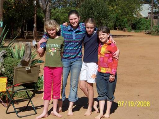
after about a month of being alone together.
-- Eliza
Day 50. July 20, 2008. Palapye to Nata, Botswana. Camping at Nata Lodge.
(20º12.9’S 026º11.2’E). Elevation: 918 meters (3012 feet).
We said goodbye to our kid friends (and their parents, Sue and Simon) and headed north on Botswana's main road, which runs the length of the country from the capital Gaborone, in the far south, to Kasane, in the northeast corner. Kasane lies on south bank of the Chobe River, a few kilometers from where the borders of Zambia, Namibia, Zimbabwe, and Botswana meet at the confluence of the Chobe and Zambezi Rivers. By late afternoon we reached Nata, about half-way to Kasane, and found a sandy, quiet campsite at the Nata Lodge.
This is one of the few paved roads in the country -- two lanes and usually no shoulder. Lonely Planet calls Botswana, which is the size of France and has a population of 1.6 million people, a "largely road-less wilderness of vast spaces -- savanna, desert, wetlands, salt pans and myriad traditional villages." Because we skipped most of the more urban and populated southeastern strip near South Africa, this description has matched our experience.
I know this may sound ridiculous, but Botswana seems very "African." The small towns are filled with people buying and selling things in makeshift road-side markets, walking beside the road, sitting in front of stores, and giving us open friendly waves as we pass by. And domestic animals are everywhere. We marveled at the goats walking through the center of Palapye
-- even grazing on tufts of grass beside the Shell gas station; the herds of cattle crossing the main paved road to reach more scrubby, dry grazing land; the sickly, thin homeless dogs patiently waiting outside grocery stores for the chance of a small morsel of food being tossed their way; and the many donkeys, who seem to be the second best type of transportation in Botswana.
I was desperate to capture this foreign land with our camera and yet I was conscious of peoples' privacy and sense of dignity. I always feel a little funny about taking pictures without asking, especially of people just living their lives. So I tried to snap shots surreptitiously, while Doug kept driving. The results were not always the best, but I think these three
pictures capture some of the roadside life we saw in Botswana.
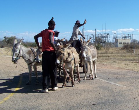
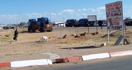
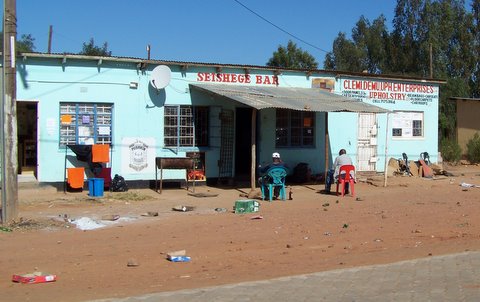
-- Kyle
Day 51. July 21, 2008. Nata to Kasane, Botswana. Camping at Toro Safari Lodge. (17º47.754’S 025º14.374’E). Elevation: 946 meters (3104 feet).
Pothole Day!! Today we traveled the 120 km section of highway north of Nata which we have been dreading. Notorious, this piece of highway has caused many tire blow-outs, break-downs and accidents. It has become something of a political issue in Botswana and, to be fair, is gradually being repaired.
We drove v-e-e-e-r-r-r-r-y slowly. With our low clearance we sometimes had to drive like a sidewinder snake, back and forth across the road, looking for a safe path (Pic 1).
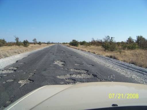
Finally past the bad part we crossed an enormous agricultural area, an anomaly in this parched land of thorn scrub. A huge flood plain was submerged during the wet season and planted with various crops as the waters receded. We passed an area with heavy, drooping sunflowers, ready to be harvested, as far as the eye could see (Pic 2).
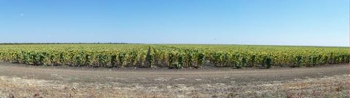
Arriving in Kazungula, just a dozen kilometers from Kasane, we encountered an amazing, long line of trucks all waiting to cross the Zambezi River into Zambia on the Kazungula ferry (Pic 3).
Trucks often waited as long as a week, the patient drivers sleeping in their cabs. Zambia and Botswana have just signed an agreement to begin planning construction of a bridge to replace the ferry.
The camping options in the Kasane area are limited. We found a home at Toro Safari Lodge, on the Chobe River. Highlights were a spot along the fence, with hippos sounding all night, and our very own "ablutions block" (bathrooms) (Pic 4).
The manager, Massimiyo, was also terrific. He recognized our car from when we'd passed him hitchhiking back to work from his home down south in Gaborone. Incidentally, his ride had carried him through the potholely section north of Nata and the rest of the way to Kasane in the dark. It was pretty scary, he said. There are mostly no fences and animals were everywhere -- wild ones! They seem to like to come out onto the warm tarred road when the air temperature drops abruptly at
night.
-- Doug
Day 52. July 22, 2008. Kasane, Botswana. Camping at Toro Safari Lodge.
(17º47.754’S 025º14.374’E). Elevation: 946 meters (3104 feet).
It was such a luxury to be able to sleep in this morning. After two days of packing camp and leaving early, I loved just eating breakfast slowly, savoring every bite of the Greek yoghurt. We had a serious discussion over whether to take a day-trip tour to Victoria Falls (Zimbabwe side). All in all, if we did a bus tour with Toro Safari Lodge (we didn’t think it would be safe to drive our car into Zimbabwe because of the political trouble there), it would cost about $700 US dollars (even though it was the best deal we could find). To see it from the Zambian side would cost a lot more, even if we drove our own car, counting the visa costs, road tax and the Zambezi River ferry crossing. Yeah, basically it was a) see Vic Falls for a few hours, or b) go to college. And college was higher on the to-do list, so we decided against the tour. Seriously, I would have loved to see Victoria Falls -- we all would have, and maybe I will someday -- but it would have been a really touristy experience (according to Lonely Planet) and our hearts right now are in the Okavango Delta. We are just really impatient to begin our peaceful mokoro trip there.
Anyway, after that discussion, we hung-out around our campsite, doing dishes, journals, and other things. Dad went to the reception to book a sunset cruise on the Chobe River, 3:00 to 6:00. So we hastily packed (animal ID books, sun and bug screen, fleeces, and water) and at 2:30 climbed aboard the safari vehicle with three other people to drive to the Chobe Marina Lodge, where our small boat was waiting. Because some other people from Toro were late and there was a mix-up with which boat got which people and coolers, the trip actually ended up starting at 3:45. Our driver and guide, Gaba, was really strange, almost acting like he was drunk. He scared the animals by talking too loudly and driving the boat much closer to them than was needed (Pic 1).
But the animals were spectacular. We saw many new bird species, including the red-winged pratincole, the yellow-billed stork (Pic 2),
and the African skimmer – only found around here (Pic 3 – sorry for the poor quality).
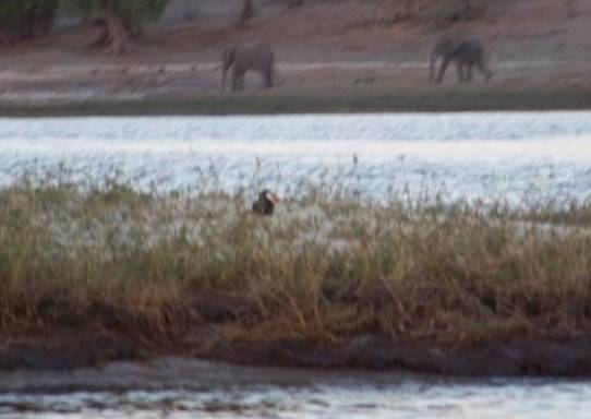
We also saw elephants, hippos, baboons, cape buffalo, kudu, crocs, and red lechwe (an antelope like a big impala), all bathed in the beautiful sunset light (Pic 4).
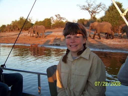
The best, though, was just being on the river, which forms the Botswana/Namibia border, and soaking up the calmness of the Chobe River (Pic 5),
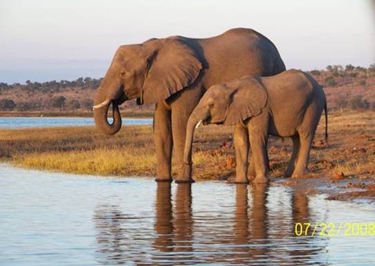
even though the motorized tour boats were noisy. I can’t wait for the silence of the Okavango Delta.
-- Eliza
Day 53. July 23, 2008. Kasane, Botswana to Katima Mulilo, Namibia.
Camping at Island View Lodge. (17º32.652’S 024º31.319’E). Elevation: 939 meters (3081 feet).
A mysterious front-end clunking noise heard en route to the Spar grocery store worried us. We had left Toro and were bound through Chobe National Park to cross the Namibian border at Ngoma and then another 120 kms to the Island View Lodge, on the Zambezi River, outside Katima Mulilo, Namibia.
So while Abby and Kyle shopped, this being supposedly the last real grocery store before our Okavango Delta trip, Eliza and I spread out a tarp under the front end. I wriggled around on the ground while Eliza pumped the suspension up and down trying to recreate the rattle. Sure enough, we both spotted a broken bracket connecting the steering rod to the chasis -- the stabilizer bracket, we were to learn. Hmmmmm . . .
This was not the place to have a car break down. I made phone calls to the Toro Lodge and the local tourist office -- no luck. The Shell station across from Spar pumped petrol but that was it. Then, by chance, just wandering around, I spotted a run-down auto parts store tucked back off the road. The guy there was sharp and helpful. He spoke English well and understood my problem immediately, agreeing that getting the part welded should do the trick. He just laughed when I asked about finding a replacement Mercedes part in Kasane. But he sent me back to Kazungula, to a place with an unlikely name: "Max Panelbeaters," even remembering the telephone number. They can do everything, he said. Come in right away, said the woman who answered the phone.
The owner of Max Panelbeaters (Pic 1)
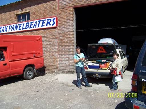
was a gem. I think his name was Max, but I'm not sure. He has two children living in the United States and would love to visit them but says he'll never have enough money. He put one of his men right to work and Kyle and the girls pulled out tea and lunch fixings (Pic 2).
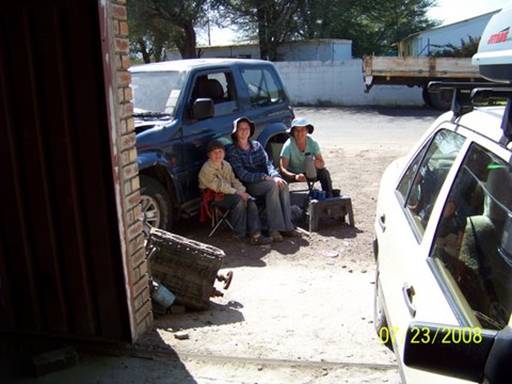
The first time the worker did the weld he dipped it in water, cooling it too quickly. It broke again in a new spot as he tightened it in place. So Max had him do the job over, welding on a metal splint. We were fixed up and out of there within an hour and a half -- at a total cost of 120 Pulas, or about $20 US dollars!
We crossed the Namibian border without serious incident, although the police official grilled us on who we were and who really owned the car we were driving. I was glad to have an affidavit from Grahame Perry, the owner, signed and stamped by a South African Police Official, saying we had permission to drive the car across international borders. We also had our first encounter with veterinary health officials, who checked our cooler for red meat, sprayed our tires with toxic chemicals and made us walk through a tray of the same to treat our shoes, uncomfortable for the girls who were wearing holey crocs.
The Namibian villages we passed in the Caprivi Strip looked drab but very tidy (Pic 3).
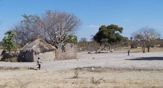
Life here seemed much more basic and harsher than anywhere we've been yet in Africa. It was so dry.
Nearing Katima Mulilo we turned off the excellent tarred road onto a 20 km stretch of gravel and sand road which was being repaired -- washed out by last year's floods, we learned later. A large triangular area east of the road to Katima Mulilo appears marked as marsh land on some maps. It is regularly inundated when the Zambezi floods. Our destination, Island View Lodge (and camp), is on a small high point of land that becomes an island intermittently. Our friends on Ocelot had stayed there in April and had had to be picked up by boat several kilometers upstream. We arrived by car, though barely. Deep sand and dips were tough for our low clearance. Kyle and the girls walked a lot of the 2 km driveway while I drove (Pic 4).
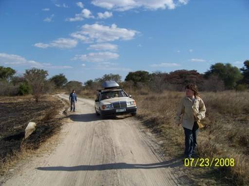
They passed big round elephant footprints and heaps of droppings.
Had we known before just how peaceful and beautiful Island View was we would have planned several nights here (Pics 5 and 6).
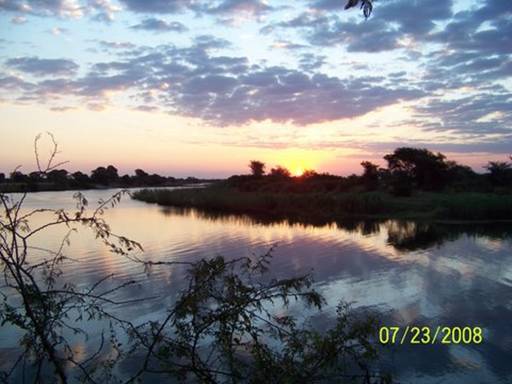
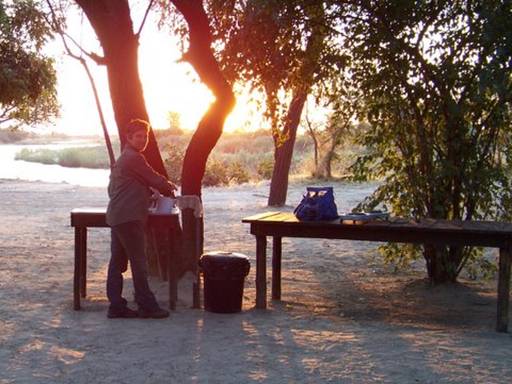
This is a paradise for birders and fishermen. Elephants were grazing on the island across from us and hippos bellowed all night. The top fishing quarry is the tiger fish, renowned for its spectacular aerial fights on light tackle, though usually released due to its boney consistency and mediocre flavor. Our generous hosts, Stephanie, Mick, and Sue, let us stay in two permanent safari tents, saving us the chore of pitching our own. What a lovely haven for the Estrelans.
-- Doug
Day 54. July 24, 2008. Katima Mulilo to Bagani, Namibia. Camping at Ngepi Camp. (18º06.904’S 021º40.144’E). Elevation: 995 meters (3264 feet).
We woke up early at Island View Lodge to see the sun rise (Pic 1)
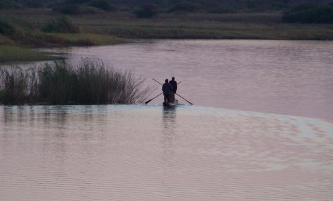
and the white-fronted bee-eaters (Pic 2)
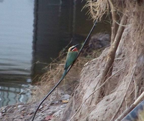
coming out of their nest holes in the muddy bank on our side of the Zambezi River. Suddenly dozens raced out of their holes all at the same time, flashes of green, red and blue. We also saw a cardinal woodpecker. Mick, one of the owners, helped us identify it. We said goodbye to Stephanie, Sue, Mick, and the two sausage dogs. On our way out the long driveway we saw a Schalow’s turaco, a kind of brightly colored lourie with a large crest curving forward, found only in this tiny area around the Zambezi River. We took pictures of it but they weren’t very good. Here’s the best one, way zoomed in (Pic 3).
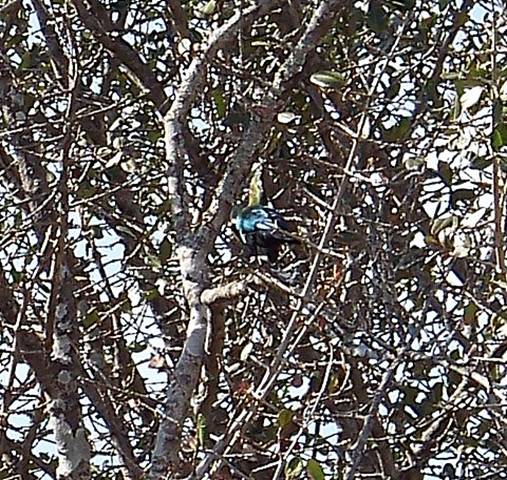
It was a very hot and sandy drive the length of the Caprivi Strip to Ngepi Camp (Pics 4 and 5).
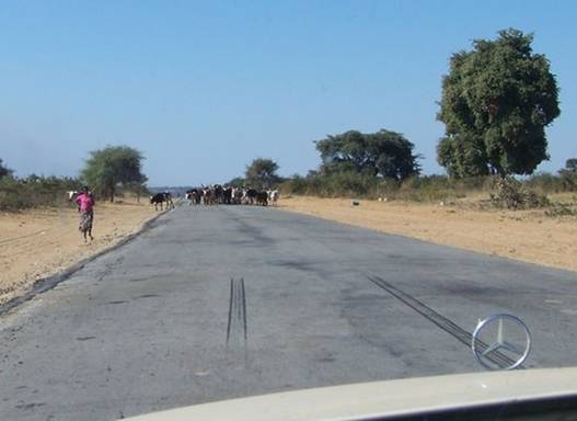
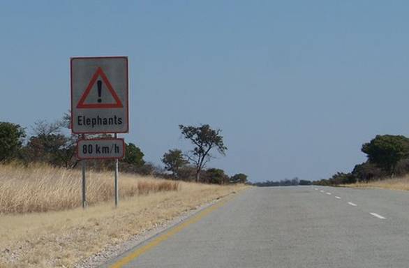
After setting up camp we heard and saw some hippos.
Dad made a pig’s belly pot-roast in our potjie for dinner. It was delicious, but fatty.
-- Abigail C.
Day 55. July 25, 2008. Bagani, Namibia to Seronga, Botswana. Camping at Mbiroba Camp. (18º49.597’S 022º25.997’E). Elevation: 978 meters (3209 feet).
We awoke at Ngepi camp very excited that today we would finally reach Mbiroba Camp, Seronga, Botswana, in the Okavango Delta, where the Okavango Polers Trust (OPT) has its base camp. We just needed to drive a gravel road described by our friends on S/V Ocelot as “bone-jarring, barely passable by 2WD.” They had told us about OPT in the first place and if they could drive this sand and gravel road, designated “4x4 only” on the road map, in their Audi sedan, then by gum, our old Mercedes should do just fine. Besides, the girls and I were getting quite good at running behind the car in difficult and bumpy situations, a tactic to add an inch or two to our clearance!
Contemplating this driving task, I looked over at our camping neighbors with the decked-out Land Rover and had an attack of the dreaded disease RE (Rig Envy)! Unable to resist temptation any longer, I introduced myself and asked if I could have a poke around and take pictures (Pics 1 and 2).
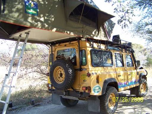
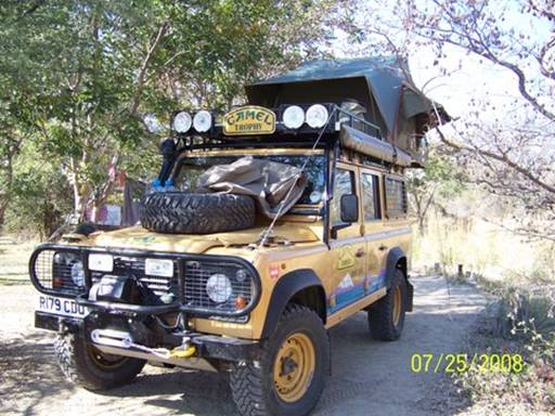
Torture!
There was one other hurdle before the “bone-jarring” road. That was crossing the Okavango River on the Shakawe ferry. This double outboard powered barge, with the capacity to hold about four vehicles and numerous foot-passengers, was basically a landing craft that dropped its tail-gate onto the river bank. That was fine for all the high-clearance trucks, but for our low-slung Merc, it was a different story. We were definitely an odd sight for all the local folks waiting to walk on as we slowly, gently, and of course, without passengers, edged our way onto the barge (Pic 3).
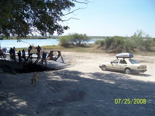
Phew, we barely made it. The tail-pipe had a bit of a scrape, no worries! But Doug had a better plan for backing off the barge. He outfitted me with leather gloves to hold up the tail-pipe, scuffling beside the car as he backed off the barge. Yikes! I almost got my hand minced, but I jerked it away just in time (Pic 4).
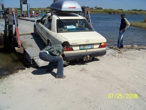
Ok, now for the “bone-jarring” road – Oh goody!
(How much was that Land Rover?!) Averaging a speed of 30 km/h, we drove 105 kms in about 3 1/2 hours and arrived at the Mbiroba Camp covered in fine white Delta dust and full of relief and joy (Pic 5).
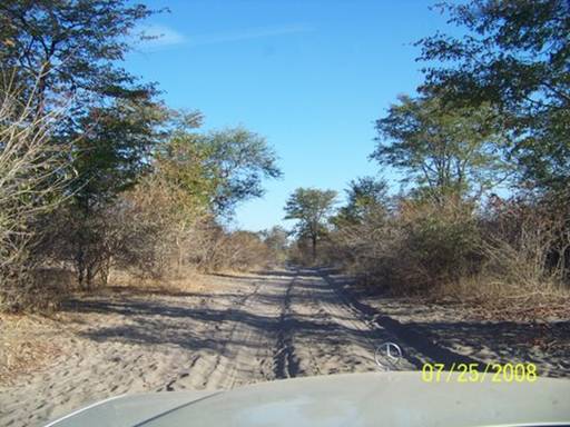
Finally here (Pic 6)!!
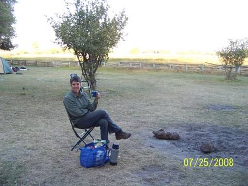
-- Kyle
Day 56. July 26, 2008. Seronga, Botswana. Camping at Mbiroba Camp.
(18º49.597’S 022º25.997’E). Elevation: 978 meters (3209 feet).
We woke up early at Mbiroba Camp and spent all day packing for the mokoro trip. Mom and Dad said goodbye to Madugah, the really nice lady who they talked with on the phone a lot to set up our trip (Pic 1).
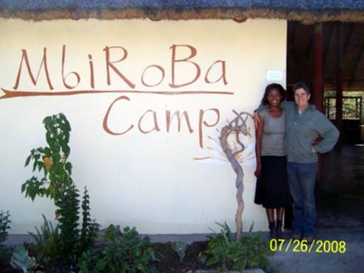
Mom was surrounded by food on the tarp (Pic 2)
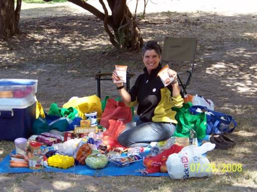
and whenever I wasn’t helping, like packing gorp (Pic 3),
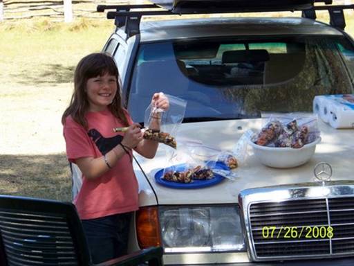
I was running around and around on the jumping course I made (sometimes Eliza would chase me), or playing with the camp dogs, Tag, Ridge, and Tiny -- we named Ridge and Tiny (Pic 4).
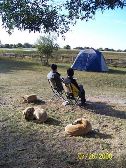
I would take the icky flying ticks off of them. We had a lovely omelet dinner, which Dad cooked on the campfire. Our dog friends were all around us.
-- Abigail C.
Day 57. July 27, 2008. Okavango Delta, Botswana. Bush camping at Savana Camp, Kao Island. (18º53.830’S 022º34.183’E). Elevation: 966 meters (3170 feet).
I’m sitting against a big log, having a lazy lunch in the shade of a huge tree at the center of a wide, flat mound of sandy earth covered in short yellow grass. It's slightly higher than the surrounding dry marsh and grassland that stretch into the distance on two sides. This is the Okavango Delta. A fire of bleached, grey branches is crackling, lit by GB so his father Kgetho and Kyle can enjoy a cup of tea.
The Okavango Delta is the end of the 1,430 kilometer-long Okavango River.
The Okavango rises in the highlands of central Angola and flows southeast,
18.5 billion cubic meters every year, but not a drop ever reaches an ocean.
It spreads out in a thin sheet, covering 16,000 square kilometers, the Delta, and eventually evaporates or seeps down into the sands of the Kalahari.
GB (his preferred nickname for Gobonamang) and Kgetho are with Okavango Polers Trust (OPT)(www.okavangodelta.co.bw). Their last name is also Kgetho, pronounced "keto," with a short "e," long "o" and the g making the grating "h" sound which seems characteristic of Afrikaans as well as various African languages. They are of the Bayei people and their first language is Seyei, though they also use Setswana, one of the two national languages of Botswana, the other being English. GB, who's 35, also speaks excellent English; Kgetho, 67, speaks only a little. They live together with their wives, siblings, cousins, aunts, uncles, nieces, nephews, children, and grandchildren in their small family village, "Mbiroba," named for the small lagoon off the Okavango River where it and the OPT base camp, with the same name, are located, near the main village of Seronga. GB and Kgetho will be our mokoro polers and guides for the next five days.
We departed from the OPT mokoro put-in place at about 11AM (Pic 1)

and paddled (or rather, they poled us) 4 1/2 kilometers ESE to this site – Savana Camp on Kao Island. We’ve pitched tents to spend the night here.
At first I felt awkward just sitting in the mokoro, Eliza in the front and I in the middle, doing nothing but looking around while our guides propelled us with strong, springy wooden poles (Pic 2).
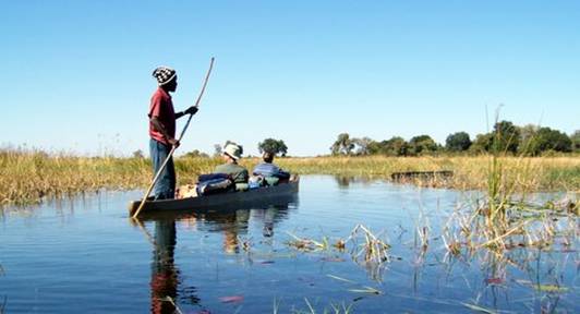
A mokoro is basically a heavy, low canoe with a wide, flat bottom. So I wanted a paddle. It didn’t take long, though, to realize I was totally out of my element. The only way to know where to go was to stand as our agile polers did, perched in the stern, peering over the bullrushes, fragmites grasses, and papyrus reeds (Pic 3).
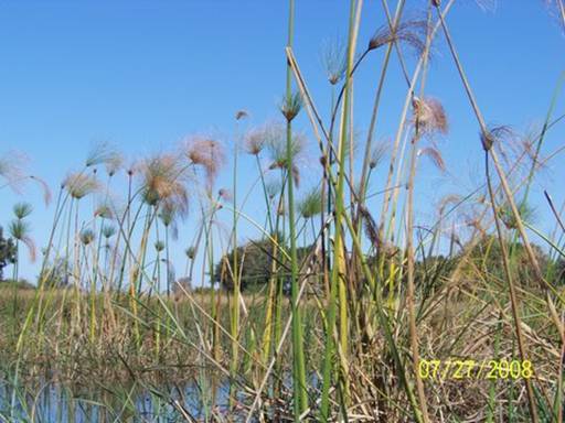
They moved deliberately, slowly sliding us along, always alert for grazing or sleeping hippos and basking crocodiles (they told us later this was what they were looking out for!). Sometimes we followed distinct channels, usually two to 10 meters across and two to three meters deep, and with an obvious current. Often we followed narrow paths made by hippos or elephants where the clear water was only one to two meters deep. And sometimes we moved through a seemingly impenetrable wall of dense grass which we parted or flattened as GB and Kgetho slid the boats forward, and where it appeared at first there’d be hardly enough water to float us. I soon surrendered to GB all responsibility for navigation, propulsion, and safety and began to enjoy this extraordinary ride through the Okavango Delta.
Very near where we landed the mokoros GB pointed out a huge dead male hippo lying on its side in the reeds on the edge of firm ground, bloated and buzzing with flies (Pics 4 and 5).

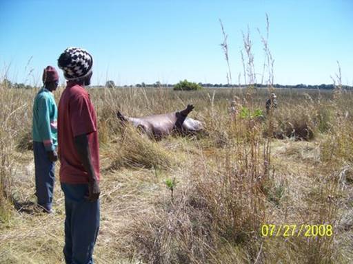
Curiously, it had not been touched yet by any scavenger. Our guides think this is because the wind blows mostly offshore here – and would only blow the other direction, toward the interior of the island, late at night, and then only lightly. A hyena pack lives on this island and would have begun feeding aggressively on this hippo if it had smelled it yet. The carcass is only about a hundred meters from our tents. If the hyenas arrive tonight – the pack usually hunts in the dark – we should hear it at work.
We’re so exhausted from the effort just to reach Seronga and to pack for the trip that we’ve decided to forgo any nature walk or other activity this afternoon. Instead we’ll lie around together on our foam mattresses in the shade and read aloud our current family book, “Sword at Sunset.” It seems a little odd to be reading the King Arthur story here in the Okavango Delta, but we’re all very happy and relaxed . . . and we’re soooooo close to the
end of the book.
--Doug
Day 58. July 28, 2008. Okavango Delta, Botswana. Bush camping at Xamoku Camp, Kau Island. (18º53.056’S 022º35.542’E). Elevation: 961 meters (3153 feet).
It’s 2:00 PM -- siesta time, according to GB. Kyle and Abby are lying in the tent. Eliza’s reading “The Power of One” beside me. She’s nearly finished. Our guides are resting. I’m leaning against an overturned mokoro canoe in our “kitchen” – that’s where we put our cooler, food bucket, and cooking gear. Quiet here except for sounds of hippos grunting occasionally on nearby grassy banks, insect sounds, and various bird calls. The campfire smoke blows into my face intermittently but I’m loathe to move. It’s been swirling and should shift away any moment.
At breakfast this morning we learned from GB that he’d gone outside his tent last night when he heard some of the same sounds that had put Kyle and me on edge from about 2 to 3 AM (Pic 1).
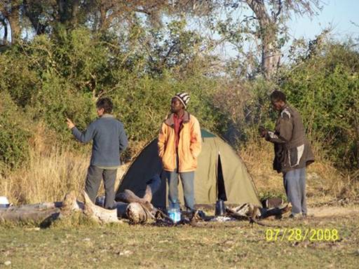
Shining his torch around he’d seen two elephants very near our camp. One was feeding on the tree by our latrine (a hole dug in the ground), which is just behind a big termite mound (Pic 2 – beyond Kyle’s right shoulder).
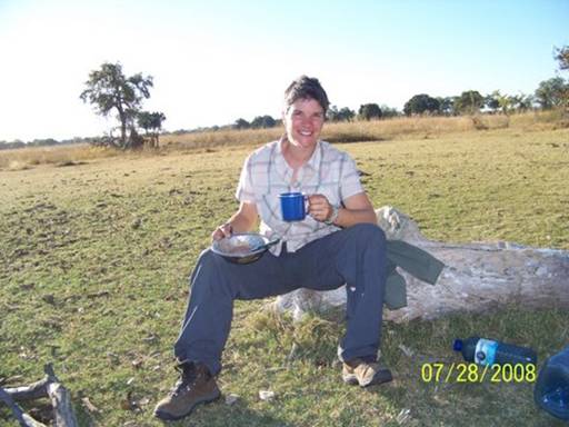
The other elephant was eating leaves from a tree close behind our tent. GB also heard male and female baboons barking warning cries, probably because a leopard was prowling nearby. GB had heard the distinctive “sawing” sound leopards make. And zebras were running back and forth not far from our camp. They seemed nervous about something, maybe the leopard, GB thought.
When we quizzed GB about whether it was dangerous for us to get up to pee at night, a bit incredulous that all these animals had been so close to our camp, he smiled and first said some of his clients just choose not to go out at night. Then he patiently coached us that if we needed to we should try to go out at least in pairs, to listen very carefully before unzipping the tent flap, to first shine the torch all around before stepping out, and then to stay very close to the tent and to get back inside as quickly as possible. Most of the animals will know exactly where our tent is, even in the pitch dark, and will avoid it, though they may walk nearby, even right through the camp. The big exception is fighting male hippos. They are oblivious to everything and might flatten our tent (and us) if their fight brought them through the camp. If we hear fighting hippos nearby (the sounds will be obvious), get out of the tent and get away fast. Such a fight was probably what had killed the bloated male hippo we’d found yesterday. Incidentally, none of us heard any hyenas last night. They still haven’t found the carcass. We hope our mokoro trip will bring us back by the carcass before we have to return to the mokoro put-in place.
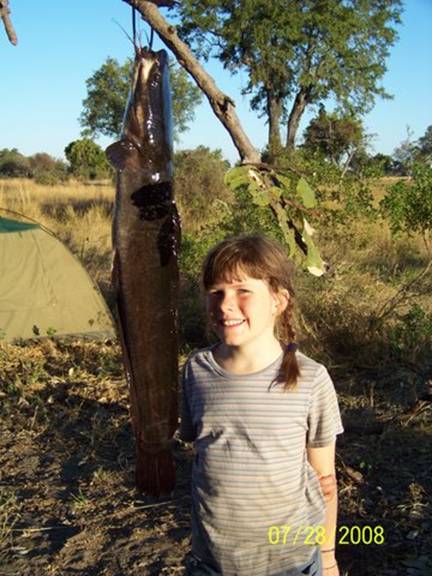
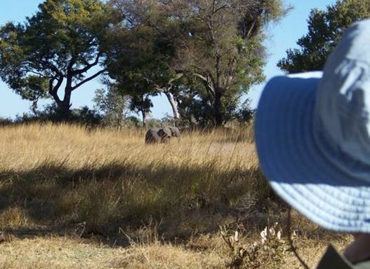
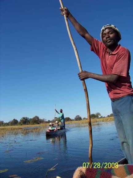
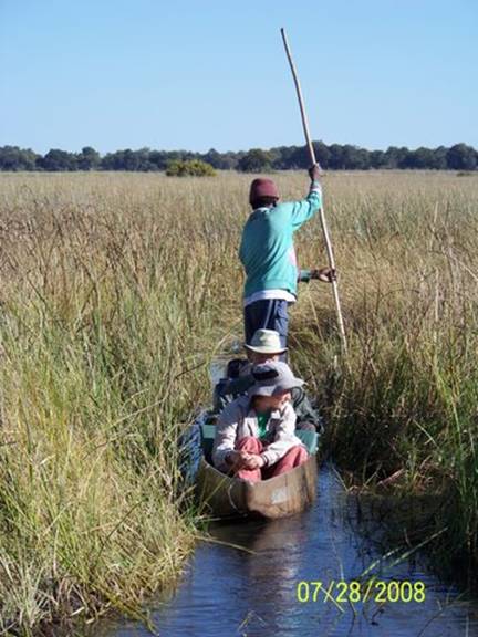
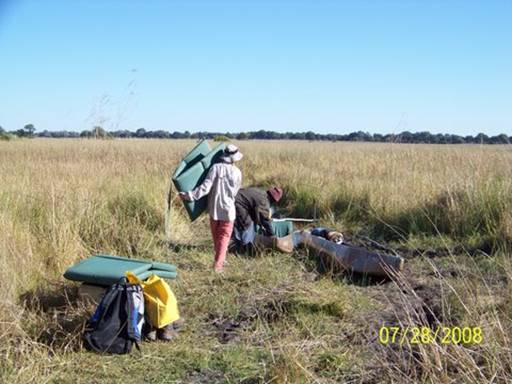
--Doug
Day 59. July 29, 2008. Okavango Delta, Botswana. Bush camping at Xamoku Camp, Kau Island. (18º53.056’S 022º35.542’E). Elevation: 961 meters (3153 feet).
I was so relieved this morning when I woke because I knew we didn’t have to pack the tent and move camp. We were spending one more night here. It was already feeling like home. We rose early, though, before sunrise, so we could be ready by 8:30 for a morning mokoro trip, before it got too hot. Dad spotted a group of elephants in the distance as we stoked the fire for breakfast. The whole world seemed to be waiting for the sun.
GB and Kgetho pushed off the bank at 9:00 exactly and poled us through the papyrus and reed beds all morning. We saw many birds; the most common was the African jacana, or “Jesus bird,” a nickname earned by its extremely long toes which allow it to walk on lily pads, seemingly “on water”. GB is very knowledgeable about birds, and because of him we identified tons more species than we would have by ourselves (Pic 1).
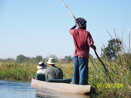
He’d see a bird silhouetted against the harsh midday sun for barely a few seconds before saying, “That is a banded martin over there on that reed.” I can’t fathom that type of experience.
We had one really scary moment this morning. We came suddenly upon a crocodile basking on the river bank with its mouth gaping. It was huge (Pic 2).
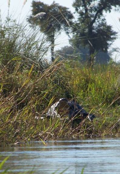
Crocs control their body temperature by lying with their mouths open to act as an air conditioner. Even though I knew this was not a threatening gesture, the glittering teeth were unnerving (Pic 3).
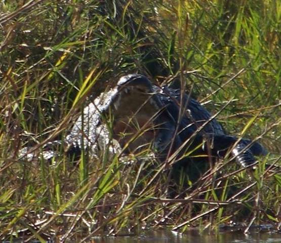
GB stopped the mokoro immediately and indicated we should be absolutely silent. But still the croc saw us and slipped into the water amazingly quickly, given that he had appeared seconds before to be sleeping. It was scarier not being able to see it and knowing it could be just a few meters away. After waiting for several minutes, GB decided it was safe to continue past where the croc had been. He said later he could tell from the direction the croc entered the water and its ripples that it was trying to avoid us, not hunt us. I thought the whole experience was really cool. But when Mom's mokoro came close enough for us to talk she told us she had been looking around for escape routes, terrified that the croc would eat us.
On the way back from our mokoro excursion GB stopped to make Abby, Mom, and me water lily necklaces (Pics 4 and 5).
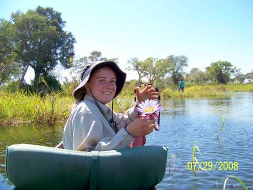
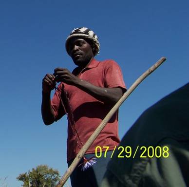
These gorgeous, delicately-scented flowers are ubiquitous in the Delta. He also made a straw out of a water lily stem so we could drink the cool, clear Okavango water right over the sides of our mokoros (Pic 6).
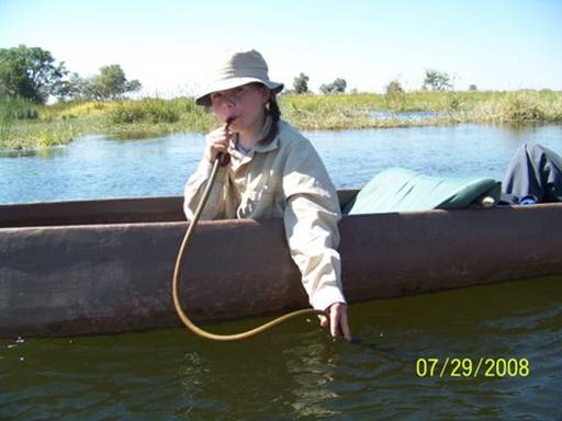
Delta water, filtered through the thousands of reed “islands,” must be the sweetest water on earth.
After our usual afternoon routine of lunch followed by a siesta, lounging in the shade and we four Hopkins talking together about (surprise, surprise) “the future,” GB took us out on another nature walk. This time we walked a few kilometers to see the Veterinary Cordon Buffalo Fence.
[According to American wildlife researchers Mark and Delia Owens in their remarkable book, “Cry of the Kalahari,” which I’m reading now, this long, cruel barrier, which stretches all across the Okavango Delta and through part of the Kalahari, is supposed to stop the spread of foot-and-mouth (FMD) disease from wild African buffalo to domestic cattle. The Owens say, though, “In spite of extensive experiments it has never demonstrated that wild animals transmit the FMD virus to domestic stock.” As you can imagine, the fence has been destructive to many wild mammals, disrupting their natural movements and especially their periodic migrations. The Owens witnessed from their small airplane one devastating event in which the fence killed tens of thousands of wildebeests. They starved or died of thirst when their migration was blocked. And despite the veterinary fence, FMD remains a problem among Botswanan livestock, more than 50 years after construction of the fence was begun. Needless to say, the fence is profoundly controversial; wildlife advocates, like the Owens, have called for its removal. – Kyle]
The portion of the fence we saw had been damaged by elephants. I was expecting the fence to be huge, barbed, and industrial-looking, not a line of wooden posts strung together with a few wires (Pic 7).
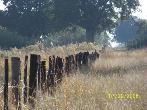
No wonder adult elephants are able to knock it down so easily. Too bad the other animals can’t, though. GB told us he’d seen many smaller animals, like baby elephants, kudu, and impala, entangled in the the fence, dead or dying.
On the walk we saw lots and lots of birds, and we got quite close to a collection of several different groups or herds, grazing or foraging near each other, including zebra, impala, warthogs and baboons (Pic 8).
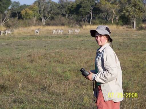
The zebras trotted away as we approached. The baboons looked really nervous and yelled a lot. For me the best part of the day was gathering the edible ebony fruits on the ground by the fence. They taste like dried dates and I
gorged myself.
When we arrived back at camp, Kgetho had started to smoke the fish he’d caught (Pic 9).
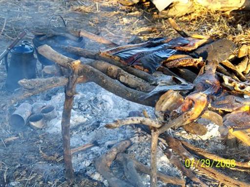
Mom made lobscouse for dinner (mashed potatoes, carrots and canned corned beef). Mmmmmmmmm . . . . We were exhausted.
-- Eliza
Day 60. July 30, 2008. Okavango Delta, Botswana. Bush camping at Makoba Camp, Makoba Island. (18º53.134’S 022º32.922’E). Elevation: 967 meters
(3173 feet).
We woke up early when it was still dark and almost had our gear packed and ready before GB and Kgetho were up. It was a beautiful sunrise welcomed by a fish eagle perched on a tiny grassy islet nearby (Pic 1).
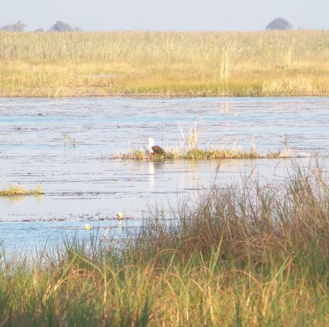
We were in the mokoros and moving before 9 AM. I was with Dad this time; mostly I’ve been with Mom. GB made us water lily necklaces like yesterday and straws from a lily stem. Then he picked papyrus plant stalks for us to eat. Here’s what papyrus looks like on top (with a reed cormorant perched in the middle) (Pic 2).
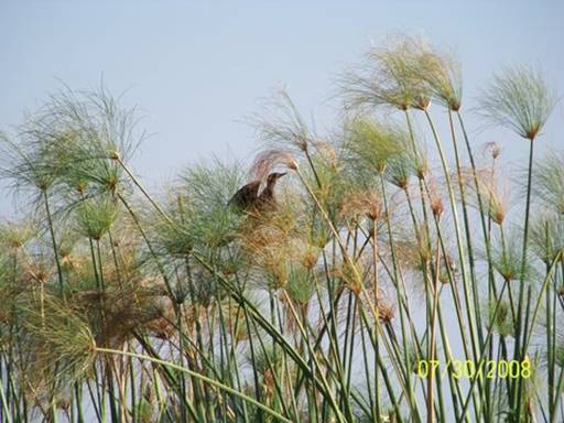
The stalk tasted like sweet, fibrous or spongey water. Here’s a picture of me with all three things (Pic 3).
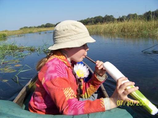
Dad and I sliced disks of papyrus and set them afloat and signaled for Eliza and Mom to pick them up.
They ate some of them. We stopped for a bathroom break at an island bordered by a long line of towering ebony trees, which grow only where there is water. Here are the two mokoros on the bank framed by ebony trees (Pic 4).
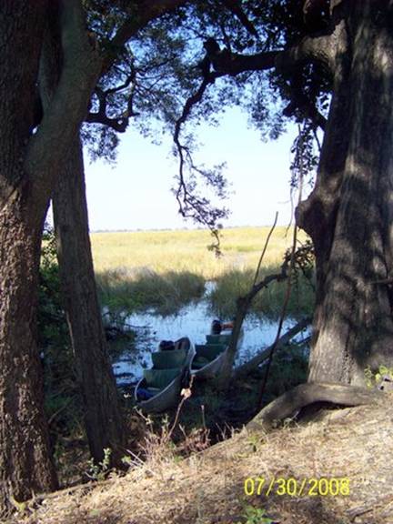
[GB said that the thick trunks of old ebony trees are prized for carving mokoro canoes in one piece. Many local polers, including GB and Kgetho, now believe it is wiser to build mokoros from fiberglass so that the big ebony trees won’t all be cut down. Our mokoros are fiberglass. – Doug]
We pitched camp around noon on Makoba Island. Makoba means knob thorn.
There were lots of makoba or knob thorn trees on this small island. There were also many ebony trees, including one big one arching over our tent.
Ebony fruit kept falling all around us. We made up a game where the winner would be the first to be hit on the head by a falling ebony fruit. We spread out our tarp, laid the mattresses on it, and had lunch and a siesta (Pic 5).
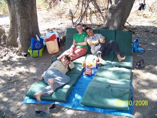
About 3:30 we went out for a nature walk. We had to pole over to a larger island nearby. Ours was too small to have any big mammals. The two most interesting things about the walk were the elephant skeleton and the hammerkop nest. The skeleton had been bleaching for three years. The bones were all mixed up. We examined the skull closely, including the teeth (Pic 6).
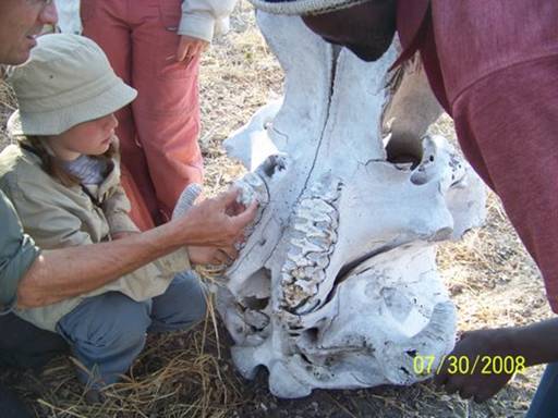
We learned about how elephants get only six sets of molars and as each one wears out a new one grows in. Sometimes old elephants die of starvation because their last set of molars are so worn down that they can no longer grind any more roots and branches to eat. The hammerkop is a duck-sized water bird with a hammer-like crest. Its nest is enormous, though, about as tall as me and about as wide as I am tall (Pic 7).
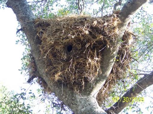
See the little hole?
The hammerkop lives inside the hole. The nest is so big that when the hammerkop finally abandons it after about three years, sometimes a pair of eagles will make their nest on top.
After we poled back to camp by about 5:00 Dad made me pose for a picture with the old skull of a male African buffalo (Pic 8).
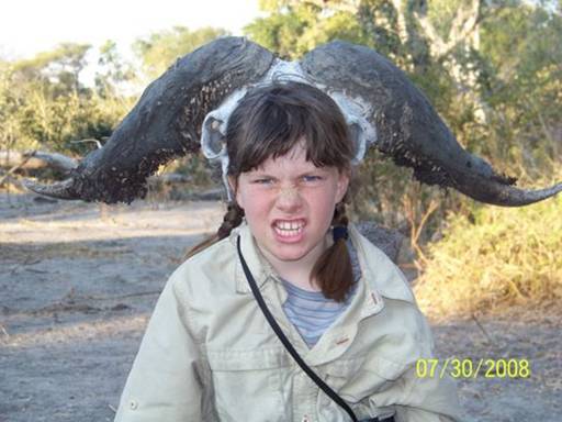
This is our last night together. I’m so sad. I wish we could stay out for another five days.
-- Abigail C. (and Dad)
Day 61. July 31, 2008. Seronga, Botswana. Camping at Mbiroba Camp.
(18º49.597’S 022º25.997’E). Elevation: 978 meters (3209 feet).
Eliza suggested we have a morning nature walk today; the other walks had all been in the afternoon. So we got up early, ate a quick breakfast and headed out in the mokoros (Pic 1),
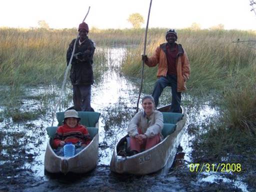
back to the place we’d first camped, on Kao Island. We were all very curious to see how the hippo looked after four more days, especially since we had heard a lot of hyenas calling back and forth last night. Had they finally discovered the hippo?
The morning light was incredible for photos (Pic 2).
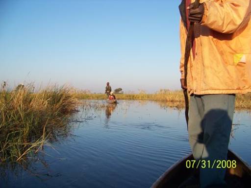
And this time the hippo snorts and grunts sounded far away, so I could relax a bit more. We landed the mokoros in the same area as before and walked toward where the dead hippo had been. Before we could even see it, the stench hit us like a wave. We nearly drowned in its putrid aroma. And then we saw the carnage.
The Hippo Restaurant had officially opened! The once intact but bloated hippo had been popped and ripped open with oozing, maggot-filled guts spilling onto the ground. We breathed through our mouths and handkerchiefs and explored, both horrified and fascinated by the sight (Pic 3).
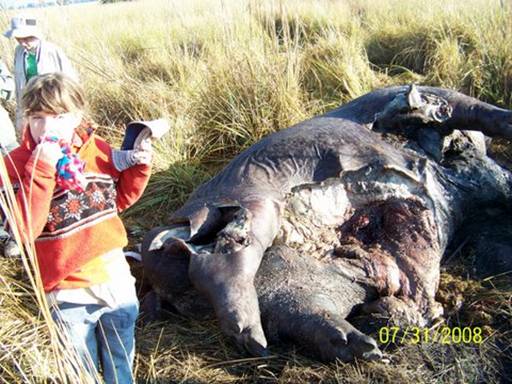
This animal was as big as a small car, and to see it torn open and already partially consumed was truly awesome; the cycle of life was at work. The hippo had obviously been opened by hyenas on the land side, the gaping wound seemingly at hyena head level (Pic 4),
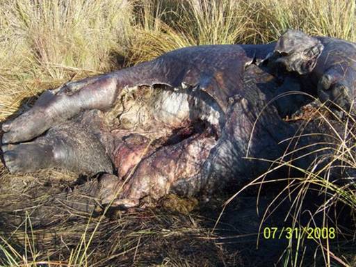
by crocs on the water side, the carcass gashed open just above the ground, where crocs eat (Pic 5).
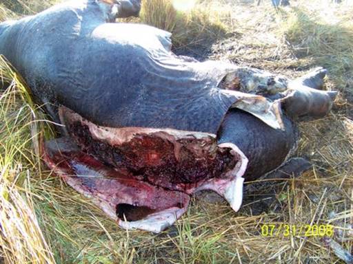
GB said that both scavengers were probably feasting at the same time, warily sharing the buffet. We found lots of hyena tracks nearby (Pic 6)
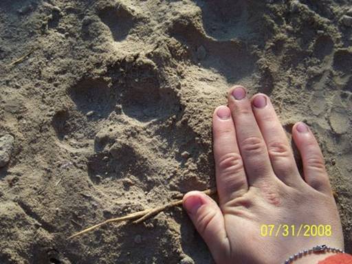
and also crocodile paths of matted grass leading back and forth between water and hippo. It felt as though we’d stumbled upon the post-shoot set of a National Geographic TV special with 3-D visual and olfactory effects.
We continued on our hike, the sun and heat rising. We came upon the veterinary fence again and easily slipped through it (Pic 7).
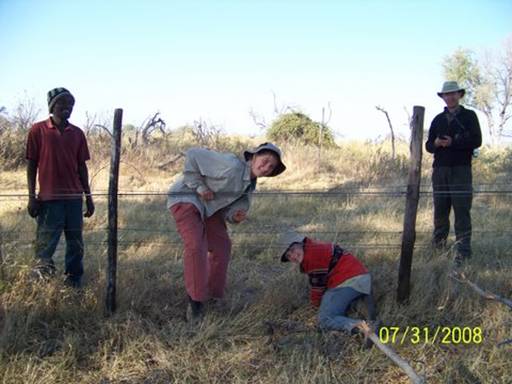
I’m glad we took our time and walked slowly and quietly, gazing over the savanna, peering through trees, watching a herd of zebras, and searching for more new bird species (Pic 8).
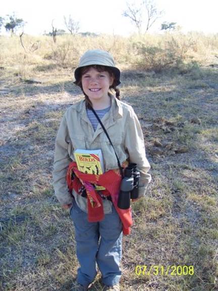
Our time in the Delta was coming to an end and I wanted to savor this amazing experience as long as I could.
It was hard to say goodbye to these two wonderful men who had shared their world with us and felt like real friends. Here’s a last picture of the crew taken at the pick-up place (Pic 9).
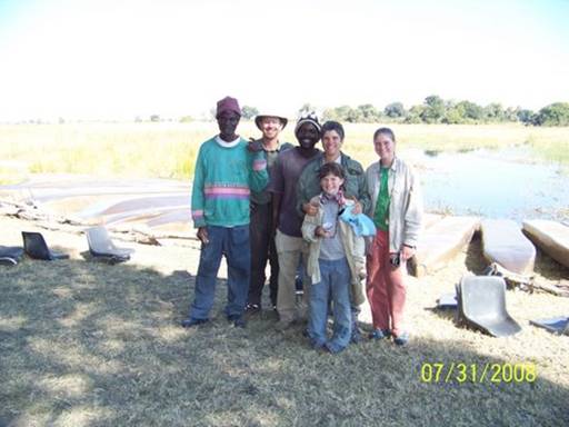
We had asked GB if his wife made baskets and said we were interested in purchasing some. On the way back to Mbiroba Camp the OPT truck stopped briefly at GB and Kgetho’s village to let them drop off gear and greet their families again before they returned to the OPT base for the final check-out.
GB disappeared inside his reed and thatched house and after a few minutes reemerged with a few beautiful woven items to show us (Pic 10).
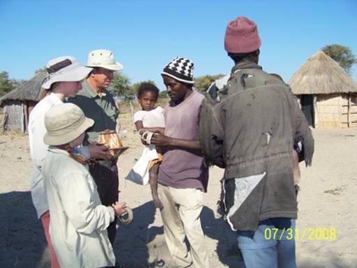
We selected several to buy. We’ll mail them to my parents to hold for us. When we finally have a land home of our own again these baskets will always bring back emotional memories of our time in the Okavango Delta with GB and Kgetho.
-- Kyle
Day 62. August 1, 2008. Seronga, Botswana. Camping at Mbiroba Camp.
(18º49.597’S 022º25.997’E). Elevation: 978 meters (3209 feet).
The birds woke me with their lovely sounds and when the others woke up Dad and I wrestled. He pretended that he was Ayers Rock and that I was a small elephant. I kept provoking him and he crushed me each time. Then I went a little bit crazy. I still had a lot of energy so I tied myself to the car and tried to pull it (Pic 1).
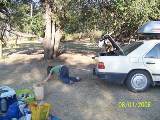
Then we had breakfast and I washed the dishes while and Dad and Eliza did all the laundry and Mom worked on repacking the car. I helped everyone (Pic 2)
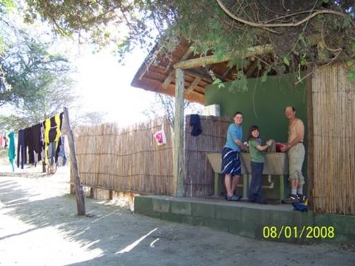
and also ran on my jump course again. In the evening while Dad and I collected wood we found a dead emerald-spotted wood-dove which had flown into a window and broken its neck. It must have just happened because it looked as though it was only sleeping. We brought it back to show Mom and Eliza. We had cup-a-snack and pesto pasta for dinner.
-- Abigail C.
Day 63. August 2, 2008. Seronga to Tsodilo Hills, Botswana. Camping at Tsodilo Hills Rhino Camp. (18º45.545’S 021º44.210’E). Elevation: 1005 meters (3297 feet).
We had a long way to go today, all the way back up the east side of the Okavango River, 105 kilometers on the “bone-jarring” dust and rock road, across the river on the dreaded ferry, to the town of Shakawe for a quick resupply, and then on to Tsodilo Hills. So we woke up very early (here’s the view out into the Delta from our campsite [Pic 1]
– we were the only ones camped at Mbiroba the night before) and began to pack. Even so, it was about nine when we had finished.
But then we did the dove. Yesterday Dad and Abby found an emerald-spotted wood-dove that had flown into a window and broken its neck. They really wanted to dissect it, but there hadn’t been any spare time. Now there was, and so we squatted on the grass and watched as Dad taught us how to pluck and clean a bird. First he plucked all the feathers off the body; Mom, Abby and I had to do it as well. The dove’s body was so tiny and fragile, and I felt horrible that we couldn’t just dig it a grave. Dad told me it is a noble end for any creature, human or animal, to be used for the advancement of the academic world. That didn’t help. Abigail wanted to keep a wing (they have gorgeous iridescent green spots), so Dad nipped it off with his knife. Then he plucked the other wing and we marveled at how strong the wing muscles were compared with the stick-like legs. Doves are obviously made for flying. After plucking the feathers and chopping off the head, Dad cleaned the bird, pointing out all the organs. Thankfully Abby wanted to be the main helper, so I didn’t have to do very much. We learned about the pope’s nose, the gizzard, and the pin feathers, as well as all the other organs. When everything was done and we all had rinsed the poor dove off, Dad insisted we eat our science project, and so I stuck it on a stick over the fire (Pic 2).
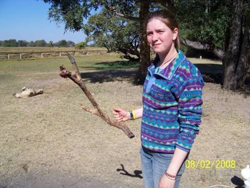
It looked like a tiny chicken, and when cooked, tasted like turkey (or wild duck according to Dad) (Pic 3).
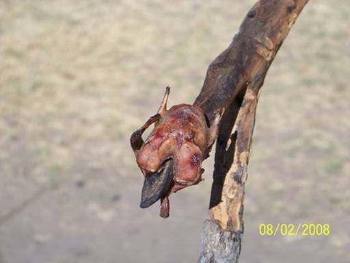
Afterwards it felt kind of neat to know that I could clean and cook a bird if I had to. I must say there was hardly any meat on the dove.
We then said goodbye to Satau, the other manager (Pic 4),
hugged the dogs (Pic 5 – Abby’s holding Ridge),
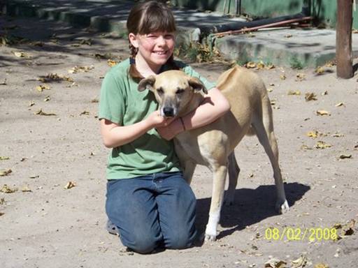
and headed back to the ferry (no troubles there; we think they switched ferries to the bigger one when they saw us show up again; and Dad backed on this time). In town, we girls went to the grocery store -- yoghurt and soda treats for everyone -- and then we drove all the way back down the other side of the Okavango River to the gravel road that went 40 km west to the Tsodilo Hills. We got lost but finally found the entrance (no signs, except a mysterious yellow triangle). The Tsodilo Hills were beautiful in the late red light (Pic 6).
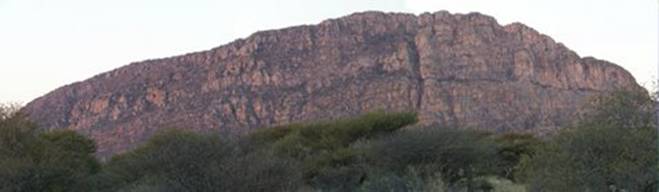
This is an ancient holy site for the San People, formerly known as “bushmen,” the first modern humans in southern Africa. The original spirit of every different living creature is supposed to reside here. We’re planning to hike and look at San rock paintings.
The 4 km road from the entrance to the camp was absolutely horrible with huge ruts and holes. We chose the “bus and truck” route and it made the “bone-jarring” road to Seronga seem like a tarred highway. The sun had set by the time we arrived and set up camp. A UK family and a Dutch couple, both driving big 4x4 adventure rigs, were camping there as well. They looked at our car, smiled, and asked how we had liked the road in.
--Eliza
Day 64. August 3, 2008. Tsodilo Hills, Botswana. Camping at Tsodilo Hills Rhino Camp. (18º45.545’S 021º44.210’E). Elevation: 1005 meters (3297 feet).
It was supposed to be a rest day, but around 10:00, the nice Dutch couple camped near us stopped by to talk. They had just finished their guided hike on the Rhino Trail, which has many ancient San rock paintings. After talking for a bit, they invited us over for tea and cold juice and Cokes (Yum!). We talked and ate and then decided that together at 3:00 we would go on a hike without a guide. We packed up and left. First we walked along a road with deep sand (Pic 1).
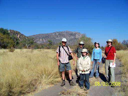
Then we got on the trail and kind of got lost and then found the trail again (Pic 2).
We saw some rock paintings and a cave/waterhole (Pics 3 and 4).
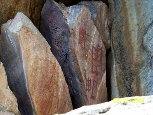
Then we went back and played card games with the kids in the other campsite next door (Pic 5).
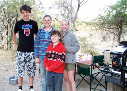
They are from England. After they had dinner they came over again and we talked while roasting marshmallows. Their names are Conor (14) and Ana (11). Then we went to bed.
-- Abigail C.
Day 65. August 4, 2008. Tsodilo Hills, Botswana. Camping at Tsodilo Hills Rhino Camp. (18º45.545’S 021º44.210’E). Elevation: 1005 meters (3297 feet).
Yesterday, Mom had arranged for a guide to take us hiking on the Rhino Trail in the Tsodilo Hills to see more ancient rock paintings by the San. Since our guide was to be San also, we hoped to learn about their culture and traditions. We sprang from our sleeping bags extra early, packed a daypack, and ate a quick breakfast so we wouldn’t be late for the eight o’clock start. Well, we waited…and waited…and waited, but Xunta, our guide (his name begins with a click sound), never showed up. While we waited, we said goodbye to Eline and Coen, the Dutch couple, who were driving to Maun today.
Ciara, the Irish/UK mom, and our mom took pictures of Ana, Conor, Abby, and me, and we exchanged email addresses. And as our guide still hadn’t arrived, we walked through the small museum, which had some interesting facts about Tsodilo and its rock paintings and archeological sites. We left the museum with a feeling of sadness for the San people, who, from what we gathered, had lost so much of their culture, a culture seemingly incompatible with either European culture or even that of the Bantu-speaking people who had migrated into southern Africa.
At ten, we just gave up waiting and after waving goodbye to Conor and Ana’s family (they were going to the Caprivi Strip) we set off on a self-guided hike, with the Lonely Planet map to help find and identify the paintings (Pic 1).
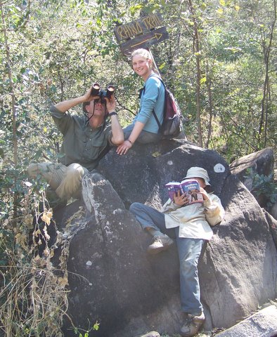
The hike was long and hot in the midday sun, and the deep sand made walking difficult, but it was worth every sweltering minute. The rock paintings were unbelievable, the weathered but still bright colors speaking of a primeval age. A few of the paintings we saw included: rhino, giraffe, and eland (Pic 2);
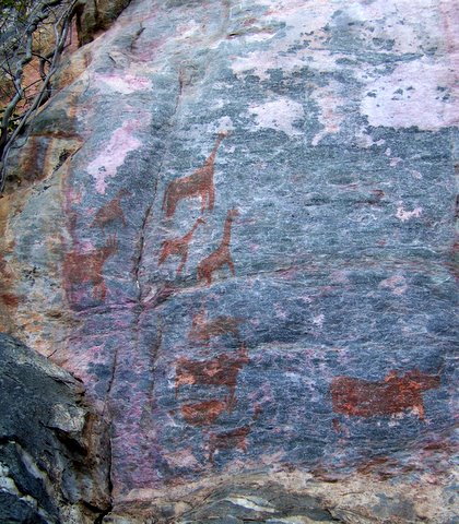
penguin and whales (Pic 3);
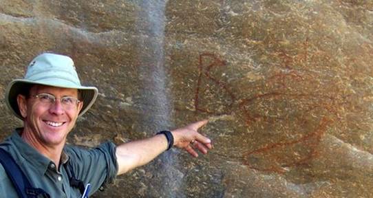
reclining giraffe (Pic 4);
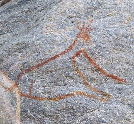
two rhinos (Pic 5);
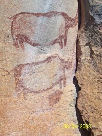
and various antelope (Pic 6).
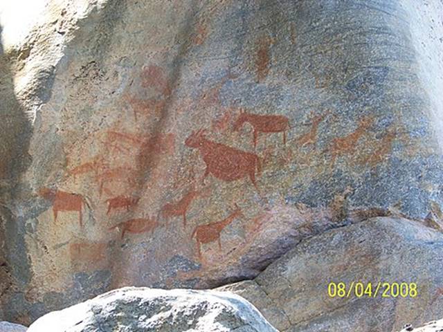
I felt like I was trespassing on some great ancient temple. What motivated the painters to make these drawings is beyond me. They must be of great spiritual importance, but what is it? What was it about a particular rock that made it a site for a painting? I think a lot of people wish they knew the answers. I wish I had a time machine.
We arrived back from the walk exhausted and drained of energy, but in awe of the San and their art. After lunch and showers, we and a group of Spanish day tourists swarmed the tiny museum shop to buy necklaces and baskets made in the nearby village. We bought two large baskets (Pic 7)
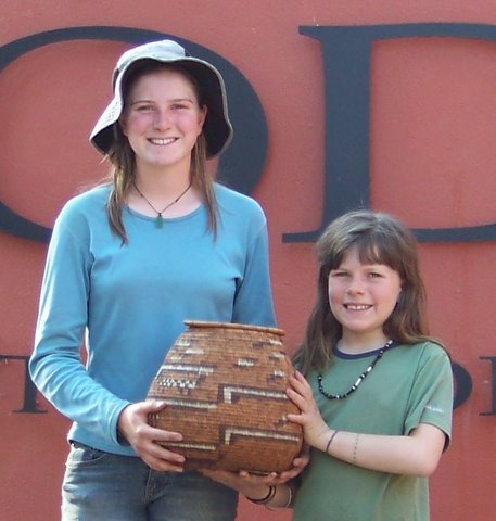
and I got a porcupine quill necklace. Today was magical.
-- Eliza
Day 66. August 5, 2008. Tsodilo Hills, Botswana to Rundu, Namibia.
Camping at Samsitu Riverside Camp on the Okavango River. (17º50.992’S 019º40.169’E). Elevation: 1057 meters (3468 feet).
Before we broke camp this morning Abby gave me a tour of the amazing world she'd created in the sand beside our tent. With a few exceptions, we've camped in sand since the Drakensberg -- almost like being at the beach. And Abigail has been quietly building complex sand worlds every chance she gets.
They're intricate but have low relief, more like 3D maps or town plans than sand castles. You probably won't be able to make out anything in this picture of her Tsodilo opus, but it was complicated enough to require almost
15 minutes to guide me through a complete tour (Pic 1).
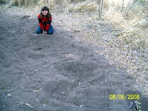
Feeling confident, we opted to try our luck with the car road on the way out of Tsodilo, instead of retracing our tracks along the nearly impassable truck and bus route. This proved a dumb idea. All went well at first, for the first couple kilometers -- Kyle and the girls running ahead to scout, directing me around the deepest ruts and biggest rocks (Pic 2).
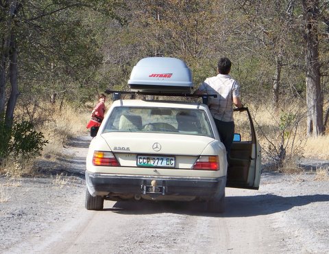
Then Abby called from just around a bend, "It starts getting pretty sandy after here; you better go fast." She stood aside and I roared past, skidding side to side and trying to keep momentum over the next little rise. Well these were the kinds of conditions that separate the 4x4 from the 2x4 folks -- deep, soft sand. Like Icarus, I'd flown too close to the sun. We and our low-slung 2x4 Mercedes were about to be humbled. I stopped before the rear tires had dug in too deeply; we had not yet "high centered." But it was clear we weren't going anywhere under our own power.
Amazingly, angels arrived within seconds -- 4 of them in 2 SUV's, plus the Botswanan camp manager who had seen us make the wrong exit choice and had tried to catch us on foot to warn of the sand trap. What a thoughtful guy; he didn't have his own vehicle and had run the whole way. The muscle-bound rigs were the only other vehicles we'd seen traveling this road today. They were clearly 4x4 experts and assessed the problem quickly (Pic 3).
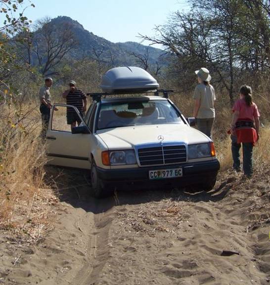
Bouncing around us through the bush, one then backed up and attached a stout piece of webbing from his trailer hitch to the special rear towing eye Mercedes has equipped us with. After telling me what to do the savvy South African driver began slowly to pull; I matched his speed and the car grudgingly slid and rolled backwards through the soft section and finally reached firmer sand. There we both stopped, unhitched and exchanged thank yous and good lucks. The manager caught a ride to camp in one of the 4x4s. This felt like the way sailboat cruisers unselfishly help each other out of tight scrapes -- the cruisers' code.
Having learned the car route was not for all cars, we slowly backtracked to the camp and then headed out on the truck and bus route. Of course it went faster and easier than on the way in, despite the almost comically rutted condition, and we were soon at the park entrance. There we let ourselves out. This park doesn't have the budget to man the entrance . . . nor to maintain the gate, as we learned when Kyle, Eliza and Abigail had to give it their all to slide the gate closed (Pic 4).
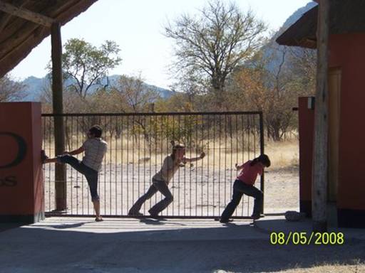
Driving away we nearly passed a woman and her two children standing at the road side a few hundred meters further along, holding up necklaces. The woman had made them herself. They were lovely, strung from porcupine quill beads and bits of carved wood. The girls bought two, for 15 Pulas each, about US$2.50 (Pic 5).
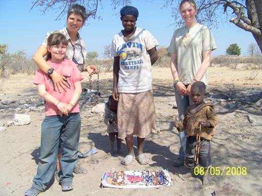
We had a long drive ahead of us, much on gravel, and it was nearly noon.
Plus we were back to phantom -- we didn't know where we'd be stopping for the night. Despite our apprehension and our poor start it turned out to be a great travel day, though. Fortune smiled again as we found a lovely spot right on the river, still the mighty Okavango, about 20 kms past the large, rough town of Rundu. Named Samsitu, it was a small, nearly empty, private campground. We saw only one other family there, a couple. We had a large grassy area, plenty of shade and privacy, electricity, a relatively elaborate and practical braai area, and clean, new ablutions -- in short, southern African car campers' heaven. The four of us quickly realized this would be an ideal spot to hole up for a few days of journal writing. Here's our first night's sunset view looking northwest -- that's Angola on the other side of the river (Pic 6).
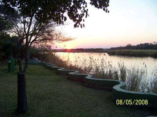
-- Doug
Days 67 and 68. August 6 and 7, 2008. Rundu, Namibia. Camping at Samsitu Riverside Camp. (17º50.992’S 019º40.169’E). Elevation: 1057 meters (3468 feet).
Samsitu proved to be everything we had hoped for in a work haven. Eliza used a blanket to shade the laptop screen (Pic 1).
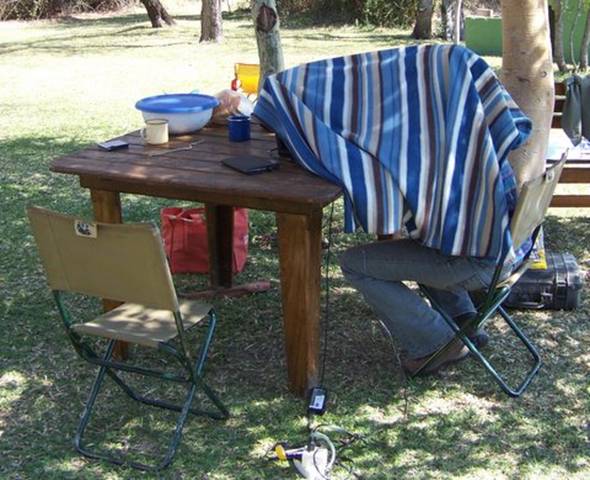
To keep mentally sharp Abigail pushed herself to hurdle higher and farther during breaks (Pic 2).
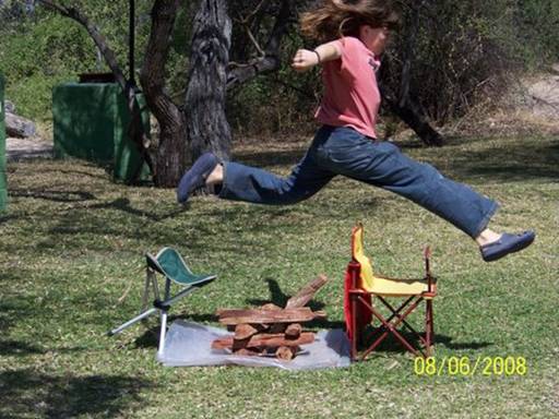
Our first day ended with spirits strong and lots of progress on the journal (Pic 3).
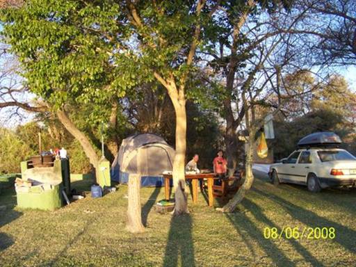
Kyle and I whipped up a potjie pot masterpiece for dinner: cheese and tomato mealies, basically a polenta, baked over coals in the cast-iron pot (Pic 4).
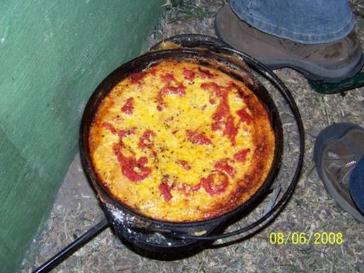
It was Eliza's turn to light the fire the next morning (Pic 5).
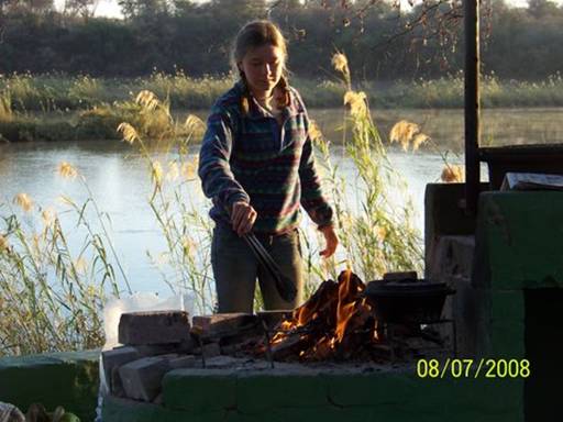
During breakfast we watched this man silently pole his mokoro upstream along the Angola river bank (Pic 6).
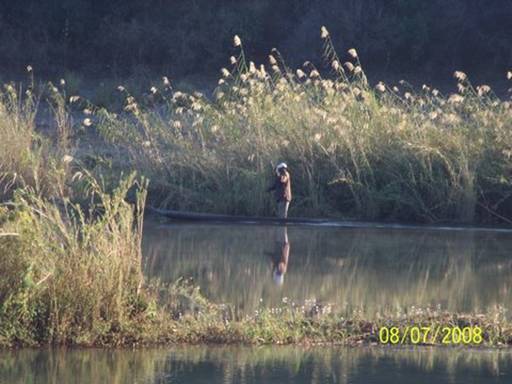
After another intense day of work we had caught up enough to all feel good about moving on to Etosha tomorrow (Pic 7.)
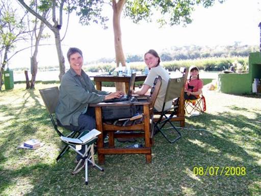
-- Doug
Day 69. August 8, 2008. Rundu to Etosha National Park, Namibia. Camping at Onguma Bush Camp. (18º43.995’S 017º02.896’E). Elevation: 1072 meters
(3517 feet).
The "Red Line" is a veterinary control fence that cuts across the top of Namibia to prevent the spread of foot and mouth disease between the
(relatively) densely populated subsistence livestock herding area north of the line and the vast commercial cattle farm region to the south. Land there was long ago parceled into large ranches, with big homesteads, few and far between. Lonely Planet describes the Red Line as the “effective boundary between the first and third worlds.” I thought we'd find the description simplistic and overly harsh. Unfortunately, I was wrong.
We'd been traveling in rural Africa since entering Botswana on July 16. We'd skipped the main cities and journeyed in a way that let us experience and occasionally even immersed us in a more traditional African world. True, we still marveled at the simple beauty of a reed and thatch hut, the practicality of donkey carts, the abundance of herds of cattle and goats grazing beside the road, and the strength and dignity of a woman carrying a bulky and heavy load on her head (Pics 1 through 4).
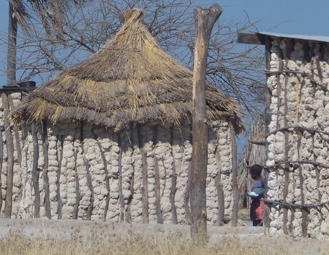
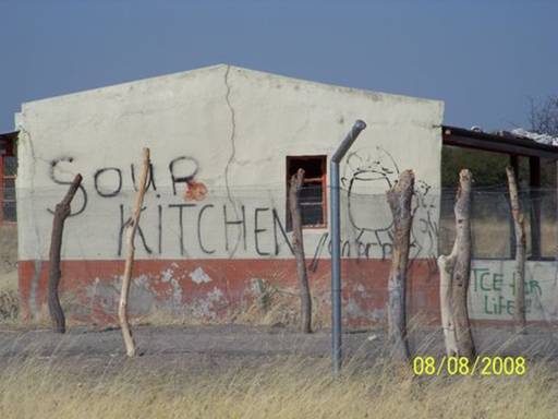
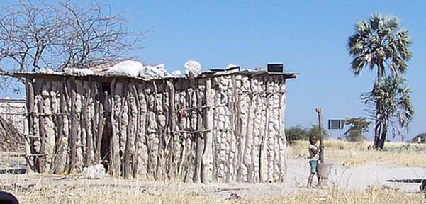
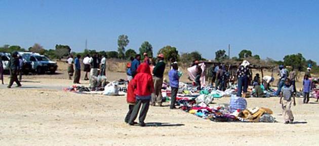
But I'd been taking fewer and fewer pictures because these vibrant scenes were what we had come to expect. I think people on the roadside were by now more likely to gawk at our crazy rig, driving super slowly, with the mysterious silver coffin-like apparatus on top, than we were to gawk at them. And after having spent time with our guides and friends GB and Kgetho, learning about their simple, yet rich lives on the Okavango, our first world lenses, already altered by our ocean cruising life, had blurred a little more. It was feeling normal to grocery shop in a small local store surrounded by dark friendly faces or to pump gas waiting in line with all the locals.
So when we drove through the Animal Disease Control Check Point, getting out to have the soles of our shoes disinfected by stepping in a box containing some chemical solution and having the tires sprayed, we entered what seemed an empty land, whose scrubveld landscape rolled before us with just cattle ranch fencing on either side of the highway -- no villages, no domestic animals, no people (Pic 5).
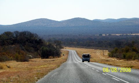
In all honesty, our hearts sank. Yes, we were entering a region that would likely be more familiar and predictable, more first world, and there definitely would be a sense of relief in that familiarity. But we were truly sorry to say goodbye to an Africa that was .
. . not necessarily more authentic, but, timeless, for want of a better term.
We were now heading south and west toward Etosha National Park for a few days of camping and self-drive game viewing. There were no campsites available within the park. So it was with crossed fingers and toes (holding our thumbs, as the South Africans say) that we asked the guard outside Onguma, a private safari camp just meters from the Etosha gate, if there were any camping spots left. He called the office and soon reported, yes -- the last one! We could enter. Surprisingly, this resort was actually cheaper than Etosha would have been. Plus we had our own private ablutions block (Pic 6)
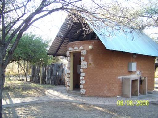
-- a small miracle, as we were soon to discover.
After setting up camp, we raced to the resort pool to take a quick and chilly dip as the sun was setting over the savannah. Sweet.
-- Kyle
Days 70 and 71. August 9 and 10, 2008. Etosha National Park, Namibia.
Camping at Onguma Bush Camp. (18º43.995’S 017º02.896’E). Elevation: 1072 meters (3517 feet).
Eliza was the first to become intimately acquainted with the private ablutions block, “Mom, I think I’m going to throw-up!” It was 2AM. The rest of the night was a blur for the two of us . . . by the morning, several trips to the toilet later, she had a fever, soon exacerbated by the hot African sun beating down on the tent -- baked, stuffed Eliza.
There was dappled shade beneath a thorn tree beside the tent, so we laid out a ground tarp and pillows. Abigail and Doug soon discovered the crimson-breasted boubou, a red bird even more striking than our cardinal back home, if you can believe it (Pic 1).
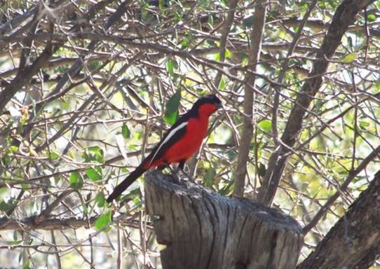
But the late morning gale, a typical August phenomenon we later learned, became so fierce, blowing sand, dirt, and dust, that Eliza soon became encrusted -- baked, stuffed Eliza smothered with bread crumbs.
Back to the resort pool! But now how do we sick, dirty campers camouflage ourselves at the posh safari camp pool? Luckily the camp manager welcomed us so we didn’t have to skulk around. Abigail even made a friend at the pool, a German girl named Melanie (Pic 2).
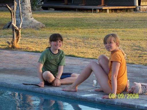
Doug plugged in the computer and worked on our journal.
By the next day Eliza was feeling much better but we decided to take the day
off and stay at Onguma – a transition day. Well, around 3:00 PM the
transition day turned into a second sick day. My turn, this time. To make things easier, I just slept by the toilet (Pic 3).
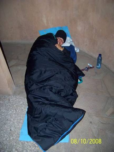
As I said, it was a small miracle to have a private ablutions block!
-- Kyle
Day 72. August 11, 2008. Etosha National Park, Namibia. Camping at Onguma Bush Camp. (18º43.995’S 017º02.896’E). Elevation: 1072 meters (3517 feet).
We woke up and leapt from the tent, excited to be off on a game-viewing day!
We got in the car. Dad drove, with me in the front passenger seat (my first time ever) and Eliza and Mom in the back. Mom still wasn’t feeling too great. We reached the Etosha National Park gate at 8:20 (Pic 1).
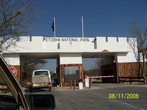
When we got to Namatoni Camp, we checked in and bought gas and an Etosha guidebook and map. We saw some banded mongoose beside the reception office (Pic 2).
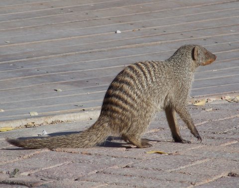
Then we were off.
Etosha is different from Kruger because 1) it is much drier, 2) it has less variety of animals (although it does have enormous herds), and 3) it has two of my favorite species of antelope, gemsbok (oryx) (Pic 3)
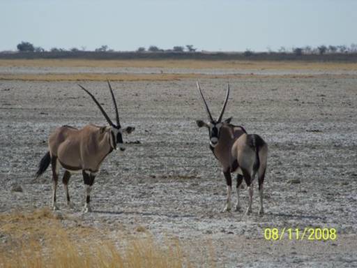
and springbok (Pic 4 -- the closer of these springbok must have lost its horn in combat).
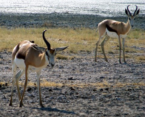
Neither of these is found in Kruger.
These two species are made for the desert. They will drink water when they have the chance, but they do not need to. They can get enough water just from their food.
The numerous impala of Kruger are very dependent on water. An impala is rarely found far away from water since it needs to drink at least once a day. Impala and springbok play similar roles in their habitats; but the impala live in lusher areas and the springbok live in drier ones. Between them they are the main lawn mowers of southern Africa's wildlife parks.
Later in the day we saw a mass of black shapes on the ground. When we looked at them through the binoculars, we saw that they were vultures (Pic 5).
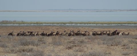
It was a kill! But there were no lions in sight. Every once in a while a few vultures would jump into the air, flapping their huge wings, making way for hungry black-backed jackals who were diving into the mass to gorge themselves on the scraps of meat. Watching the kill was probably my favorite part of the day.
We left Etosha at 6:15 and drove down the long, bumpy driveway to Onguma.
We stopped to watch a big kudu bull jump over a six-foot high fence into the grassy strip between Etosha and the private game reserve we were camping in.
Then all of a sudden he jumped back over, right in front of us, and disappeared into the bushes. He jumped so fast that Mom only got a blurry picture of his disappearing rump (Pic 6).
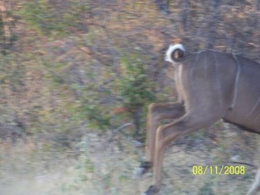
We continued driving and then stopped again to watch the big red sun set (Pic 7),
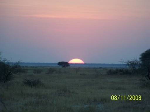
while two jackals stretched and yawned before beginning their evening hunt (Pic 8).
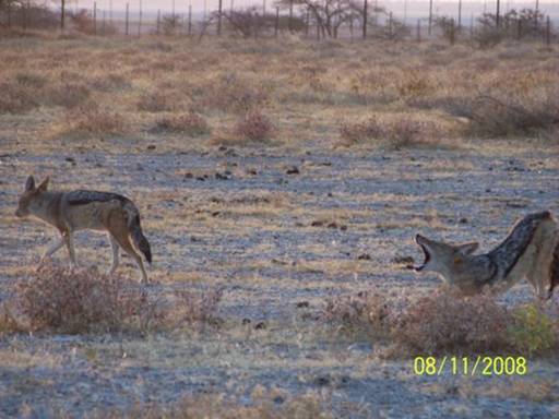
-- Abigail C.
Day 73. August 12, 2008. Etosha National Park, Namibia. Camping at Etosha Safari Camp. (19º24.692’S 015º55.379’E). Elevation: 1146 meters (3760 feet).
The day started off with a bang. We were heavily loaded with all our gear, packed to move on to Etosha Safari Camp, a private camp located 15 kms outside the western gate on the other side of Etosha. Just before 8:00, minutes after we had entered the park, we came upon a cluster of open-sided safari vehicles. They had spotted an animal carcass hanging from a tree a few feet from the road (Pic 1).
A leopard kill! Obviously it was a type of buck. This was what we’d been hoping to find each morning as we'd driven slowly along Kruger's roads. Without success, we'd daily searched the branches of likely "leopard trees," big spreading trees we imagined to be just the right size and shape to make a good spot for a wary leopard to devour its nighttime kill, safe from marauding lions intent on stealing the leopard's hard-won meal. We couldn’t believe our good fortune today. If only we'd happened by before the leopard had finished eating.
I cheered up after that; yesterday was slightly disappointing in its lack of large carnivorous animals. But this half-eaten carcass, though we couldn’t figure out exactly what it had been, was sure proof that big cats actually DID exist here and we might have a chance to see one. We were right, a few hours later we watched for 15 or 20 minutes as a full-maned male lion, camouflaged by the dense underbrush, napped restlessly by a tree close to the road.
The ecosystem in Etosha is very different from that of Kruger or of the Okavango panhandle. In the latter two there are reliable water sources which the animals of that area depend upon, and which flow all year round.
But in Etosha there are very few permanent natural water sources. Animals used to migrate elsewhere in the dry season. But since fences were built around the enormous park, to define farm borders and to prevent diseases from spreading, the animals of Etosha have been trapped in an area that is unable to accommodate all their water needs. That’s why boreholes were dug to fill artificial waterholes with enough water to allow the animals to live here year-round. Luckily for us tourists, Etosha's roads pass near these waterholes, so we can watch the animals coming to drink. During the wet season (Dec-Mar) the animals are scattered throughout the park as the vast Etosha Pan, an intermittent lake, fills again, making water and food more widely available. But in the dry season, which is now, these artificial waterholes concentrate the animals, as a bright outdoor light draws clouds of insects on a summer night.
In contrast to Kruger, where we might view animals almost anywhere along the roads, Etosha seems best known for the chances it offers to observe animals at waterholes, at least during the dry season. In fact, most of the self-drive and guided tourists (virtually all in 4x4's) sprinted the rough roads from waterhole to waterhole, acting as though there was little of interest in between. Driving slowly and remaining constantly alert, as if we were back in Kruger, we had fun spotting birds of prey and some small groups of animals in unlikely places far from waterholes (Pic 2 -- a lappet-faced vulture).
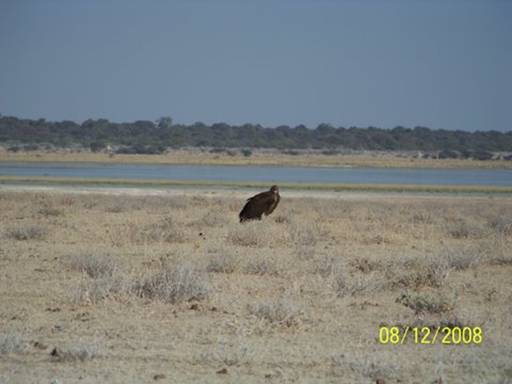
We were also mesmerized by a sight rarely observed in Kruger, large herds of grazing antelope and zebra set against limitless vistas of parched, flat grassland.
Whether you’re a predator or prey, you still have to drink, and this time of year waterholes are your only option. This is why waterholes can be dramatic. Some herbivores try to limit their danger by coming to drink in large flocks or herds. Each individual animal gets more time to eat and drink because it doesn't need to lift its head as often to look around. It may relax slightly because there are many other herd members also watching, smelling, and listening.
Sometimes herbivores gain additional security by accompanying other species who have complementary senses. For instance, you often find Burchell’s zebra grazing and drinking together with blue wildebeest. While they both have good senses, the zebra have particularly good eyesight, and the wildebeest good hearing. So predators can rarely surprise a mixed herd. At Kalkheuwel waterhole we saw eight kinds of herbivores (and many types of
birds) all benefiting from each others’ warning systems, although the predators seemed far away while we were there (Pic 3 -- kudu, zebra and black-faced impala).
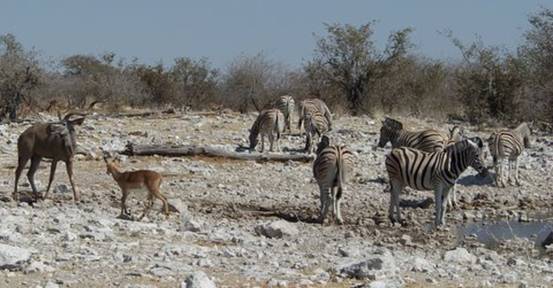
Even big herbivores are in danger at waterholes. Surprisingly, giraffes are some of the most vulnerable. They can’t just bend their heads to drink; ironically, their necks are too short for that! Instead they spread their front legs wide in an awkward crouch, which leaves them completely open to attack (Pic 4).
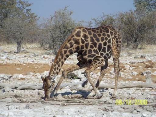
It’s no wonder that one herbivore, the springbok, has evolved to be able to avoid the waterhole risks entirely; it can get all the moisture it needs from its diet.
My favorite waterhole today was Kalkheuwel, where we parked and ate breakfast in the car, watching for nearly two hours. We visited about six other waterholes today but none of the others had Kalkheuwel's wide diversity and sheer number of animals.
The Etosha Pan is an enormous, shallow, inland lake in the wet season, after heavy rains, and a stretch of half-dried, cracked mud in the winter. It’s about 1/5 of the park’s total area. It did look huge from the Etosha Lookout spot a few kilometers into the pan. We were surrounded by bleached mud flats stretching to the horizon, the reflected afternoon sun blinding us. Abby and I felt the mud, and although it looked hard and dry, it was actually quite slick under the surface (Pic 5).
Dad tasted it and said it was a little salty. Stepping on it was a mistake, though; it stuck to our shoes and later got the floor of the car crusty white. The pan was truly gigantic; I felt like a little speck compared to it (Pic 6).
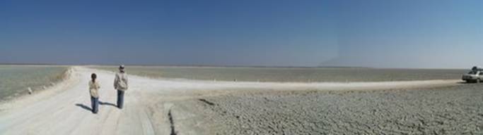
We couldn’t even see the other side. It was so hot and dry and white in the middle that we had to wear hats and sunglasses so we didn’t feel like we were going to burn our faces and eyes off. We were in a kind of parched ocean.
-- Eliza
Day 74. August 13, 2008. Etosha National Park, Namibia. Camping at Etosha Safari Camp. (19º24.692’S 015º55.379’E). Elevation: 1146 meters (3760 feet).
The Estrela safari crew has coined a new phrase, "A Kruger Morning". It doesn’t matter where we are. When Doug or I announce, “Tomorrow we’re going to have A Kruger Morning,” then everyone knows what to expect: 1) Awaken in the dark, usually around 0530. 2) Dress quickly and silently. 3) Boil water with the electric kettle to fill the thermos – the car is pre-packed with the breakfast bag at the feet of the front passenger seat and the lunch bag and cooler are at the ready in the trunk. 4) Brush teeth, toilet and go! We were thoroughly schooled through our careful observation of the many expert South Africans camping near us in Kruger National Park – hence, “A Kruger Morning."
As we drive I serve coffee, cocoa, and rusks (a South African style biscotti -- a kind of commuter-plane flight attendant maneuver. We eat cold cereal with milk and yogurt, usually in the car, while stopped at a game viewing place or a highway picnic spot, depending on our travel plans.
There are two possible variations on this routine: #1) A Kruger Morning with Camp Breakdown -- the same as above plus a silent tent-striking and car-packing, the breakfast still eaten underway. #2) A Kruger Morning with Camp Breakdown and a Quick Breakfast Before Departing -- like variation #1 but add a simple breakfast in camp. In order to ensure full stomachs AND a fast getaway under variation #2, we've adopted two rules: no brewed cowboy-style coffee (poured through a tea strainer or a nearly clean bandana), and no entertaining stories by Doug about his boyhood. Failure to enforce these rules could add hours!
This morning we had a basic "A Kruger Morning" -- the purest form; we were planning to return to Etosha Safari Camp for one more night, so had no need to break camp.
I try not to get too competitive about arriving at the game park gate before it opens, usually about dawn, but I can’t help myself. This day we maintained our excellent record, 6th car in line before the 0630 opening (Pic 1).
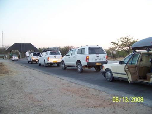
Once inside a game park, however, our competitive spirit usually dissipates. We are thankful that our low-riding sedan's best pace (slow! -- especially on rough roads) matches our natural viewing pace -- a symbiotic relationship.
However, for our game-viewing brethren, the other Etosha tourists, competitive urges seemed to intensify inside the park. Etosha's roads do not seem populated mainly by national park game viewing veterans from South Africa, as Kruger's are, but mostly by northern hemisphere tourists on relatively short, ambitious holidays, driving rented, white 4 x 4 Toyota Hi-Lux canopied trucks, many with roof-top tents. These SUV trucks, or "bakkies," love tough gravel roads and so do the drivers. So while we plodded along at under 30 kph, the white bakkies zoomed by, shrouding us and the adjacent bush with white dust. They raced to a waterhole, quickly snapped pictures, and then raced on to the next.
This intense, single-minded tourist behavior was really getting us down, as well as dirty. We can appreciate that these folks have limited time and that they want to get the most for the money they've spent on airfare and 4x4 rig rental. And we acknowledge how privileged we are to be able to take our time traveling. But the frequent disregarding of written and unwritten rules of the road and of courtesy has shocked us. Common infractions include driving well over the posted speed limit; failing to slow down when passing or converging, to reduce the dust cloud; hanging way out or even alighting from vehicles to take pictures; and even talking loudly at waterholes, scaring animals and disturbing other tourists. Our goal today was to avoid all this nonsense.
We decided to cover minimal ground, to stick to back roads, and to patiently enjoy waterholes, letting the waves of other tourists wash over us. It was a great day, especially for bird of prey sightings on the back roads. These gorgeous birds are notoriously difficult to identify because their plumage keeps changing through several sometimes lengthy stages of development.
They may at times resemble another species altogether. Also, a given species often has a wide range of "normal" plumage, sometimes known as different "morphs." So it is only with patience and persistence that an amateur birder identifies these creatures.
The girls have those qualities in spades. It is hardly unusual now for us to spend half an hour on one bird. Long after I’ve started to lose patience with a bird resisting easy identification, Abigail and Eliza are just getting started. They're still scouring our various reference books, checking and re-checking with the binoculars, and taking pictures and then zooming in on the digital display for a closer look. They have become such enthusiastic birders that they sometimes even make us stop to identify dull-looking small birds, affectionately named "LBJs" by one group of South Africans whom we met – Little Brown Jobs! It gets to the point sometimes where Doug, the driver, has to announce, “No more LBJ IDs, we only stop for big cats!” Here are pictures of some of the majestic birds of prey we saw today (Pic 2 - Greater Kestrel, Pic 3 - Marshall Eagle, the largest eagle in Africa, and Pic 4 - Gabar Goshawk [juvenile]).
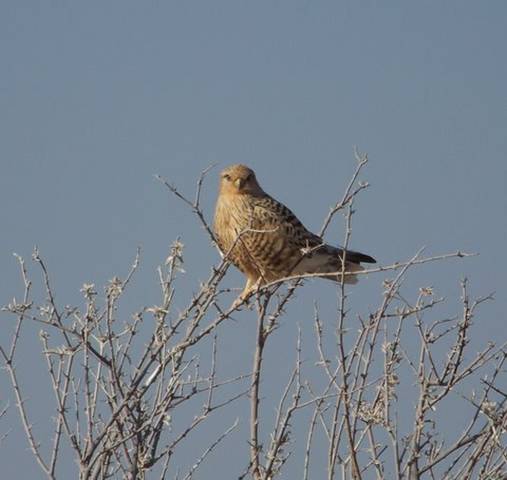
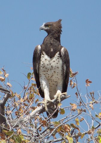
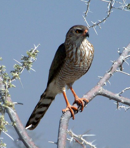
On our way back to camp, we stopped at Newbrowni Waterhole, our last. This place captured all the beauty and uniqueness of Etosha: flat, open terrain with little vegetation; stark white, dusty soil; and many animal species, including ostrich, gemsbok, springbok, zebra, and huge Etosha elephants (10% larger than Kruger's, on average) ghostly with dried mud which they wear to block insects and prevent sunburn (Pic 5).
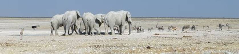
It has been a thrill to experience this magical place.
-- Kyle
Day 75. August 14, 2008. Etosha National Park to Outjo, Namibia. Camping at Buschfeld Park Lodge. (20º05.688’S 016º07.624’E). Elevation: 1281 meters
(4202 feet).
The Etosha Safari Camp has been a great stop. Friendly, motivated staff; an active training program; clean, well-maintained facilities; reasonable prices; and a clear commitment to the local community make this tourist outfit one of the most impressive we've encountered during our land trip, second only to the Okavango Polers Trust. Sue, one of the trainees, checked us out this morning (Pic 1).
We were back to phantom, heading south (Pic 2),
hoping to find a place to camp for a few days for laundry, a car wash and vacuum, journal writing and a mechanic. It was wonderful to be back on paved roads and to be able to drive 100 kph again after Etosha's poor roads where we could rarely go comfortably more than 30 kph.
In Outjo, an old farming community 125 kms south, we found a welcoming oasis, the Buschveld Park Lodge. Most of Namibia was a German colony in the late 19th and early 20th century and evidence of the German influence abounds. We found a spectacular German bakery in Outjo. Across the street was a clean-as-a-whistle German auto repair shop. I thought I was in luck.
But apparently this guy really was the best mechanic around and he couldn't fit us in. Uggh. But his referral to another mechanic 70 kms south in Otjiwarongo magically got me an instant appointment.
After setting Kyle and the girls up at Buschveld, I drove alone to Otjiwarongo, arriving about 3:45. Mr. Radek, the crusty, hyper-kinetic owner said he thought he could clean up and weld the broken left front steering stabilizer bracket which had failed again -- the one welded at Max Panel Beaters in Kasane, Botswana. Mr. Radek had just ordered some super welding rods from Germany and was keen to try them out. While he did the grinding and welding, with the car up on the lift I hovered over one of his mechanics as he checked belt, fluids and bolts under the hood and chassis, blew the air filter and engine surface clear of dust with compressed air, and changed the oil and oil filter. It felt great to give the car some well-needed TLC. I am so impressed by how tough and reliable this 22 year-old car has been. There must really be something to the German-engineered Mercedes mystique.
After paying Mr. Radek's modest bill I was headed north again by a little after 5:00 and returned to Bushveld just at dusk, a gorgeous drive into the setting red African sun. Kyle and the girls were full of adrenalin when I got there; they'd watched Olympics field hockey and judo on the big TV in the bar. We still had no internet connection, but we could watch the Olympics -- just like everyone back home!
-- Doug
Day 76. August 15, 2008. Outjo, Namibia. Camping at Buschfeld Park Lodge. (20º05.688’S 016º07.624’E). Elevation: 1281 meters (4202 feet).
Eliza and Mom did some hand laundry while Dad and I made coffee and Milo (the Ovaltine of the southern hemisphere) and put out the cereal. After breakfast I was helping Mom with the washing (Pic 1)
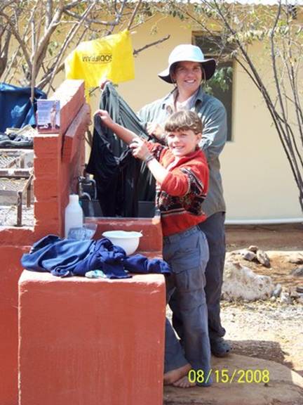
while Eliza cleaned and repacked the tools (Pic 2).
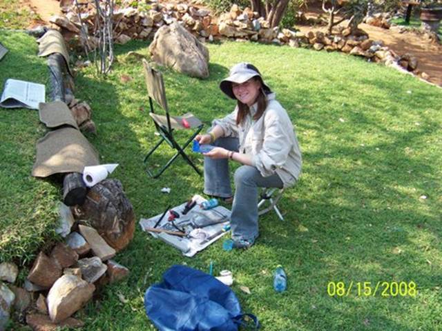
They had starting rusting, even though they were stored in a plastic box in the trunk. Dad said the big wrench got really cold at night, stayed cold during the day, and made moisture condense inside the box. This made the tools rust.
Suddenly, we heard a scream and looked at each other. Mom said, “Somebody must be playing around.” Later two men walked over to us, holding a broken plank of wood, with a two-foot, almost dead, snake hanging from the end (Pic 3).
They put the snake down and, grabbing our wildlife guide from the car, we identified it as a puff adder, a very venomous snake that causes most of the venomous snake bites in southern Africa (Pic 4 – it was really exciting to see the long fangs).
The men told us that the woman spotted the snake in the kitchen, screamed for help, and ran outside. Then the men ran in, mashed the snake’s head with the end of the plank (not quite killing it), and brought it to us to see. When they walked away, leaving the snake with us, Dad chopped its head off with our hatchet, putting the poor snake out of its misery. It had been squirming the whole time we were trying to identify it. I felt sorry for the snake because it hadn’t meant any harm (at least not that I know of).
We still had more chores to do. Dad packed the two baskets from Tsodillo Hills in boxes to mail home. For days Eliza and I had had the baskets between us in the car, so it was great to get them out of there. Then we had to clean the inside of the car. This was fun.
Mom and I borrowed a vacuum and cleaned everything: foot pedals, dashboard, steering wheel, trunk, glove box, and much more (Pic 5).
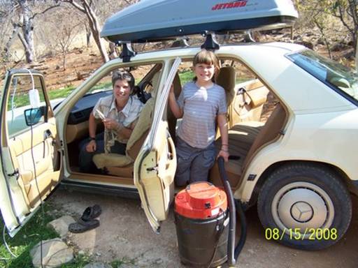
Every bit of the car was filled with dust and more dust. You couldn’t get away from it. Think how dusty an Etosha lion’s mane must be J! After “undusting” the car (ha ha ha), we had dinner sitting at the camp bar and watched the Olympics. Our favorite sport was the women’s gold medal heavy-weight judo match. It made me want to try some new moves on Dad when we wrestle in the morning.
-- Abigail C.
Day 77. August 16, 2008. Outjo, Namibia. Camping at Buschfeld Park Lodge.
(20º05.688’S 016º07.624’E). Elevation: 1281 meters (4202 feet).
I had a surreal reality check today. I like to think of myself as a relatively experienced traveler in developing countries, particularly in rural and even remote traditional villages. On many occasions I've sat on dirt floors, in my long-sleeved blouse and long skirt, paying respect to a chief or just talking with women as they weave baskets or take care of half-naked children, noses running. We've always sought to meet people on their own terms, dressing so as not to offend, listening with respect, learning even a few words of local language, and trying always to suspend judgment. Doug even started wearing a man's skirt, or sulu, in Fiji, which was appreciated by many villagers, especially elders. It's often been a little uncomfortable for us at first, and the effort exhausting, especially as a family with young children. But ultimately these experiences have been some of the most memorable of our five-year voyage.
So it's with humility and self-loathing that I report that all this changed in a small grocery store in Outjo today. There in the very narrow canned food aisle, all my savvy, non-judgmental, can-handle-anything traveler-ness shattered. For when I looked up from my struggle to make sense of another unfamiliar African store's canned tuna section, there, squeezing past me were two Himba women. My jaw dropped. These striking, nearly naked nubile women, wearing only body makeup of red-ochre and perfumed butter (except for a belted loin blanket and necklaces), strong and tall, majestic beyond all reasoning, were just chatting away in their native tongue, carrying shopping baskets filled with potato chips and soda. I nearly dropped the Light Tuna in Brine. I tried to stop staring, I really, really did. And I said to myself, "Come on, Kyle, you've seen naked ladies before -- in changing rooms at the gym or in backstage dressing rooms." But not like THESE women, and IN A GROCERY STORE...????!!!!!
At that moment I was just a dorky tourist (and my feminine self-esteem had sustained a serious body-blow). But . . . I did curse myself for foolishly leaving my camera behind. So, sorry, no photo today! But go to
http://en.wikipedia.org/wiki/Himba and you'll see what I mean.
-- Kyle
Day 78. August 17, 2008. Outjo to Brandberg, Namibia. Camping at Brandberg White Lady Lodge. (21º01.041’S 014º41.194’E). Elevation: 455 meters (1493 feet).
I felt especially cheerful all day because I had new jeans, bought yesterday in Outjo. The tight style now isn't very practical for months of camping and hiking. My old pair had split apart, worn out along the seams. But I think we were all cheerful about leaving Buschfeld Park and moving again.
Right before we left, Abby spotted a mother cape turtle dove and her day-old chick in their nest above the laundry sinks (Pic 1).
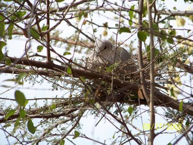
We’d seen this dove on her nest before, and had been waiting for the baby to hatch.
From Outjo we drove west to Khorixas and then south almost to Uis. I read for most of the drive because there was nothing else to do and the desolate scenery, though beautiful, couldn’t capture my attention for hours on end (Pic 2).
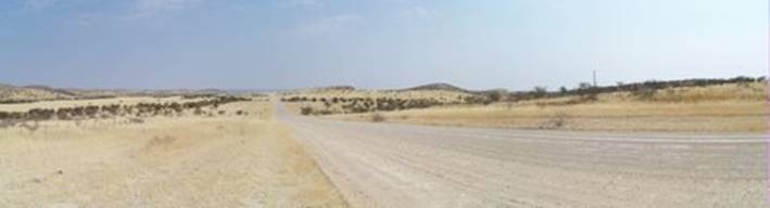
As we dropped down off the plateau into Damaraland (headed for Khorixas), we began to see more villages and people and animals by the side of the road (Pic 3).
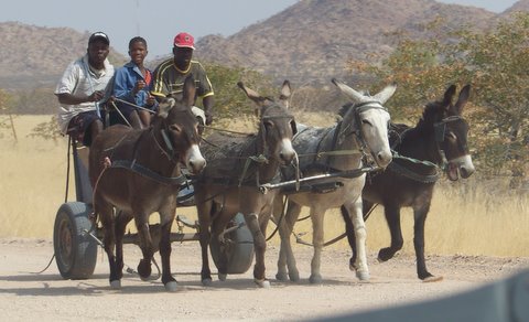
We were passing through rural Africa again, at least for a little while.
The stretch of road from Khorixas to Uis was lined with small, reed or thatch lean-to stalls selling dolls. The women managing the stalls were dressed in long, colorful dresses of thick fabric, with cloth caps twisted to points at the sides. Their dolls looked exactly like the women. Every time we passed a stand, the women and their children would hold up the dolls and plead with us with their eyes to stop and buy one. “We’ll buy some later in Swakopmund,” Mom said. Unfortunately, after Uis, we never saw those dolls, anywhere. Once again we were reminded that if you see something interesting to purchase, don’t wait. Just buy it or you will kick yourself later for the opportunity missed.
We entered an area dominated by the dramatic Brandberg, an Afrikaans name which means "Fire (brand) Mountain (berg)." At 9000 meters, it is the tallest mountain in Namibia. This region is known for its many rock paintings and Brandberg has a rich concentration of these. One Brandberg painting in particular, the “White Lady,” is very famous. It depicts a light skin-colored person with long, fair hair. What’s interesting is that it was painted, as far as experts can tell, before any Europeans had come to the area.
We checked-in at the Brandberg White Lady Lodge, arranging to pitch our tent in their remote camping area. It’s strange, but the lodge had a depressing atmosphere, though none of us could put a finger on why it felt that way.
On the other hand, there were a tame springbok and meerkat wandering freely near the two murky swimming pools outside the bar. Dad even got to pet the meerkat, but he frightened away the springbok when he plopped down next to it. The view from the lodge of the sun-reddened Brandberg Mountain was beautiful (Pic 4).
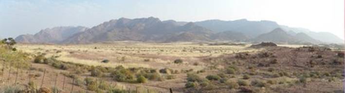
We set up camp beneath an enormous tree whose low branches hid us from the other campers. It was very cozy. Dad read Edgar Allen Poe’s The Pit and the Pendulum as we crowded around the campfire after dinner.
-- Eliza
Day 79. August 18, 2008. Brandberg to Jakkalsputz, Namibia. Camping at Jakkalsputz Beach Camp. (22º11.361’S 014º18.453’E). Elevation: 0 meters (0 feet).
For some reason Abigail announced at breakfast that she thought she could pick each of us up. And she did (Pic 1).
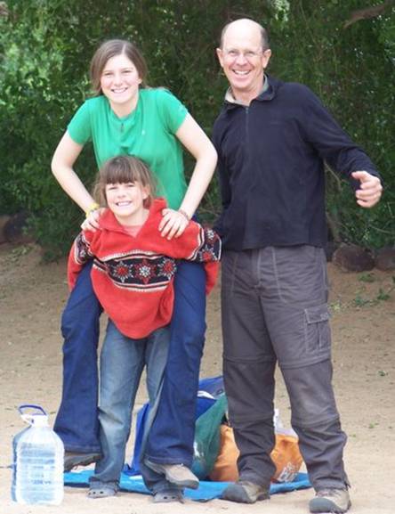
Both girls are very keen to wrestle -- it's now Abby's favorite way to start the day -- and they've become tough fighters. Kyle will no longer go toe to toe with Eliza. They're always trying to ambush and take me down. Abby discovered the "Warriors" book series, by Erin Hunter, which relates the adventures and battles of wild cat clans. We've all been reading them. I suppose, considering the inevitable influence of these books, of all the Harry Potters, Eragon and Eldest, Brian Jacques' Redwall series, Jane Porter's "The Scottish Chiefs," and Rosemary Sutcliff's several exciting novels of Romano-Britain and of Celts battling Saxons -- all central to our family read-aloud fare over the last several years -- I shouldn't be surprised.
Were they boys, I wouldn't bat an eye at driftwood transforming into weapons. But as Eliza and Abigail also play dolls for hours on end and create elaborate fairy worlds, especially when we're on passage, I'm constantly amazed by their eager warrior play. Moreover, the weaponry they assemble from sticks -- including swords, spears and bows and arrows -- demand much more skill and sophistication than the make-believe stick machine guns my boyhood buddies and I armed ourselves with. Needless to say, I'm having a ball with my two fierce girls.
We drove very slowly away from Brandberg today, slowly not only because of our speed but also because we could see it looming behind us for hours, it so dominated the otherwise featureless landscape (Pic 2).
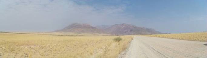
As we drove west southwest toward Henties Bay, on the Atlantic Coast, we soon passed the last vestige of human habitation (or even human existence) (Pic 3)
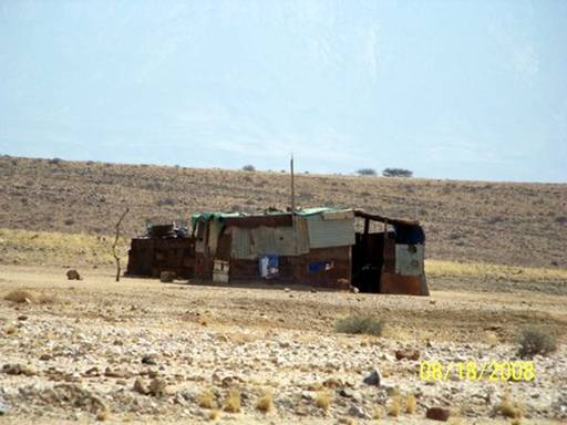
and entered the true Namib Desert, the oldest desert in the world. This is the most desolate place one can imagine (Pic 4).
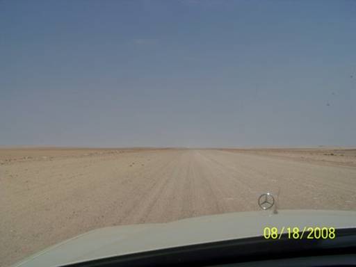
I began to understand how one might feel walking on the Moon, or an asteroid. A springbok spotted where nothing but nothing could possibly be at large, especially in the midday sun, testified to this antelope's adaptation for water and heat management (Pic 5).
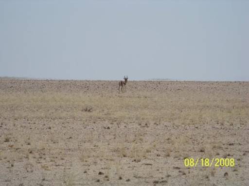
As we neared the coast we encountered the low cloud cover that forms most days, especially in winter and often accompanied by fog, as the cold Benguela current meets the scorched Namibian west (Pic 6).
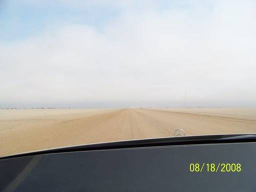
Rare lichens and other ultimate-survivor life forms suck fog to thrive in dune sand and exist nowhere else on earth. The blinding fog also helps makes this a treacherous landfall for ship, dubbed the Skeleton Coast for the eerie stubble of shipwrecks that lines the surf-pounded beach for hundreds of miles.
It was exciting to reach the Atlantic Ocean. After stopping in Henties Bay to mail our baskets and to try (unsuccessfully) to make an internet connection, we drove 11 kms south to Jakkalsputz where we camped right on the beach (Pic 7),
as urged by Namibian friends who now live near Knysna and miss their native land terribly. This camping site is just about our friend's favorite place on earth. In the summer he would come here to camp and to cast for fish in the surf. Before overfishing took its toll, mostly by commercial boats, this was one of the most productive surf casting spots in the world. It can still be very good at times, we gather, and we hoped to watch some surf fishing the next morning.
-- Doug
Day 80. August 19, 2008. Jakkalsputz to Swakopmund, Namibia. Overnight stay in Hotel Prinzessin Rupprecht (www.prinzrupp.com.na). (22º40.931’S 014º31.456’E). Elevation: 4 meters (13 feet).
We woke to a cloudy beach morning and had a cloudy beach breakfast (Pic 1).
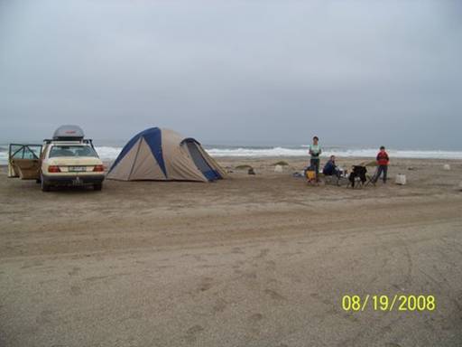
We ate porridge and watched fishermen surf-casting from the beach (Pic 2).
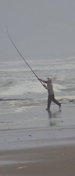
We were packing the car when all of a sudden the sun found its way through the clouds, burning away the cold.
Then we drove all the way down to the very end of the long line of yellow ablutions blocks, about a kilometer, to visit campsite #1 (Pic 3),
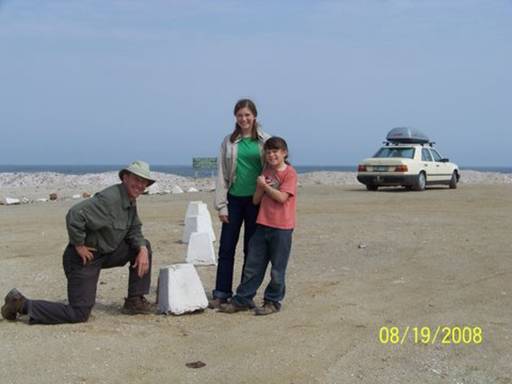
recommended to us by the dad of my Namibian friends living in Knysna, Zelda and Charlize. We walked down to his favorite fishing place and collected pretty stones. As we were driving back to the reception, Mom smelled something yucky. Then we saw a black mass on the beach. Was it a shipwreck? As we got close we saw that it was a carcass. Holding our noses we walked over to it. It was a dead, stranded humpback whale (Pic 4).
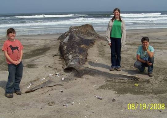
It was huge!! And stinky.
We drove about 60 kms north to the Cape Cross Seal Colony. When we got close to the colony, we could smell their stinky scent before we could see them. (It was a smelly day!) As we walked along the viewing walkway, watching what seemed like a normal, noisy day in the colony (Pic 5),
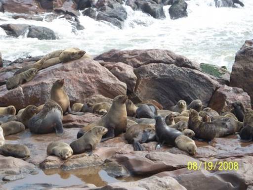
we could also see strewn on the beach and rocks many seal bones, skulls, blood and fur (Pic 6).
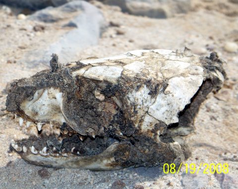
We wondered what could be killing the seals. Then we saw all the dog-like paw prints; we figured it out: jackals. Black-backed jackals, which we'd seen on the drive in (Pic 7)
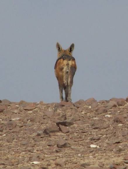
and wondered how they were surviving in the empty desert, must be killing young, sick, and old seals, leaving the bones, fur and spoor we saw. The mystery was solved.
When we reached the town of Swakopmund far to the south we couldn't find anywhere to camp. But Mom and Dad found something better, a room at the very old Pension Prinzessin Rupprecht Heims Hotel, a special treat, said Mom. It used to be the German hospital. Mom loved that our "family room" was an old doctor’s office suite. I was just glad to be in a room with a real bed. Yay, no camping! We ate dinner at the Brauhaus, a noisy German restaurant. I had chicken schnitzel. It was to die for. We went to bed with our tummies full and our hearts soaring.
-- Abigail C.